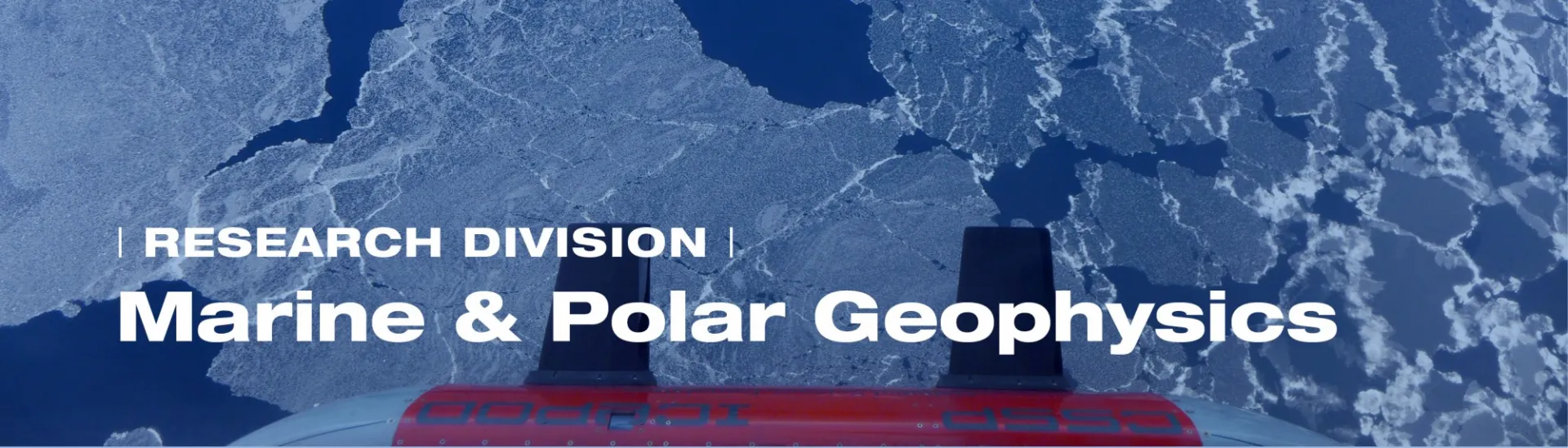
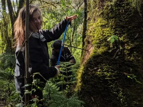
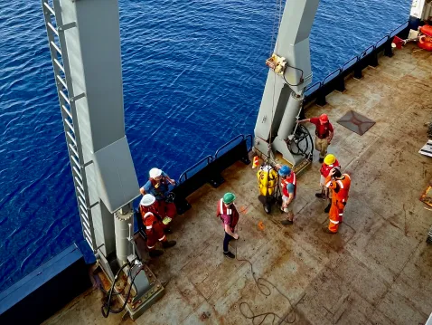
"We make geological and geophysical measurements on land, sea, and ice, and we create models in order to better understand processes of our dynamic planet that impact life on Earth."
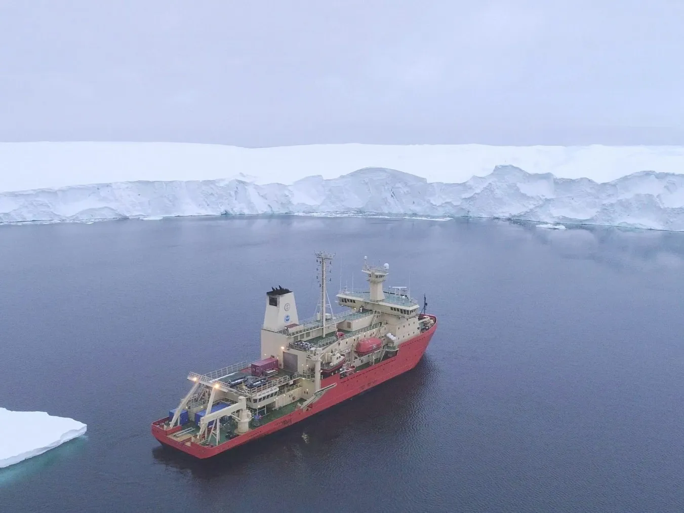
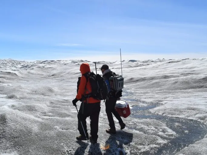
Lamont's exploration of the largely unknown terrain beneath the world's oceans began at the inception of the observatory more than 70 years ago. Today, members of the Marine & Polar Geophysics (MPG) Division remain explorers at heart, motivated by the drive to understand some of the most remote and dangerous reaches of our planet, from the deepest oceans to the polar ice sheets.
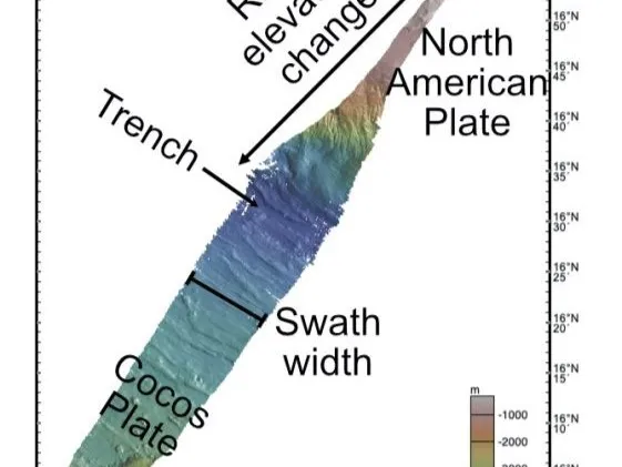
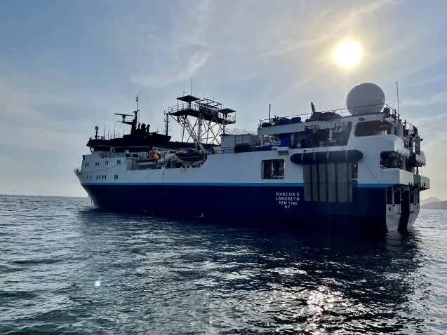
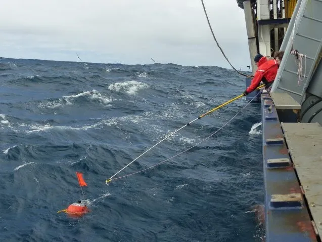
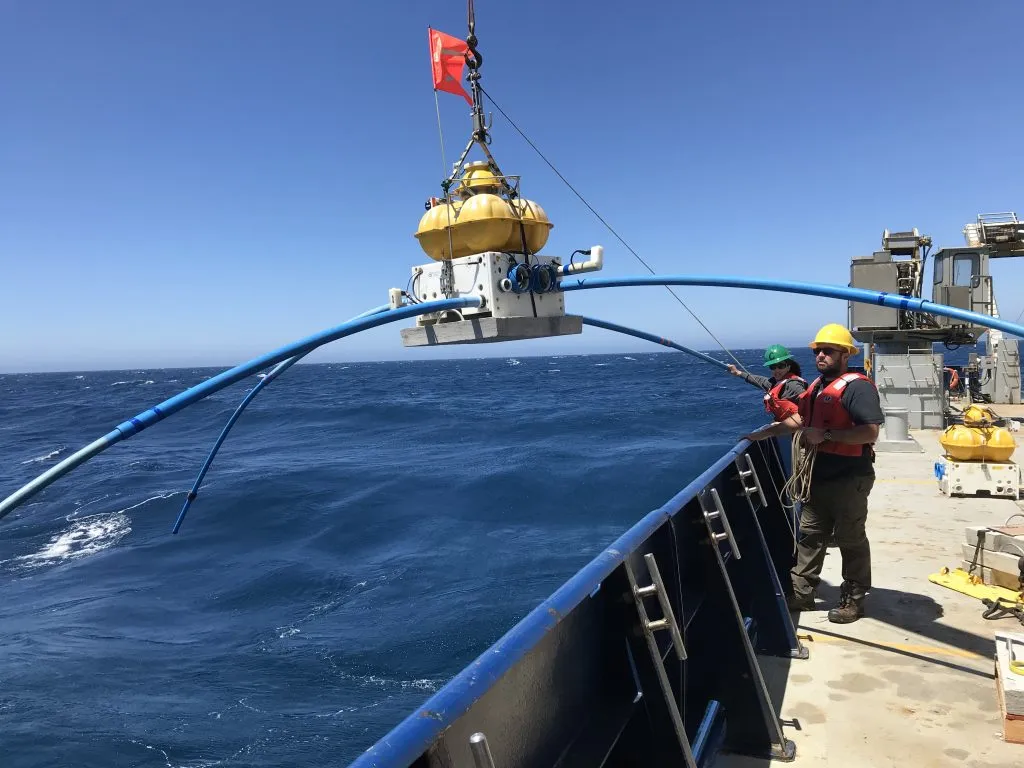
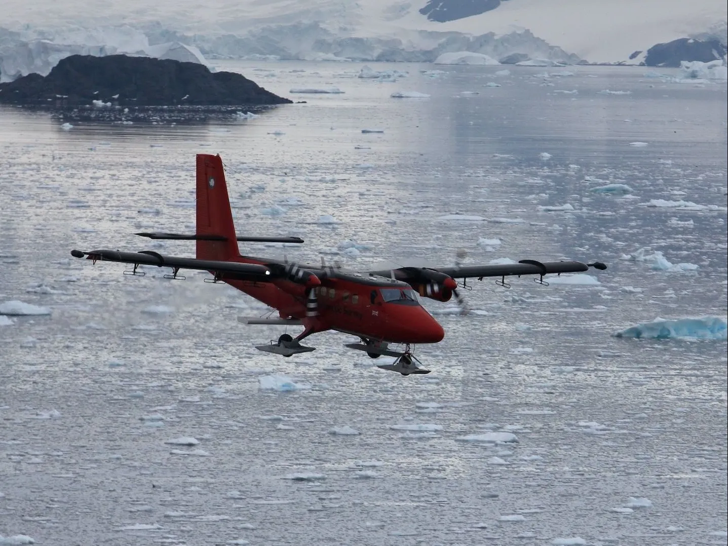
Today’s tools of exploration have evolved from simple echosounders and towed seismic source-and-receiver instruments, to MultiChannel Seismic (MCS) Reflection techniques that allow researchers to probe more deeply into the Earth. Multibeam bathymetric and side-looking sonar imagers can map large areas of the seafloor in ever greater detail. While the surface ship has remained the "workhorse" of MPG research, other types of platforms and vehicles are playing an increasingly important role. These include satellites, with their ability to cover large areas of the oceans very rapidly (and revisit the same area many times), and innovative remote sensing equipment, as well as data systems for mapping and visualizations.
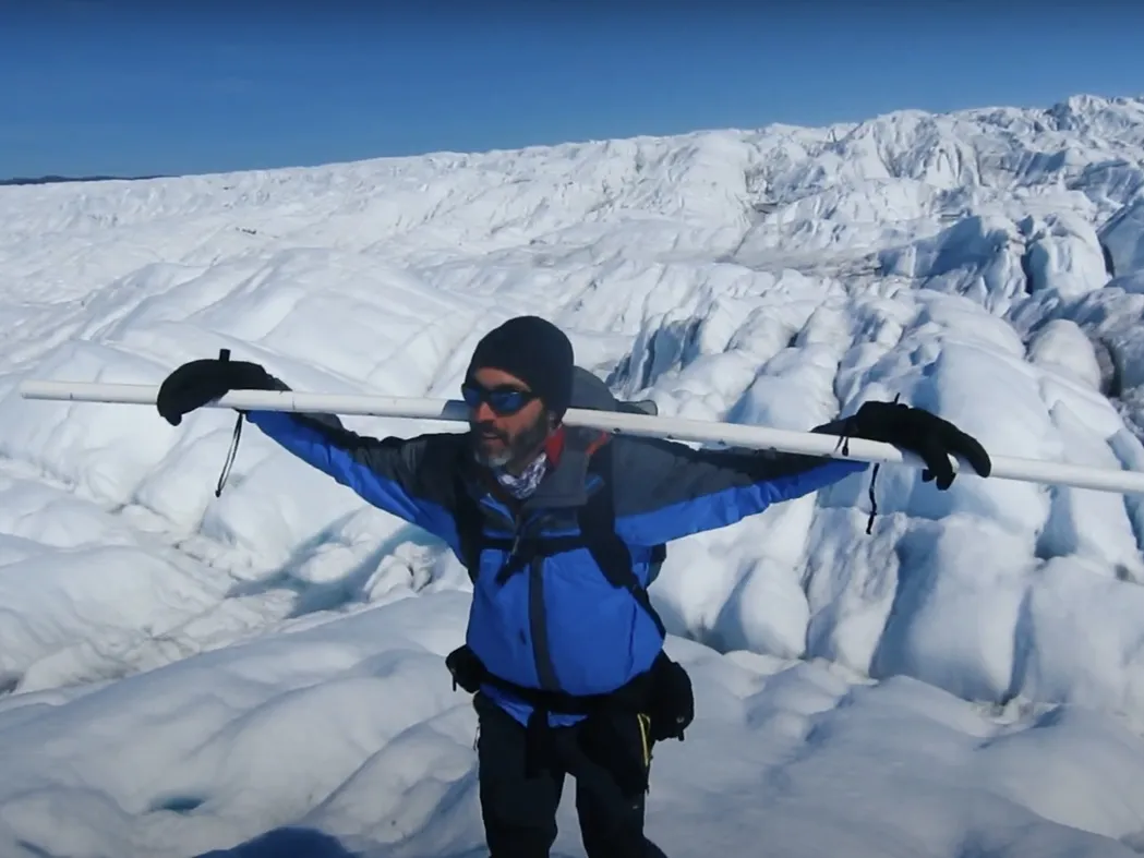
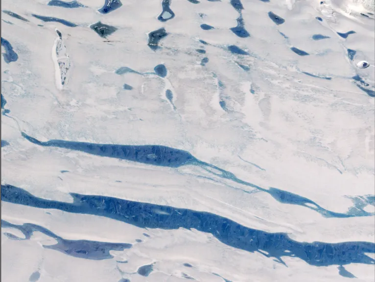
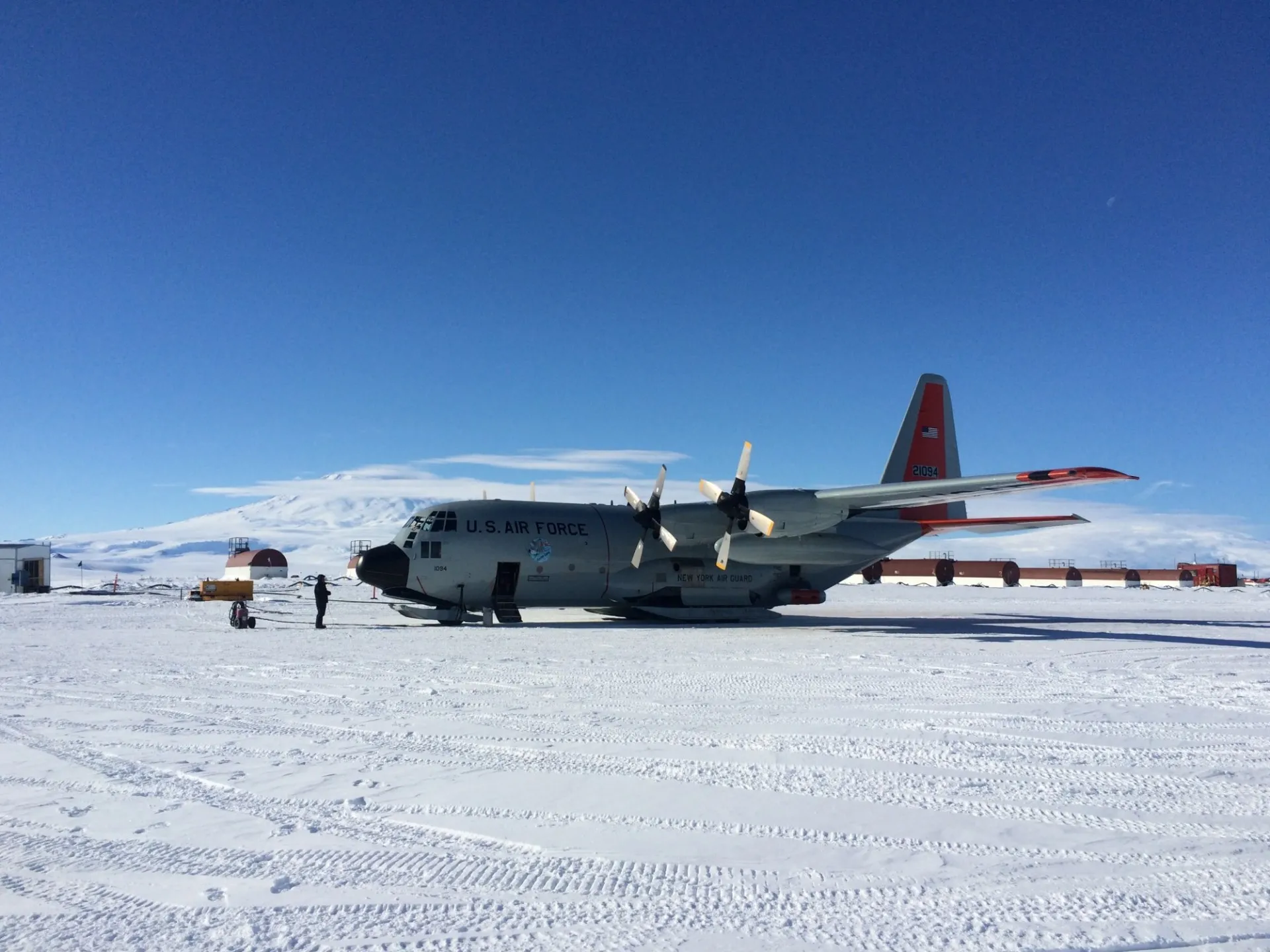
The IcePod, designed and developed at Lamont, offers an airborne integrated ice imaging system that can measure in detail both the ice surface and the ice bed. The Marine Geoscience Data System (MGDS) provides a suite of tools and services for accessing marine geoscience research data acquired throughout the global oceans and adjoining continental margins.
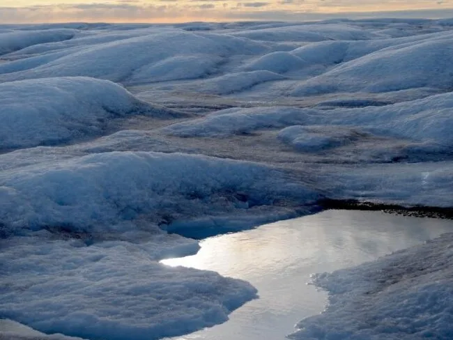
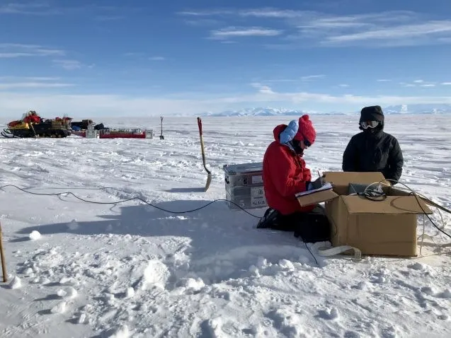
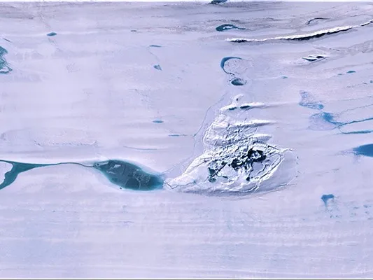
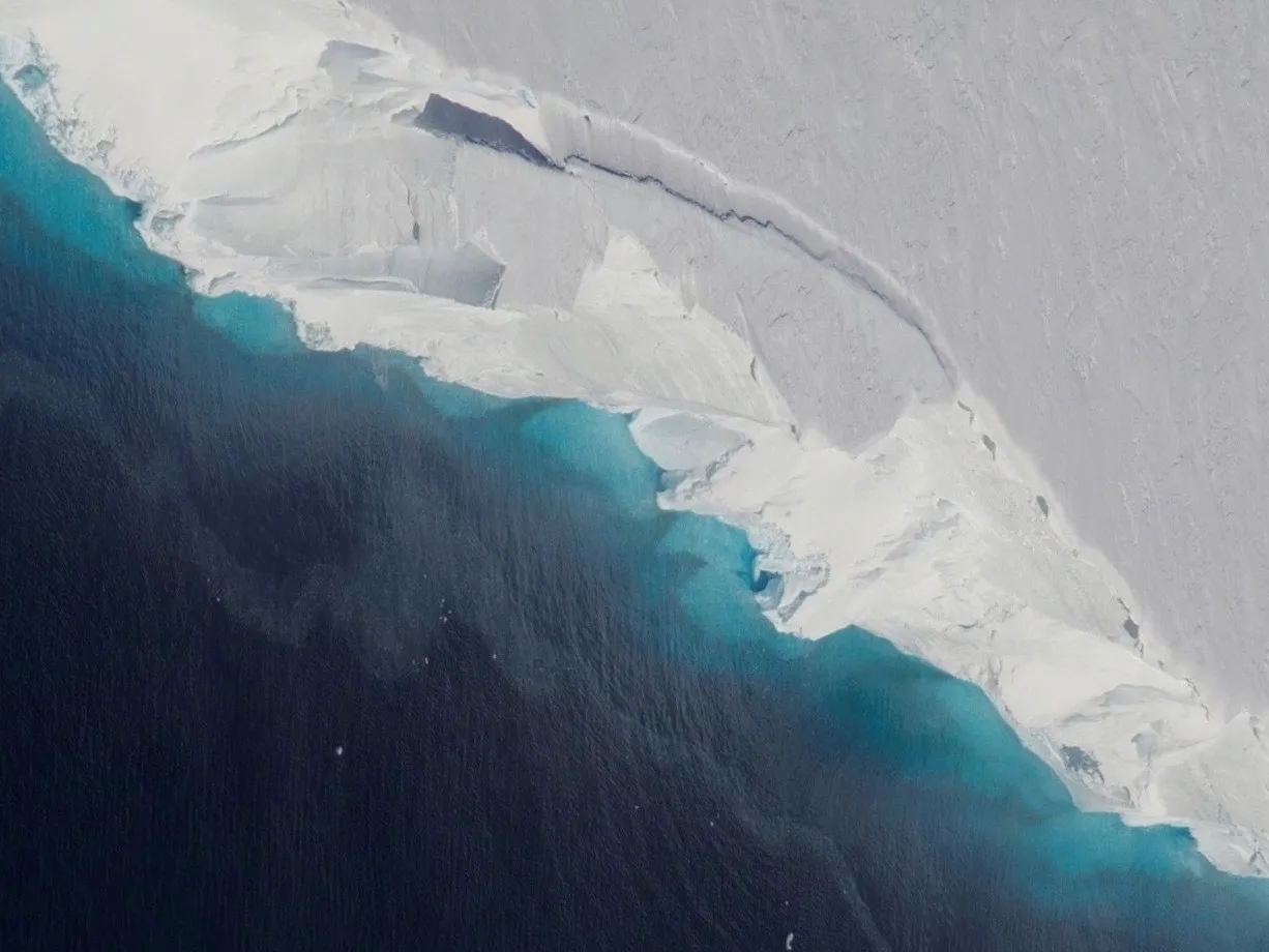
Making new and exciting observations of the ice sheets and geological processes occurring on and beneath the seafloor is a key element of MPG Division research.
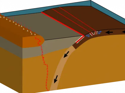
Lamont points to a legacy of discoveries, including seafloor spreading, which led to the general acceptance of plate tectonics as the broad foundation for understanding how our planet works. Communities of scientists emerged to test hypotheses generated by the plate tectonics paradigm in the oceans.
Lamont scientists have used ocean drilling data and technology to study the sediments and hard rocks beneath the seafloor, as well as the fluids that flow through them. One of Lamont's major contributions to scientific ocean drilling was the establishment of the Borehole Research Group to provide down-hole geophysical measurement services to the Ocean Drilling Program (now the International Ocean Discovery Program), developing new types of borehole logging instruments, adapting oil-field logging tools for use in ocean research drilling, and maintaining a database of all logging measurements on behalf of the ocean drilling community.
Featured Video
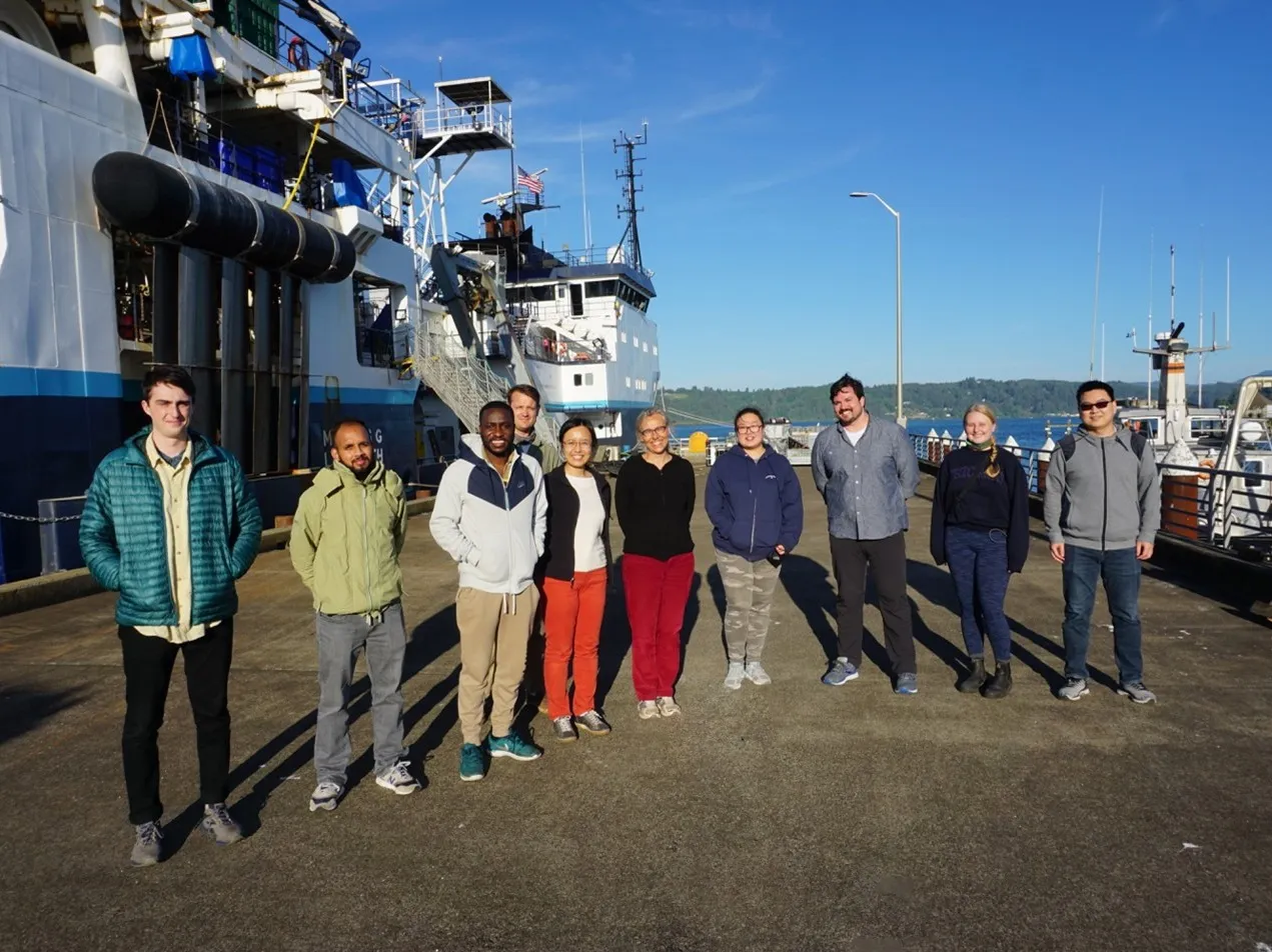
Marine & Polar Geophysics Researchers & Staff
Professional Appointments
- 2025-Present: Doherty Senior Scholar
- 2014-Present: Special Research Scientist, Lamont-Doherty Earth Observatory
- 1986-2014: Doherty Senior Scientist, Lamont-Doherty Earth Observatory
- 1984-1986: Senior Research Scientist, Lamont-Doherty Geological Observatory
- 1984-2014: Adjunct Professor of Geology, Columbia University
- 1982-1984: Associate Director of Marine Geology and Geophysics Div. at Lamont-Doherty Geological Observatory
- 1979-1984: Adjunct Associate Professor of Geology, Columbia University
- 1975-1984: Senior Research Associate, Lamont-Doherty Geological Observatory
- 1969-1975: Research Associate, Lamont-Doherty Geological Observatory
- 1962-1969: Graduate Research Assistant at Columbia University
- 1961-1962: Research Assistant at the Woods Hole Oceanographic Institution
Prestigious Invited Lectures
- Oppenheimer Lecture, Los Alamos
- Evnin Lecture, Princeton University
- Dean’s Lecture, G. H. W. Bush Library, Texas A&M
University Course Subjects Taught at Columbia University (1977 to 2014)
- Marine Geology & Geophysics
- Plate Tectonics
- Earth Environmental Systems: Solid Earth
- Paleoceanography Sedimentary Geology
Oceanographic Expeditions
- 1961 R/V Chain in Atlantic Ocean and Mediterranean Sea
- 1962 R/V Chain in Mediterranean Sea
- 1965 R/V Robert D. Conrad in Indian Ocean, Red Sea, Mediterranean Sea and North Atlantic
- 1966 R/V Robert D. Conrad in Caribbean and North Atlantic Ocean
- 1968 USNS Elisha Kane in Atlantic Ocean 1970 Glomar Challenger in Mediterranean Sea
- 1973 R/V Vema in Atlantic Ocean
- 1974 Glomar Challenger in South Atlantic Ocean
- 1976 Glomar Challenger in North Atlantic Ocean
- 1977 R/V Melville in Mediterranean Sea
- 1978 R/V Eastward in Mediterranean Sea
- 1982 NOAA Ship Surveyor in Northeast Pacific Ocean
- 1983 R/V Thomas Washington in Pacific Ocean
- 1984 CFAV Endeavour Northeast Pacific
- 1984 R/V Robert D. Conrad in North Atlantic and Mediterranean Sea
- 1985 CSS Hudson in North Atlantic
- 1990 R/V Point Sur in Monterrey Fan
- 1991 R/V Urania in Marmara Sea
- 1992 R/V Maurice Ewing on Pacific/Antarctic Ridge in Southwest Pacific Ocean
- 1993 R/V Aquanaut in Black Sea
- 1993 R/V Hudson in Labrador Sea
- 1995 R/V Ewing in the Northeast Pacific
- 1996 R/V Creed in the North Atlantic
- 1998 R/V Le Suroit in the Black Sea
- 1999 R/V Atlantis in the Southeastern Pacific
- 1999 R/V Walford in the Hudson River Estuary
- 2000 R/V Le Suroit in the Mediterranean Sea
- 2005 R/V Mediterranean Explorer in Marmara and Black Seas 2009 R/V Akademik in Black Sea
- 2011 R/V Akademik in Black Sea
Ph.D. Dissertations Directed (20)
- Daniel J. Fornari, 1978: “Submarine lava flows on island flanks and seamounts: chemistry and texture”
- Kim A. Kastens, 1981: “Structural causes and sedimentological effects of cobblestone topography in the eastern Mediterranean”
- Raymond P. Freeman-Lynde, 1981: “The marine geology of the Bahama Escarpment”
- Maria A. M. da Silva, 1983: “The Arapipe Basin, NE Brazil: Regional geology and facies analysis of Lower Cretaceous evaporitic deposition complex”
- John A. Farre, 1985: “The importance of mass wasting processes on the continental slope”
- Ellen S. Kappel, 1985: “Evidence for episodicity and a non-steady state rift valley”
- Suzanne O’Connell, 1986: “Anatomy of modern submarine depositional and distributary systems”
- Angela M. Barone, 1989: “Morpho-tectonic evolution of subsea volcanoes near the boundary of separating plates: Examples from rifting and spreading stages”
- Alberto Malinverno, 1989: “Statistical studies of seafloor morphology”
- Carlos Pirmez, 1994: “Growth of a submarine meandering channel-levee system on the Amazon Fan”
- Lincoln F. Pratson, 1994: “Submarine canyon initiation by downslope-eroding sediment flows: Evidence in late Cenozoic strata on the New Jersey continental slope” Jennifer Robin Reynolds, 1995: “Segment-scale systematics of mid-ocean-ridge magmatism and geochemistry”
- Raymond Paul Freeman-Lynde, 1981: “The marine geology of the Bahama Escarpment”
- Ana Lucia Goncalves Macario, 1995: “Crustal accretion at intermediate spreading rates: Pacific-Antarctic Ridge at 65° S”
- Wen Jin, 2000: “Tectonic strain and submarine lava flows in the mid-ocean ridges”
- Johanna Lofi, 2002: “La Crise de Salinité Messinienne: Conséquences directes et différées du l’évolution sédimentaire de la marge du Golfe du Lion”
- Candace O. Major, 2002: “Non-eustatic controls on sea-level change in semi-enclosed basins”
- Angela L. Slagle, 2007: “Spatial and temporal variability of sedimentary processes in the Hudson River estuary”
- Anne E. Cook, 2009: “Gas hydrate-filled fracture reservoirs on continental margins”
- Anastasia G. Yanchilina, 2016: “Excess freshwater outflow from the Black Sea during glacial and deglacial periods and delayed entry of marine water in the early Holocene requiring evolving sills”
I am a marine geophysicist interested in the interplay between relatively large-scale geophysical processes and the microbial biosphere. I am currently studying the tidal modulation of aqueous fluid flow within mid-ocean ridge hydrothermal systems, with the hope of understanding how such flow variations can affect subseafloor primary production. I also study spatial variations in the tidal triggering of microearthquakes within ridge systems, and I study problems in acoustics associated with high-temperature hydrothermal vents and seafloor seismic networks. Ultimately my work has implications for theories about the origins and evolution of life on this planet, and for theories regarding life elsewhere in the universe. I use numerical models to investigate these processes, and I develop new observational techniques and seafloor instrumentation to verify model predictions.
My research involves marine geophysical studies of the formation and early evolution of the Earth's oceanic crust at mid-ocean ridges, magma chamber processes, crustal evolution within plate interiors, and subduction zone properties. I make use of marine reflection seismic imaging, as well as other marine geophysical methods including sonar mapping, magnetics, gravity, and deep submergence studies. I am also involved in the development of cyberinfrastructure for geosciences providing data tools and services for the academic marine geoscience community. I have been a participant on 16 marine research expeditions since 1986, 7 as Chief, Co-Chief or co-PI. My field-work includes expeditions in the Pacific and Atlantic Oceans as well as near shore studies of sediment processes in the New York region.
As Research Support Staff, I wear many hats:
- Data Curator at the United States Antarctic Program Data Center (USAP-DC)
- Project Manager for the Visualizing Ice Sheets in Extended Reality (VISER) Project
- Antarctic Fieldwork Cargo & Logistics (via USAP & BAS Operations) Manager for Polar Geophysics & Glaciology Group (PGG)
- Data Manager for the ROSETTA-Ice Project
- Marine & Polar Geophysics Division Organizer for Open House (2022+)
- Ice Penetrating Radar Geek
- Former Archaeologist
Robin Bell, AGU president (2019 – 2020), has been a member of AGU for more than 30 years. She is a past president of the Cryosphere section and was elected as an AGU Fellow in 2011. Bell received her undergraduate degree in geology from Middlebury College in Vermont and her Ph.D. in geophysics from Columbia University in 1989. Since completing her doctorate, Bell has led the research at the Lamont-Doherty Earth Observatory on ice sheets, tectonics, rivers, and mid-ocean ridges.
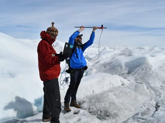
Currently, Bell is the Marie Tharp Lamont Research Professor, directing research programs in Antarctica and Greenland, and she has developed technology to monitor our changing planet. Bell has coordinated 10 major aero-geophysical expeditions to Antarctica and Greenland, studying what makes ice sheets collapse. She has discovered a volcano beneath the West Antarctic ice sheet, several large lakes locked beneath two miles of ice, and demonstrated that ice sheets could thicken from below. Bell also led a Lamont team to map the Hudson River from Staten Island to Albany.
In 2006, Bell received an honorary degree from Middlebury College and had an Antarctic Mountain named after her. During the International Polar Year, Bell led a major expedition to Antarctica to explore the last unknown mountain range on Earth, the Gamburtsev Mountains, which were completely covered with ice. Bell’s team discovered that water hidden beneath the ice sheet runs uphill. Using the new IcePod and gravity technologies, Bell’s team is currently exploring the Ross Ice Shelf, a floating piece of ice the size of France that covers the least-known piece of Earth’s ocean floor.
Patrick Alexander is an Associate Research Scientist in the Marine Geology and Geophysics division at the Lamont-Doherty Earth Observatory. He is a cryospheric scientist focusing on interactions between ice and climate. He incorporates remote sensing and in situ measurements with global climate models and regional climate models to study ice-climate interactions, particularly interactions between climate and polar ice sheets, with the goal of understanding the future impact of climate change on sea level rise. Prior to his current position, Patrick was a Postdoctoral Research Scientist at Lamont and a Postdoctoral Research Fellow at the NASA Goddard Institute for Space Studies. He earned his undergraduate and master's degrees in environmental engineering from Columbia University, and his doctorate from the Graduate Center at the City University of New York. A complete list of his publications can be found on Google Scholar.
Nick came to the Lamont Earth Observatory within the Earth Institute in 2007 to work with Dr Robin Bell to develop and deploy an Airborne Geophysics system capable of mapping the remotest parts of Antarctica in preparation for the International Polar Year. In the process he and Robin set up the kernel of the Polar Geophysics Group that has grown today into an extended family of scientists, researchers, Grad Students, Doctoral Students and Engineers that number over 30 in total. Nick also set up the Polar Geophysics lab to develop the sensors and systems necessary to carry out the work and today has extended the role of the lab to develop sensors for many aspects of the Earth Sciences.
I am a Postdoctoral Research Scientist in the Marine and Polar Geophysics group at LDEO. I use marine geophysical methods such as seismic reflection imaging and drill data to investigate processes associated with submarine landslides on continental slopes and around volcanic islands. In particular, I am interested in: (1) trigger and precondition mechanisms (e.g., excess pore fluid pressure, hydrothermal alteration, fluid flow in shallow sediments), (2) processes involved in the formation of mass transport deposits, (3) tsunami generation.
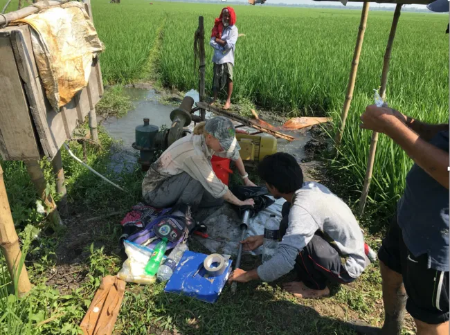
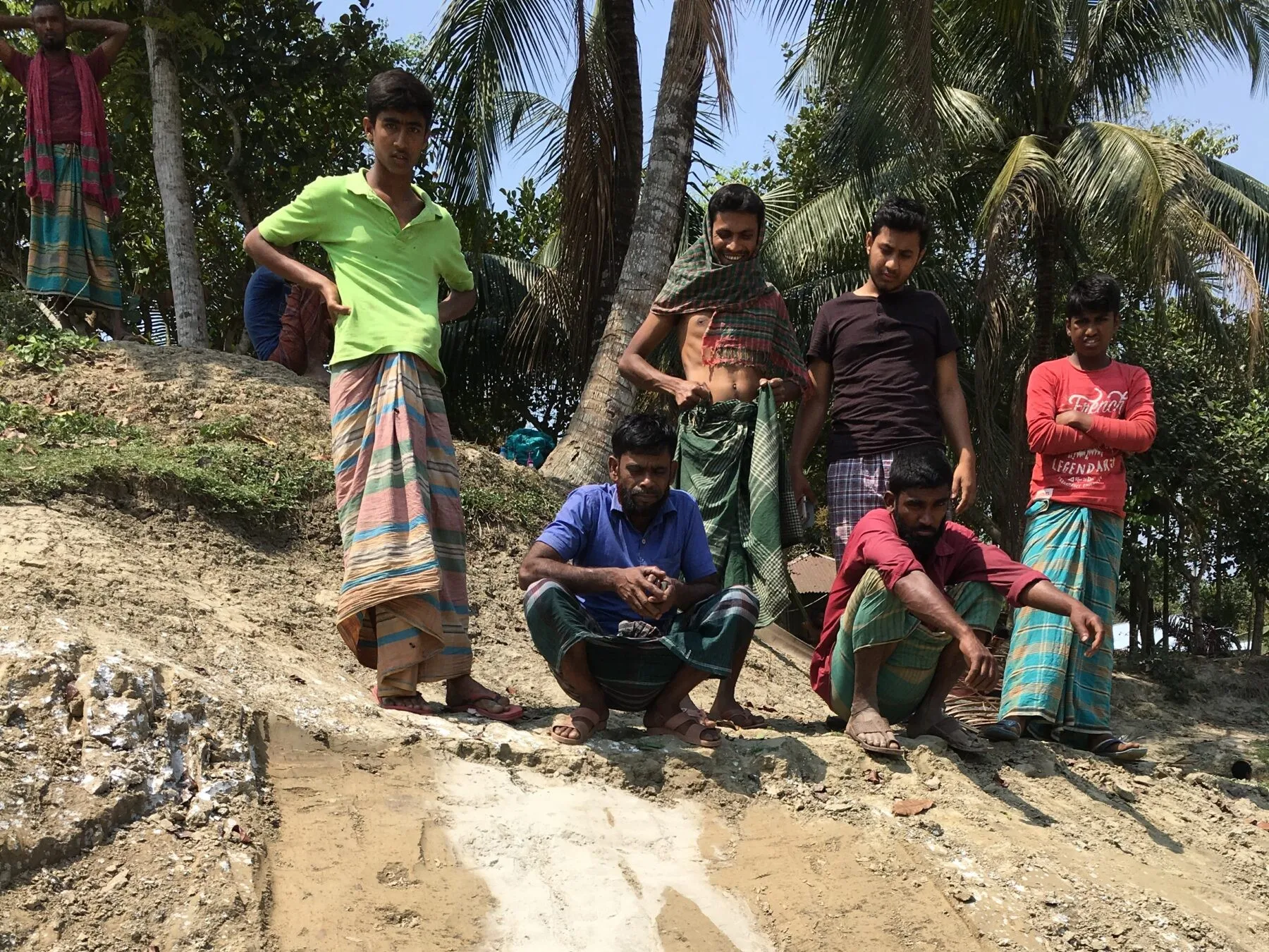
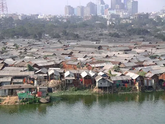
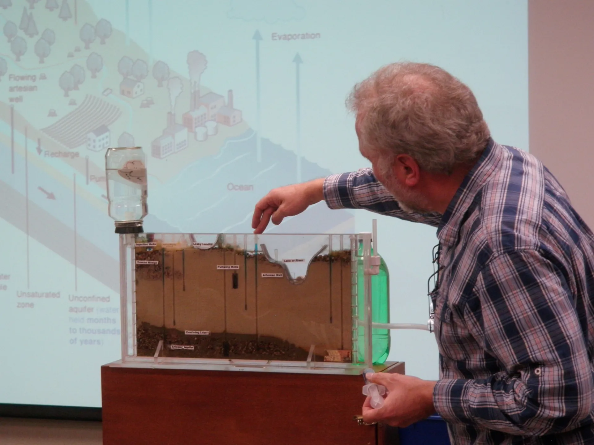
I am a geophysicist who works mainly on sedimentary systems with projects related both to tectonics and earthquakes, and to sea level and stratigraphy. A particular interest is vertical motions of the Earth’s surface and their preservation in the sedimentary record. My main field area is currently Bangladesh where I work both on the heavily-sedimented IndoBurma subduction zone (IBSZ), including the earthquake hazard, and on deltaic processes in the Ganges-Brahmaputra Delta (GBD), including sea level rise, land subsidence, sedimentation and river avulsions. I have worked in Bangladesh, and adjacent parts of India and Myanmar, for 20 years, taking part in and leading a number of field campaigns. I am also currently working on tectonics in Western Turkey, and on fresh and salty groundwater in both Bangladesh and offshore New Jersey.
Maya Tolstoy is a Professor in the Department of Earth and Environmental Sciences at Lamont-Doherty Earth Observatory of Columbia University in New York. She is a marine geophysicist specializing in seafloor earthquakes and volcanoes. Dr. Tolstoy has led 18 research expeditions at sea as Chief or co-Chief Scientist, and has 62 peer-reviewed scientific publications, including 6 in Science and 4 in Nature. She has led or co-led over $22 million worth of federally funded research, including co-PI for an Ocean Bottom Seismology National Facility for more than a decade, and was part of the leadership team that implemented the largest community marine seismology experiment to date – The Cascadia Initiative. Professor Tolstoy has been teaching in her area of expertise for more than 20 years, including courses at the graduate and undergraduate level in geophysics.
In addition to her research and teaching, Professor Tolstoy was the Interim Executive Vice President of Arts and Sciences at Columbia University from September 2018 through December 2019. Prior to that she led a number of key faculty governance groups. She co-chaired the Columbia Senate’s Commission on the Status of Women for 5 years, and led its 2014 Pipeline report. In 2016 she was elected to the Policy and Planning Committee (PPC), the faculty governance committee of Arts and Sciences at Columbia. In 2017/18 she chaired PPC leading a number of important initiatives, including developing a faculty voting process, leading a major equity study of faculty, and initiating studies on lecturers in discipline, best practices for by-laws, and childcare and schooling.
She is the recipient of the Wings Worldquest Sea Award honoring women in exploration and was a finalist for NASA’s Astronaut selection. She serves on the National Academy standing Committee on Seismology and Geodynamics and was honored by the American Geophysical Union as the Birch Lecturer in 2016. Dr. Tolstoy has also done extensive outreach work to communicate the excitement and importance of earth science to non-science audiences and worked with film-maker James Cameron on the IMAX documentary Aliens of the Deep. Her research has been covered by The New York Times, The Washington Post, NPR, and numerous other media outlets.
She holds a BSc Honors in Geophysics from the University of Edinburgh and a Ph.D. in Earth Science from the Scripps Institution of Oceanography, at the University of California San Diego.
Maureen E. Raymo is Co-Founding Dean Emerita of the Columbia Climate School, past Director of Lamont-Doherty Earth Observatory (July 2020-June 2023), and G. Unger Vetlesen Professor of Earth & Environmental Sciences.
She has degrees from Brown and Columbia Universities and studies the history and causes of climate change in Earth's past. She is best known for the Uplift-Weathering Hypothesis that ties global cooling and the onset of the ice ages to a drawdown in atmospheric CO2 caused by the uplift of the Himalayas and Tibetan Plateau.
In addition to publishing fundamental work on the stratigraphy and chronology of the recent geologic epochs, Raymo has also proposed hypotheses explaining the patterns of ice sheet variability observed over the last few million years and developed new ways of studying past sea level change. In 2014 she was the first woman to be awarded the Wollaston Medal by the Geological Society of London, their most prestigious award given out annually since 1831.
Raymo’s research has always focused on documenting how and discovering why the Earth's oceans, biogeochemical cycles, and climate have changed in the past, knowledge that is integrated with numerical models of past and future climate. Through detailed analysis of deep sea sediment cores, she has generated records of geochemical, paleontological, and paleoclimatic change that have advanced the study of Earth’s climate on tectonic, orbital, and millennial time scales.
For much of her career she has also worked to improve the timescales and stratigraphy that provide the foundation for the study of Earth’s history. Most recently her research group has focused on the reconstruction of sea level and ice volume during past warm climate intervals with the goal of improving predictions of future sea level rise in response to global warming.
Margie Turrin is Director of Educational Field Programs at Lamont-Doherty Earth Observatory where for over 20 years she has developed and delivered science education for formal and informal educators, and conducted research linking science and education. She is committed to field based teaching and research opportunities. Margie has worked extensively on the Hudson River and surrounding watershed, and is the Director of Lamont’s Hudson River Field Station. She has participated in multiple field programs in both Greenland and Antarctica on climate research projects, focusing on linking these regions into climate education, and is currently working with Greenlandic partners as part of a project working on the co-production of field-based education for students in Greenland.
Some of her favorite educational contributions are a book she co-authored “Earth Science Puzzles: Making Meaning from Data,” a series of publications she co-authored on the power of question asking in science education, and two map based educational apps she co-developed on changes in the Antarctic Ice Sheet (Thwaites Explorer) and the science of sea level change (Polar Explorer: Sea Level).
Margie is on the Board of the Hudson River Environmental Society, and serves on the Lamont's Diversity, Equity, Inclusion and Anti-Racism Standing Committee, and the Thwaites International Glacier Collaboration Inclusion, Diversity, Equity and Access Committee.
Marco Tedesco is a Lamont Research Professor at the Lamont-Doherty Earth Observatory of Columbia University and Adjunct Scientist at the NASA Goddard Institute for Space Studies (GISS). He is also affiliated with the Data Science Institute, he is Affiliated professor at Sant’Anna School of Economics in Pisa, Italy and has been the Resident Scientist at the Columbia Business School for the past two years. He is a fellow of the Explorers Club and a member of the New York City Panel on Climate Change, Equity Working Group. Dr. Tedesco received his Laurea degree and PhD in Italy, from the University of Naples and the Italian National Research Council. He then spent five years as a postdoc and research scientist at NASA Goddard Space Flight Center. He moved to CCNY in 2008 as an Assistant Professor where he was promoted to Associate Professor in 2012. During his time at CCNY, he founded and directed the Cryosphere Processes Laboratory and was a rotating Program Manage at the National Science Foundation between 2013 and 2015. In January 2016, he joined Columbia University. Dr. Tedesco’s research focuses on the dynamics of seasonal snowpack, ice sheet surface properties, high latitude fieldwork, dendrochronology, global climate change, its implications on the economy and real estate and climate justice. Dr. Tedesco led more than 10 expeditions to Greenland and to Antarctica, beside fieldwork in many other places, including Iceland, Northern US, Canada, Italian Alps and more. He is the editor of he book “Remote Sensing of the Cryosphere” published by Wiley in 2015 and he is the author of the book “The hidden llid of ice” originally published in 2018. the book has been translated in 7 languages and was selected by the Washington Post and by the National Geographic Traveler as one of the best 10 books of the year.
Dr. Lin Shen is an Associate Research Scientist at Lamont-Doherty Earth Observatory, Columbia University. Her research focuses on understanding the interactions between surface deformation and dynamic Earth processes that drive geohazards, using satellite remote sensing techniques with a specialization in Interferometric Synthetic Aperture Radar (InSAR). Her work spans a range of geophysical applications, including seismic hazard assessment along intra-continental faults and plate boundaries, forecasting global volcanic activity through machine learning integration, and monitoring environmental changes related to sea-level rise.
Her ongoing and past research projects include:
- Coastal subsidence mapping in the Ganges-Brahmaputra Delta
- Strain partitioning and earthquake hazard assessment in the Indo-Burma Subduction Zone
- Interseismic strain accumulation along the Altyn Tagh Fault in the Northern Tibetan Plateau
- A comprehensive observational database of global volcanic deformation for machine learning applications
- Geodetic constraints on the 2018 Mw 7.5 Palu earthquake
- InSAR atmospheric correction techniques to enhance the accuracy of ground deformation measurements for various geoscience applications
As of Summer 2022, I am no longer working at Columbia.
I went to The University of York, UK, and did a Physics BSc. My final year project was on the nucleation of freezing in supercooled water, supervised by Dr Richard Keesing. We scattered a laser through droplets of supercooled water to observed freezing as it was initiated by the application of an electric field.
Between 2009 and 2013 I did PhD in glaciology in the Department of Geography, Sheffield University, supervised by Dr Felix Ng. My thesis was entitled 'Modeling ice-dammed lake drainage'. I used mathematical models to study how water flows beneath glacier.
Between 2013 and 2016, was a Glacier Geophysicist at the British Antarctic Survey (BAS), Cambridge, UK. I was employed on a NERC-funded project led by Richard Hindmarsh. We used radar and mathematical models to study present-day and past ice flow in West Antarctica. I conducted two two-month field seasons in the Weddell Sea Sector of Antarctica.
In March 2016 my wife and I moved from the UK and I started my current position as Assistant Professor in the Department of Earth and Environmental Sciences, Columbia University, and the Lamont-Doherty Earth Observatory.
My research is concerned with obtaining a better understanding of glacial processes to improve predictions of ice-sheet evolution.
I advise a group of students and post-docs using remote-sensing, mathematical modeling and fieldwork to better understand glacial processes.
My research investigates the thermo-mechanical evolution of the Earth's lithosphere by means of computational and analytical modeling. I specifically study the interactions between tectonic, hydrothermal, magmatic and surface processes at continental rifts and mid-ocean ridges, as well as the dynamics of subduction zones.
Huy Le is a graduate student majoring in geophysics in the Department of Earth and Environmental Sciences at Lamont-Doherty Earth Observatory, Columbia University. He received a B.S. degree in geology from the University of California, Davis, in 2019.
Huy's research concentrates on applying electromagnetic (EM) geophysical methods for imaging subsurface structures in different geological settings. His current work is imaging offshore groundwater systems in the U.S. Atlantic margin and Bangladesh.
Frank O. Nitsche received a MS in geophysics from the University of Kiel, Germany and a Ph.D. from the University of Bremen, Germany. Between 1997 and 2001 he was a postdoctoral researcher in the Applied Geophysics Group at the ETH Zurich. In 2001 he came to the Lamont-Doherty Earth Observatory of Columbia University where he started as a postdoctoral researcher and is now a research scientist. There he studies sediment processes and morphological conditions of the Hudson River Estuary and the Long Island Sound. In addition, he investigates the morphology of the Antarctic continental margin and is reconstructing the path of past ice streams and related sediment transport processes. His research uses mostly acoustic mapping techniques and data integration through GIS to understand sediment transport, deposition and related processes that shape continental margins from estuaries to the deep sea. In addition he is a data manager for the USAP Data Center since 2016.
Emily received her BA in Physics from UC Berkeley in 2019, and subsequently spent two years working on quantum technologies at HRL Laboratories. In 2021, she began a PhD in Earth and Environmental Sciences at Columbia University and joined the Polar Geophysics Group at Lamont. Her research interests include Antarctic ice shelf stability, glacier surface hydrology, and mass balance of Antarctic ice sheets.
Donna Shillington uses active-source seismology together with other geophysical and geological data to investigate deformation and magmatism at plate boundaries, including continental rifts and rifted margins, subduction zones, and transform boundaries.
David Porter is an Associate Research Scientist at the Lamont-Doherty Earth Observatory in the Climate School at Columbia University. He studies how the atmosphere and ocean drive changes in the ice sheets, and how the resulting changing sea level affects coastal communities. His research involves climate processes at high-latitudes, and is particularly interested in the interactions between different Earth System components. His expertise is at this intersection of traditional disciplines. At the ice-ocean interface, he studies how ice is melting in warming ocean waters, likely the most pressing question for the future of the Greenland and Antarctic ice sheets. Are warming ocean waters responsible for the increase in mass loss of marine-terminating glaciers worldwide? How stable are Antarctic ice shelves, especially the Ross Ice Shelf which holds back several meters of sea level rise? At the atmosphere-ice interface, he asks “what drives the newly-observed liquid water on the surface of the frigid Southern Continent?” And at the solid earth-ice interface, under the massive and ancient ice sheets themselves, he’s involved in projects to link geological controls on fast moving glaciers and ice streams.
Dave started his science career in meteorology at Rutgers University in New Jersey, fascinated both by the power of hurricanes Andrew and Allison but also playing in snow drifts dropped by potent nor’easters. Since that time, he has diversified his interests, advancing polar meteorology by modeling atmospheric changes to Arctic sea ice loss for his doctorate from University of Colorado at Boulder. Further broadening for his postdoctoral project at LDEO of Columbia University, he used new gravity-derived bathymetry from NASA Operation IceBridge to link ocean heat to glacier mass loss. Since then he has sailed aboard the US ice breaker Nathanial B. Palmer to the remote East Antarctic coast to map the seafloor and collect new water samples, and currently working with coastal communities in Greenland to link changes in the Greenland ice sheet to impacts on the built environment and social systems.
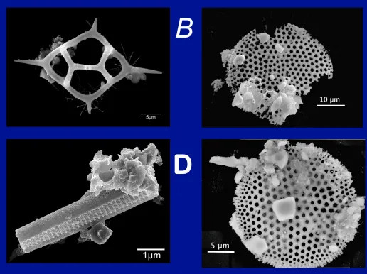
Dallas Abbott has worked in the areas of Marine Geology, Geophysics, Precambrian Geology, and Impact Geology. Over the past 13 years, Abbott has developed the microtechniques necessary to study the fine debris from oceanic impacts. Deep-sea impacts pose several problems. The first is a very restricted sample size compared to subaerial impacts. The second is a lack of large quartz grains in most settings, resulting in a reduced abundance of or no shocked quartz. Her collaborators and she have developed microtechniques to study oceanic impacts. They use the scanning electron microscope and analyses of thin sections of tiny grains to find and confirm impact ejecta.
Abbott has also learned how to separate out particulates from ice cores at ages of suspected Holocene impacts. They measured the highest concentration ever of marine diatoms in the GISP2 ice core. The diatoms are low latitude and originate from a source on a continental shelf with high biological productivity. Several other types of dust, including micrometer sized CaCO3 crystals, accompany the diatoms. The latter may have caused a dust veil and climate downturn that lasted for 18 months (Feb. 536 to June 537 AD). Some dust with both substantial Ni and K may be impact ejecta. They are still developing these microtechniques but they have already yielded some important scientific results. By combining proxies for continental dust with historical accounts of unusual dust storms, they have managed to date their ice core samples to within a calendar year. This allows us to tie our scientific results into the historical record-a mix that should attract students of both Earth Science and History. One accomplishment is documenting oldest primary native Fe ever found. Abbott and her collaborators found 1.6 Ga native Fe in the Chaibasa Formation in India. This is the worlds oldest primary native Fe by over a billion years.
I am a Postdoctoral Research Scientist in the Marine and Polar Geophysics Division. I am a marine geophysicist who primarily uses active source seismology, both multichannel seismic reflection and wide-angle refraction, to constrain crustal structure.
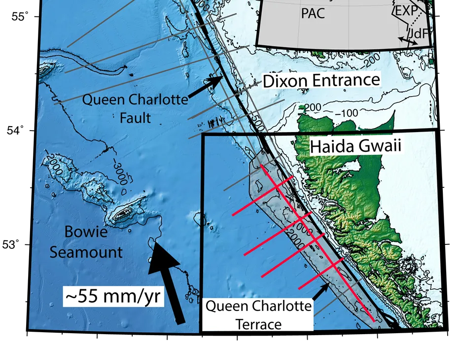
I am interested in the structure and evolution of past and present plate boundaries. These environments inform our fundamental understanding of plate tectonics and can have major societal impacts through hazards like earthquakes and tsunamis. During graduate school, I worked on the east coast of the U.S. using data from the ENAM-CSE (Eastern North American Margin-Community Seismic Experiment) and on the Queen Charlotte Plate Boundary using data from TOQUES (Transform Obliquity on the Queen Charlotte Fault and Earthquake Study).
At Lamont, I am working on a collaborative project to understand the Blake Plateau offshore eastern Florida. Blake Plateau is significantly wider than its adjacent rift segment (the Carolina Trough) suggesting that there were substantial differences during breakup. The active source seismic dataset, FLAME (FLorida Atlantic Margin Evolution), was acquired in 2023 to constrain the crustal structure of Blake Plateau and understand its rifting history.
- 1963 - Born
- 1985 - BS Geophysics & Geology, University of Wisconsin Madison
- 1989 - MA Geological Sciences, University of Texas at Austin
- 1993 - PhD Geophysics, Scripps Inst. Oceanography, Univ. of California San Diego
- 1993 - Lamont Postdoctoral Fellow
- 2010 - Lamont Research Professor
My research focuses on marine geology and sedimentation processes to understand earthquake and tsunamis, sea-level changes, climate and the impact of anthropogenic activities in the local rivers and estuaries such as the Hudson and Long Island Sound. I have also studied the effects of extra-terrestrial impact events as the one that happened 35 million years ago in what is today Chesapeake Bay in Maryland and Virginia. My driver for conducting research is the discovery of the unknown. Very little is known about the ocean floors in proportion to their huge coverage of the Earth 70%. Indeed there are discoveries in every expedition I participated. The beauty of studying sediments is that in the submarine environment they tend to be deposited and not disturbed as on land. So the history of events in preserved back in time for millions of years. We learn about the past to understand the future and the sediments are great sources of information. As one of the precursors of the field of submarine paleoseismology I study earthquakes and tsunamis under the sea. This work began in Turkey in 1999 after catastrophic earthquakes caused thousands of casualties and much destruction. As Pi and CoPi, I have lead expeditions to study the M7.0 2010 and M7.2 2021 Haiti earthquakes as part of RAPID Responses, and I am studying the disastrous M 9.0, 2011 Japan earthquake and tsunami as part of the International Ocean Drilling Expedition to the Japan Trench.
The burning of fossil fuels releases gases into the atmosphere creating a greenhouse effect. So the Earth is getting warmer and so are the oceans. As a result, mountain glaciers and ice sheets are melting and the oceans are warming. These processes lead to a rise in sea-level that is accentuated by thermal expansion of the ocean waters. Warmer oceans lead to increased storm activity and greater storm surges that are penetrating further landwards and maintaining their energy through longer periods of time. These factors threaten our heavily populated cities. By studying the sedimentation record I learn what climate and sea-level were in the past and hope to help understand their impact in the future.
Caitlin received a Bachelor of Science in Earth Science from Columbia University in May 2013. She joined the Polar Geophysics Group at Lamont-Doherty Earth Observatory in December 2016 as a Senior Research Staff Assistant where she processed, analyzed, and managed airborne geophysical data for the group, in addition to participating in fieldwork. In 2021, she became a first year graduate student working with Kirsty Tinto. She is involved in the Bed Classes, Oceans Melting Greenland, Operation IceBridge, and ROSETTA-Ice projects.
Dr. Anne Bécel's research focuses on characterizing the seismic structure of the Earth’s crust and uppermost mantle to better understand major processes that are taking place along active plate boundaries such as transform faults or subduction zones but also at rifted passive margins and ocean basin settings. To investigate these processes, she primarily uses marine active-source seismology. Her research at Lamont has mainly focused on the study of the Alaska Peninsula and Hellenic subduction zones with an emphasis on assessing specific risks such as large earthquakes and associated tsunamis and the development of the Eastern North American continental rifted margin.
I joined Lamont as a Systems Analyst/Programmer in January 2023. I work on USAP-DC, R2R, and GeoMapApp.
Prior to joining LDEO, I received a double Bachelor of Science in Computer Science and Math and a Master of Science in Computer Science from Binghamton University, with some professional software engineering experience in between. My master's thesis is entitled Compiler-Directed Regulation Enforcement for Unmanned Aerial Vehicles.
When not working, I enjoy baseball, skiing, and live music, often playing vibraphone at jazz jam sessions in the New York City area.
Alberto Malinverno received a degree in geology at the University of Milano, Italy, in 1981 and a Ph.D. in geology at the Lamont-Doherty Earth Observatory (LDEO) of Columbia University, New York, in 1989. After graduating, he spent three years at LDEO as a post-doctoral scientist and research scientist, participating in a total of twelve marine geology and geophysics seagoing expeditions. In 1992 Alberto joined the Schlumberger-Doll Research center in Ridgefield, Connecticut, where he worked on the quantifying uncertainties in the inversion of borehole measurements. He returned to Lamont in 2005 as a principal research scientist at the LDEO Borehole Research Group. As a logging scientist, he participated in five scientific drilling expeditions on the US drilling vessel JOIDES Resolution (North Cascadia margin, Bay of Bengal, Equatorial Pacific, and twice on the Costa Rica Pacific margin). Alberto is now a Lamont Research Professor and an adjunct professor at the Department of Earth and Environmental Sciences of Columbia University, where he teaches "Quantitative Methods of Data Analysis" (EESC G6908). See also the career profile interview published in the September 2010 issue of Oceanography.
Dr. Al-Maruf is working as a Professor at the Department of Geography and Environmental Studies, University of Rajshahi, Bangladesh. In 2023, he received Fulbright Research Fellowship to work on climate resilience through ecosystem services at Columbia Climate School in Columbia University, USA. He worked as a research collaborator at the Mershon Center for International Security Studies at Ohio State University (USA) in 2019. In 2017, he completed his PhD from the University of Cologne, Germany. His research interests span climate resilience, disaster resilience, ecosystem services, and livelihood succession, focusing on coastal Bangladesh. He is keenly interested in collaborating with distinguished academics worldwide, considering his research field of interest.