“Making observations in the oceans is the fundamental basis for research and educational initiatives within this division—sea surface, sea floor, and sub-bottom information helps scientists and students understand global climate, marine resources, geological processes, and their interconnections on our unique planet."
From research expeditions aboard the R/V Marcus G. Langseth to seafloor mapping to ship-based experiences for students and more, Marine/Large Programs (MLP) marine geoscientists and experts are seafaring explorers committed to making high-quality data widely accessible to scientists and the public. MLP investigators also manage the participation of U.S.-based marine scientists in a longstanding international program of scientific ocean drilling that continues to advance knowledge of climate history, geohazards, limits of life, and other topics of important societal relevance.
Marine Programs
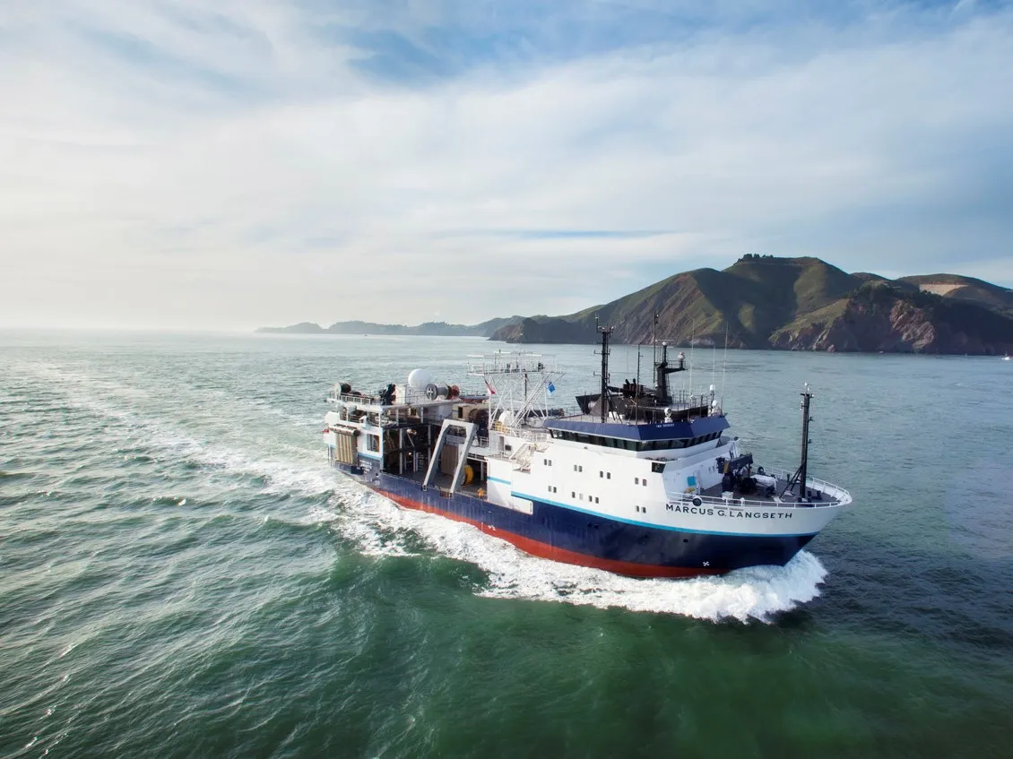
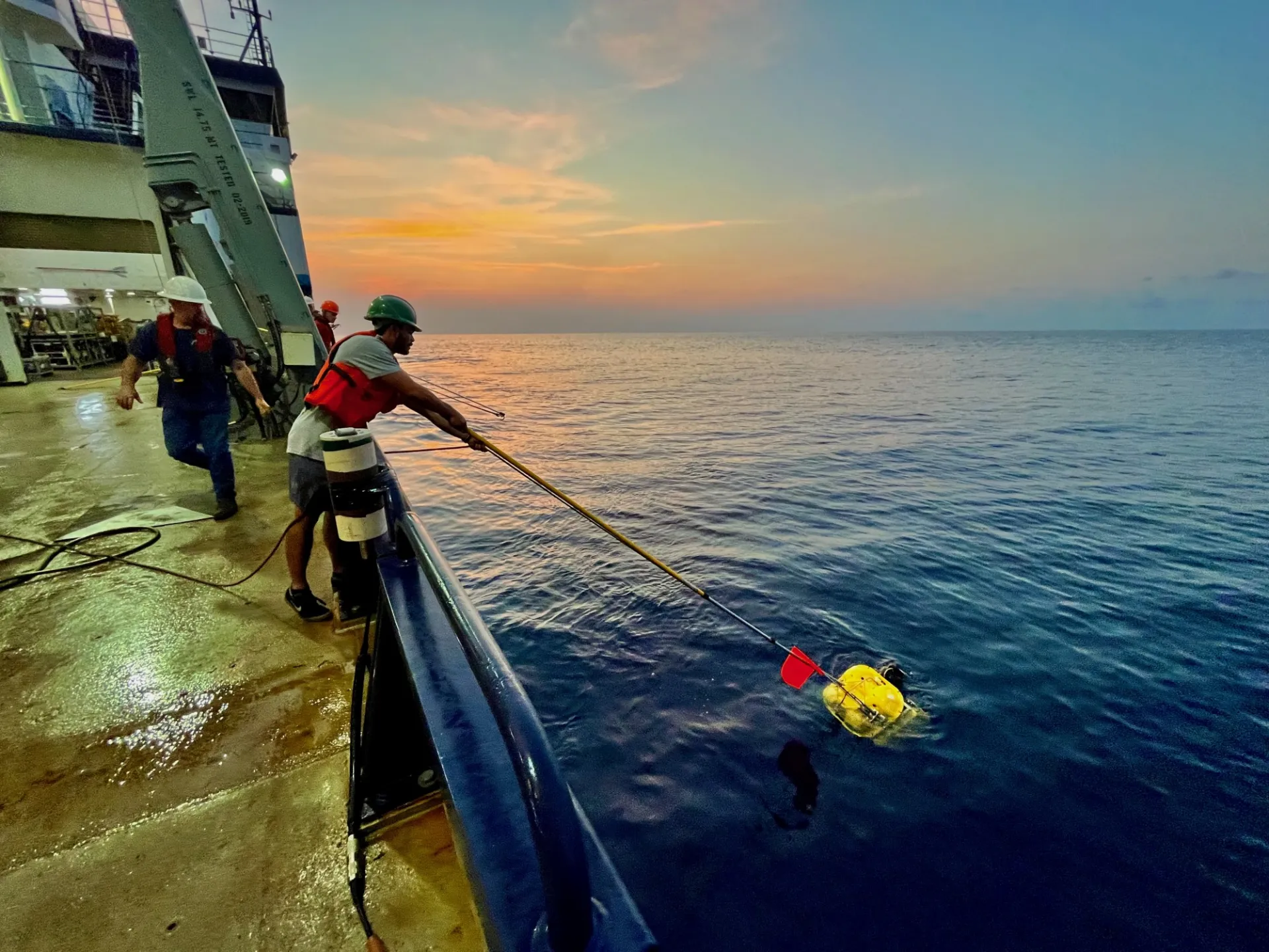
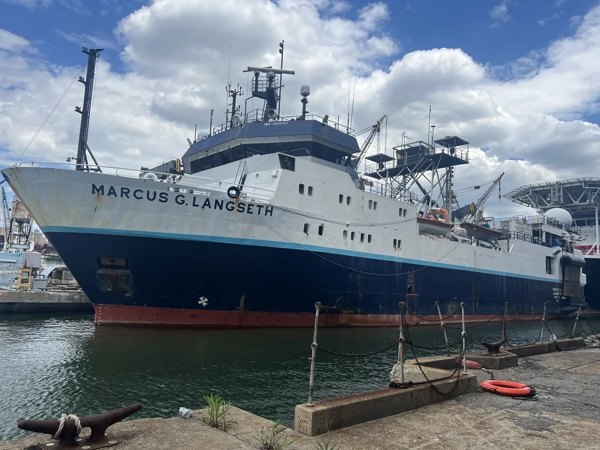
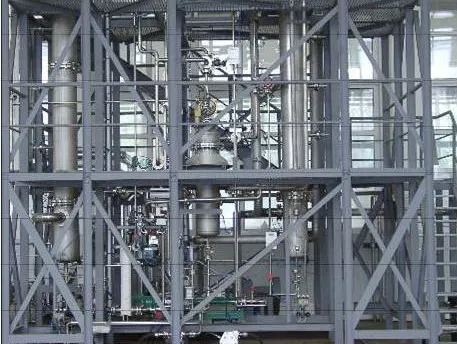
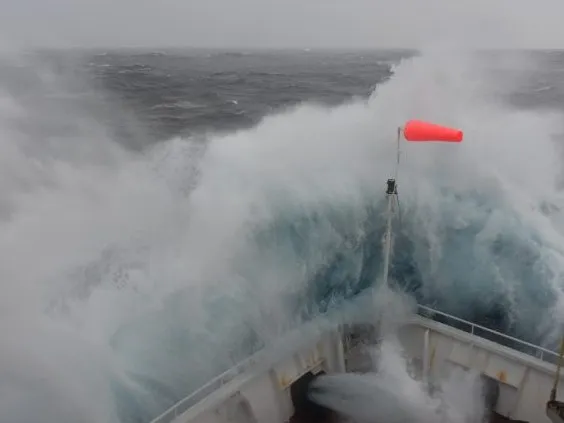
The Office of Marine Operations (OMO) operates Lamont-Doherty’s Research Vessel Marcus G. Langseth, which serves as the national seismic research facility for the United States academic research community. Scientists and researchers from all over the world participate in research programs aboard the Langseth to understand climate variations, our oceans, and submarine volcanoes.
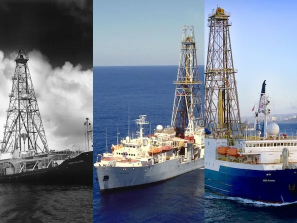
The U.S. Science Support Program (USSSP) facilitates involvement of the U.S. scientific community in the IODP, an international program of basic research in marine geosciences that explores the Earth’s history and environment via ocean-going drilling vessels. Scientific ocean drilling remains one of the preeminent tools for reconstructing Earth’s history and improving predictive models for its future.
Data Resources
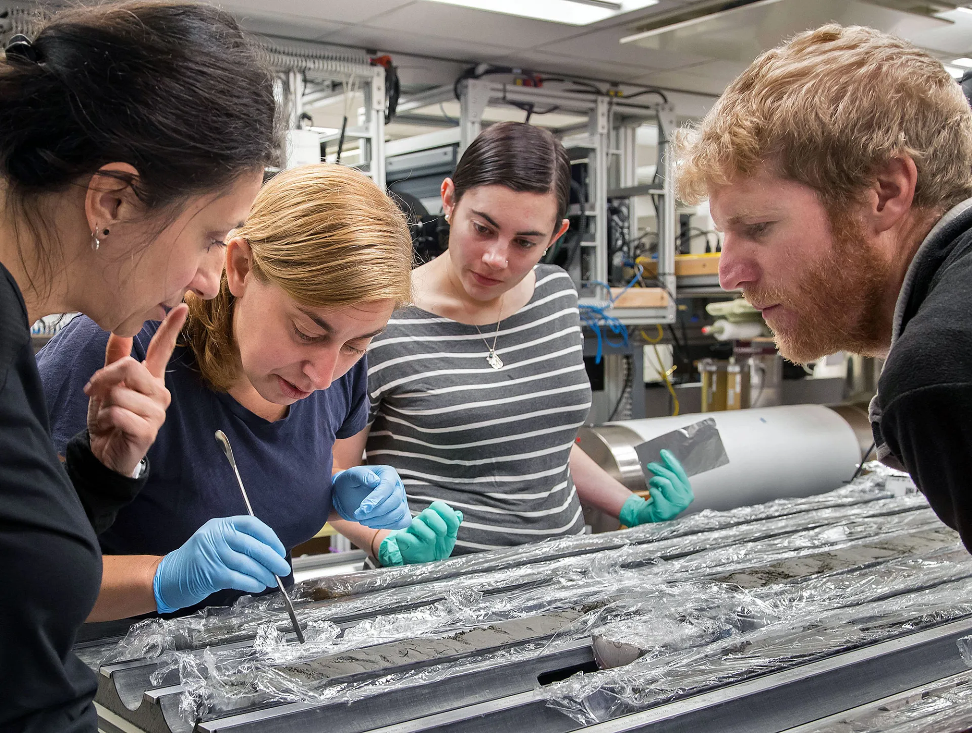
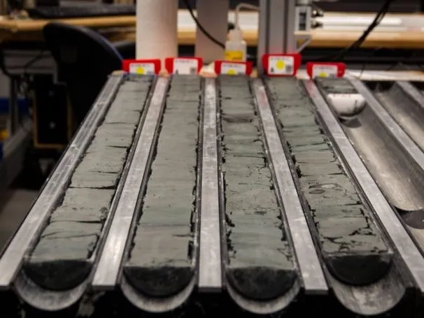
The Borehole Research Group has been collecting and processing logging data from scientific drilling projects around the globe for more than 30 years. The logging database (LogDB) is the repository for all the logging data collected by the IODP and its predecessors DSDP and ODP as well as from some of the most comprehensive gas hydrate drilling programs, and from various continental scientific drilling projects.
Marine Geoscience Data System (MGDS) is a trusted data repository offering free public access to a curated collection of marine geophysical data and metadata related to the formation and evolution of the seafloor and sub-seafloor. MGDS is developed and operated by domain scientists and technical specialists with deep knowledge about the creation, analysis, and scientific interpretation of marine geoscience data.
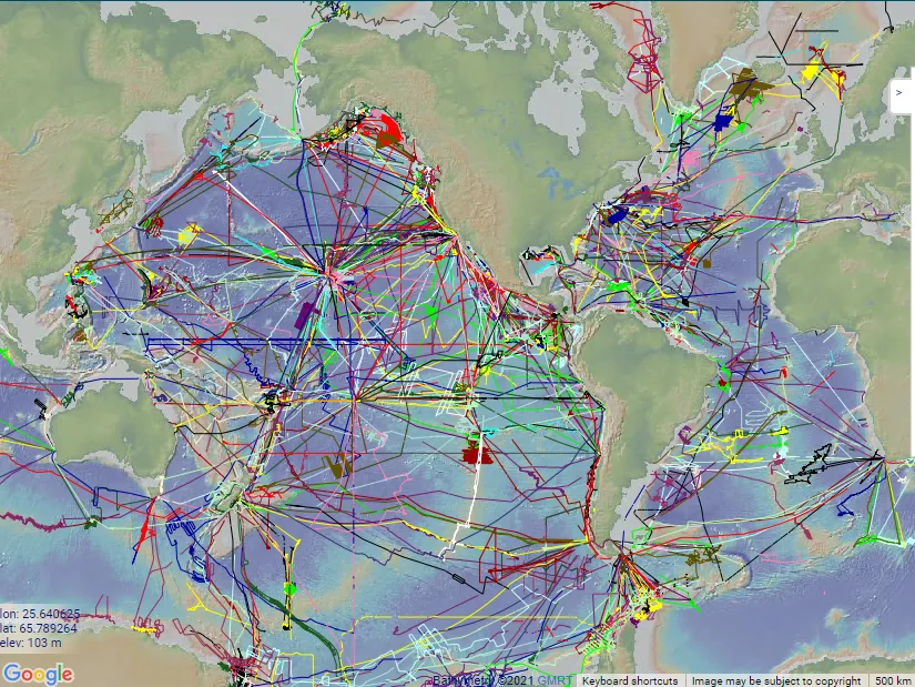
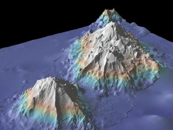
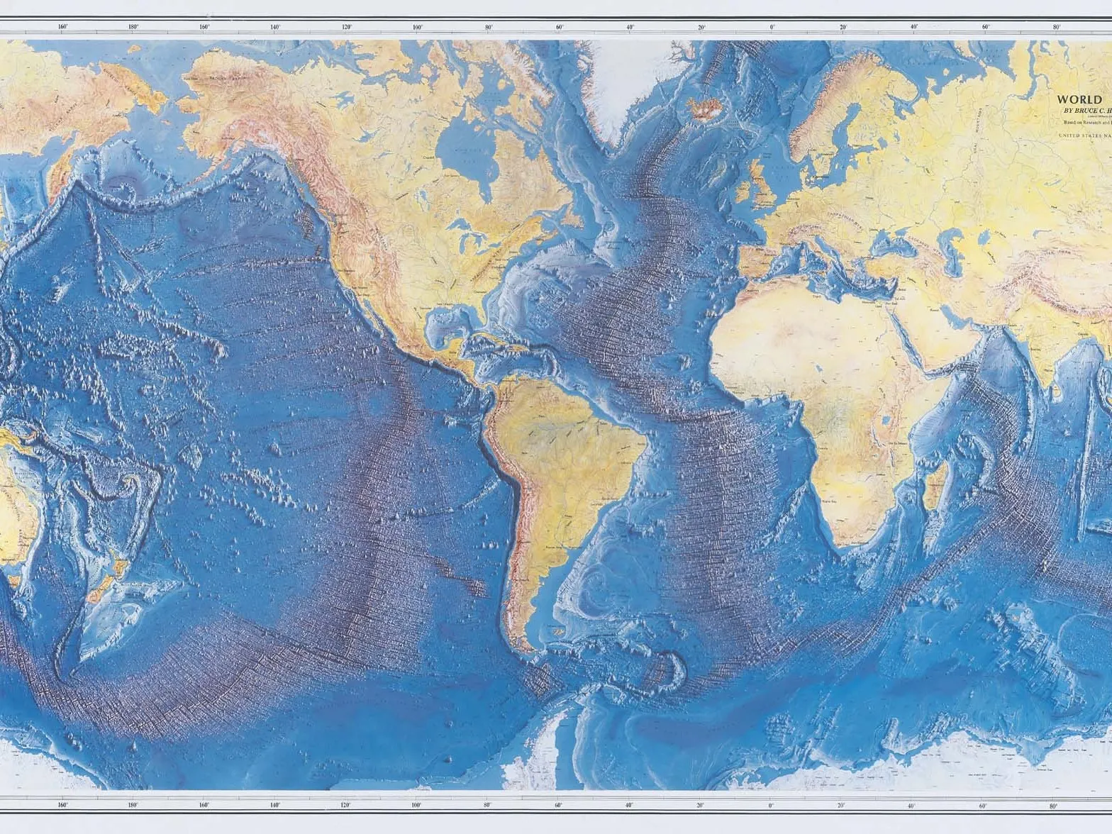
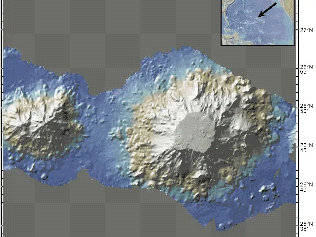
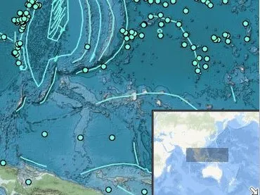
Global Multi-Resolution Topography (GMRT) Synthesis is a multi-resolutional compilation of edited multibeam sonar data collected by scientists and institutions worldwide that is reviewed, processed, and gridded by the GMRT Team and merged into a single continuously updated compilation of global elevation data. GMRT is jointly led by Suzanne Carbotte (MGG, lead PI) and Vicki Ferrini (MLP, co-PI).
Paleo-CO2 provides access to published paleo-CO2 data that have been assembled and curated by an international group of proxy experts in paleo-CO2 reconstructions from terrestrial and marine archives. The data product will evolve as our proxy understanding evolves in this diverse and rapidly growing research field. Paleo-CO2 is jointly led by Bärbel Hönisch (Geochem, PI) and Vicki Ferrini (MLP, co-PI).
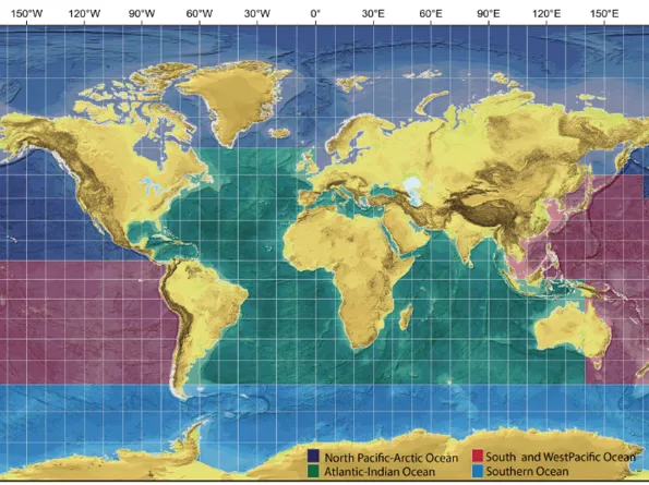
The goal of Nippon Foundation-GEBCO Seabed 2030 Project is to map the world’s ocean by 2030, with all bathymetric data made freely available to inform policy decisions, sustainable ocean use, and scientific research. Atlantic & Indian Oceans Regional Center, based at Lamont-Doherty, compiles data and coordinates activities for the Atlantic and Indian Oceans.
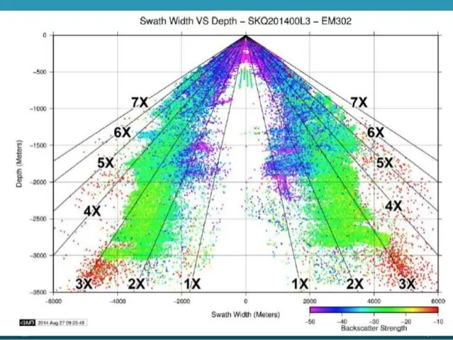
Multibeam Advisory Committee (MAC), a collaboration between Lamont-Doherty and the Center for Coastal and Ocean Mapping at the University of New Hampshire, is a community-based effort to ensure that consistent, high-quality multibeam data are collected across the U.S. Academic Research Fleet, including the exchange of technical knowledge for optimal performance of multibeam sonar systems.
Education
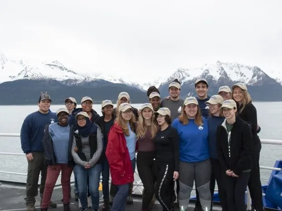
Science, Technology, Engineering and Math Student Experiences Aboard Ships (STEMSEAS) provides ship-based, 6-10 day exploratory experiences for undergraduates from diverse backgrounds aboard NSF-funded research vessels. Students sail with experienced faculty mentors and engage in geoscience and oceanography activities.
Alliance-Building Offshore to Achieve Resilience and Diversity (All-ABOARD) builds on the power of off-shore experiences and successful professional development models to provide inter-generational teams of geoscience leaders with tools to advance diversity, equity and inclusion (DEI) on their home campuses.
Ambassadors for STEM Training to Enhance Participation (A-STEP) seeks to raise the profile of geosciences and geoscience-related careers, particularly among underrepresented populations, through transformative seagoing experiences that broaden perspectives on the role of the oceans as a driver of global and environmental change.
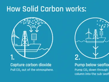
Research Initiatives for Carbon Storage
Marine/Large Programs Researchers & Staff
Vicki Ferrini is a Senior Research Scientist at Columbia University's Lamont-Doherty Earth Observatory (LDEO). Her research focuses on using mapping techniques to understand the processes that shape the seafloor in a variety of environments. She has participated in research expeditions around the world mapping shallow water and deep-sea environments using ships, boats, submersibles and towed platforms. Most of her work is in the field of geoinformatics and is focused on ensuring that high-quality marine geoscience research data are made available to the science community and to the public. She is the Head of the Seabed 2030 Regional Center for the Atlantic and Indian Oceans.
Sheila Cáceres is a Research Staff Assistant at Columbia University’s Lamont-Doherty Earth Observatory. Originally from the Dominican Republic, Sheila graduated from City College of New York in 2022 with a degree in Environmental Earth Systems Science and a concentration in Hydrology and Climate. She began working with the Seabed 2030 Atlantic and Indian Oceans Regional Center and GMRT at Lamont during a summer program in 2022 as part of its data apprentice program. After joining the team full-time, Sheila works on data processing and assembly and science communication activities in support of Seabed 2030.
Sean Higgins is a Senior Research Scientist at LDEO and has served as Director, Office of Marine Operations for the Columbia-owned R/V Marcus G. Langseth since 2010 that operates as part of the US Academic Reseach Fleet. Prior to that, he worked as part of the Bore Research Group at LDEO and as Associate Director of the US Ocean Drilling Program in Washington DC. He received his B.S. in Geology from University of Nebraska-Omaha , his M.S. in Geology from Univ. of Maine-Orono and his Ph.D. in Earth Sciences from Columbia University. His research interests range from glacial geology to marine geology and paleoceanography to sedimentary marine geochemistry.
Michael was a classroom Earth Scence Educator in middle school, high school, and college for 44 years. He continues to provide instruction in the graduate ES teachers program at the American Museum of Natural History in a career that now spans more than 50 years.
In 1998, he offered the first scientist-teacher Saturday workshops at Lamont that developed into the Earth2Class program. E2C is a unique science/math/technology resource for K-12 teachers, students, the general public, and geoscientists. It is a collaboration among researchers and an Earth Science educator at the Lamont-Doherty Earth Observatory of Columbia University; technology integration specialists from Brasil; and classroom teachers from New York, New Jersey, and elsewhere.
Pre-pandemic,E2C centered around “Saturday Workshops for Educators” held at Columbia's Lamont Campus in Palisades N.Y.Now, programs are provided via zoom, so they are available to teachers and students anywhere.Michael Has been a leader in Earth Science Education at the local, regional, national, and international level. He has served as President of the Science Teachers Association of New York State, Eastern Section of the National Aassociation of Geoscience Teachers (three times), and National Earth Science Teachers Aassociation (twice). Currently, he is the Newsletter Editor of the International Geoscience Education Organization (IGEO).
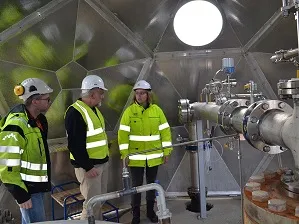
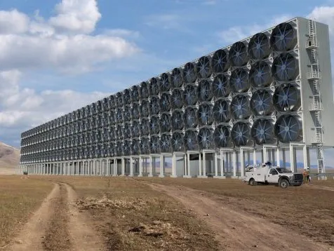
I am a geophysicist focussing on mapping the distribution of basalts with carbon storage potential along the US eastern coastline. New high-resolution aeromagnetic data will be used with seismic interpretation to constrain the geometry and depths of offshore basins and identify the presence of basalt flows.
I conducted my PhD at Imperial College London, which identified the characteristics and universality of magnetic anomolies in mature hydrocarbon reservoirs. I used rock magnetic techniques in conjunction with basin modelling and seismic interpretaion to constrain the petroleum migration history of the Wessex Basin, UK. I also designed a reaction path thermodynamic model to identify the boundary conditions for the formation of metastable iron sulphides associated with subsurface reservoirs.
David Goldberg is Paros Lamont Research Professor in Climate Science Research and Carbon Management. His interests focus on the integration of different technologies and cross-disciplinary approaches to develop achievable climate solutions. Goldberg received his undergraduate and MS degrees in earth and planetary sciences from the Massachusetts Institute of Technology, and his doctorate in geophysics and an MBA from Columbia University. He conducted post-doctoral studies at the Institute Français du Petrole in Paris and has been at Lamont-Doherty since 1985. He also currently serves as a Deputy Director of the Lamont-Doherty Earth Observatory, Associate Director of the Marine Large Programs division, Director of the Lenfest Center for Sustainable Energy, and a lecturer in the Columbia University Sustainability Science program.
Cody Bahlau is a Science Officer with the Office of Marine Operations at Lamont-Doherty Earth Observatory, where he supports global oceanographic research aboard the R/V Marcus G. Langseth. He has participated in more than 30 scientific expeditions, coordinating complex marine geophysical operations including multichannel seismic surveys, ocean bottom seismometer deployments, and integrated oceanographic data collection.
In his role, Cody serves as the primary liaison between scientific teams, vessel crew, and shore-based operations, ensuring the safe and effective execution of research programs in diverse and often remote environments. His work has contributed to studies of plate boundaries, mid-ocean ridges, subduction zones, and deep ocean processes across multiple ocean basins.
Cody holds a degree in geology from the University of Michigan and a graduate certificate in Geographic Information Systems from the University of Colorado Denver. He is an active member of several professional organizations, including the American Geophysical Union and the Marine Technology Society.
In addition to his operational work at sea, Cody is engaged in STEM outreach through the “Desk to Deck” program, which connects classrooms with real-time oceanographic research to promote ocean literacy and awareness of marine science careers.
Dr. Nelson is a geochemist with expertise in basalt chemical weathering, aqueous geochemistry, and secondary mineral formation. She earned both an M.S. and a Ph.D. from Northwestern University, where her field-based research focused on basalt weathering in both subsurface and surficial settings in Iceland. She is researching carbon capture and storage technologies. Her current interests include in-situ carbon mineralization in basaltic reservoirs, as well as coastal and terrestrial enhanced weathering as climate change mitigation strategies. Currently, Dr. Nelson uses reactive transport modelling to optimize mineralization during carbon dioxide injections into basaltic rock. Her aim is to contribute to the scaling of this in-situ mineralization technology by specifically focusing on large-scale injections in offshore settings. When not working, Claire is usually skiing, biking, or indulging in NYC's abundance of live music.
I am the Director of the U.S. Science Support Program (USSSP) associated with the International Ocean Discovery Program (IODP). IODP is the latest iteration in a series of internationally collaborative scientific ocean drilling programs, in which marine drilling vessels recover data recorded in seafloor sediments and rocks to monitor susbseafloor environments, investigating topics such as climate change, geohazards, geomicrobiology, and the evolution of ocean crust. Lamont has managed USSSP since 2015 through a cooperative agreement with the National Science Foundation. Among the activities supported by USSSP are thematic workshops, pre-drilling research, shipboard staffing and salary support, post-cruise studies, fellowships for graduate students, and an IODP-themed lecture series.
Angela Slagle is a Senior Research Scientist at Lamont-Doherty Earth Observatory of Columbia University. Her work focuses on petrophysical measurements as a means of characterizing sub-seafloor sediments and rocks, applied to a range of projects and geologic environments. Her current projects include studies of carbon sequestration in marine basalts (western Atlantic, Cascadia region in NW Pacific); cyclicity in physical properties as a response to Earth processes (Maldives Inner Sea); and integration of core, downhole logging, and seismic properties (various locations). Angela received a Ph.D. in Marine Geology and Geophysics from Columbia University.
Over the last fifteen years, she has sailed on eight research expeditions for the Integrated Ocean Drilling Program and International Ocean Discovery Program (IODP), as well as a number of research cruises on UNOLS vessels. She is the Associate Director of the U.S. Science Support Program (USSSP) for IODP (usoceandiscovery.org), from 2021-2026. Starting in 2025, she is the Director of Science Services for the NSF U.S. Scientific Ocean Drilling Coordination Office (SODCO; sodco.org).
At Lamont, I am part of two main efforts: the Marine Geoscience Data System (MGDS) which provides access to marine geoscience data, and the GeoMapApp development team for which I help guide functionality and enhancements, run workshops and webinars, and add new data. For a while, I also worked on providing content for the EarthObserver and PolarExplorer:Sea-Level apps. I enjoy running outreach and education events and mentoring summer interns. I have interacted with educators at all levels and I studied for a masters degree from Teachers College to better understand the educational context.
Before coming to Lamont, I spent eight years at Scripps Institution of Oceanography in California. There, I followed my research interests in geodynamics, participated in nine sea-going research cruises, and worked in the SIO Geological Data Centre. Also, as part of the international GEBCO project, I worked on generating digital elevation models from echo-soundings and contours for about one-quarter of earth's oceanic area.
I have a degree in geology-geophysics from Durham University (UK) and a doctorate from the University of Oxford. My thesis topic was a study of tectonics and geodynamics in the south-central Pacific area and involved the analysis of shipboard gravity and bathymetry and the construction of satellite-derived geoid and free-air gravity data.
I like building a sense of community and have been on the Campus Life Committee, most recently as its chair, and like working on things to bring about positive change. For many years, I have organised the annual Lamont Bike-to-Work Day event. When not working, I like hiking in the mountains - the Alps are hard to beat, playing tennis, going on walks with my dog, and enjoying tasty meals.