Lamont in the Media
June 17, 2026
A Snapshot of Continental Crust in the Making
Earth & Climate Science News
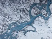
Off the coast of New Zealand, there is an area where earthquakes can happen in slow-motion as two tectonic plates grind past one another. These slow-slip events create an ideal lab for studying fault behavior along the shallow portion of subduction zones.
The Interdisciplinary Earth Data Alliance is fueling groundbreaking multi-disciplinary discoveries worldwide. "This is a new era of data mining," says IEDA Director Kerstin Lehnert, a geochemist at Lamont-Doherty Earth Observatory.
The Arctic is warming twice as fast as the rest of the planet, and scientists are seeing the effects across ice and ecosystems. Lamont-Doherty Earth Observatory's Marco Tedesco describes the changes underway.
Declassified spy satellite images are beginning to provide the first consistent look at how glaciers across the Himalayas are changing and what future water supplies might look like for millions of people.
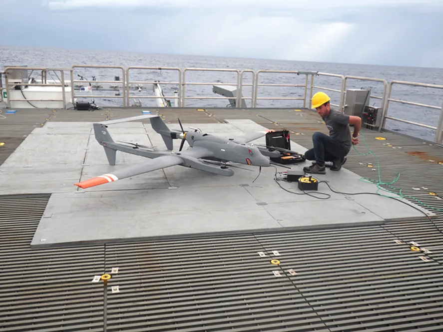
Research that couples state-of-the-art geophysical observations from unmanned aerial systems (UAS) with a community-engaged research approach will bridge scientific and indigenous understanding of sea ice change in the Alaskan Arctic.
Earth scientists from around the world will be in San Francisco next week to share their latest discoveries at the American Geophysical Union’s fall meeting. You can watch several of their presentations live online through AGU On-Demand, including seven involving scientists from Lamont-Doherty Earth Observatory.

The first of six ALAMO floats parachuted into the Ross Sea off Antarctica to begin profiling the water in a check for areas where warmer than normal water could put the Ross Ice Shelf at risk.
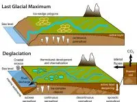
A new study documents evidence of a massive release of carbon from Siberian permafrost as temperatures rose at the end of the last ice age.
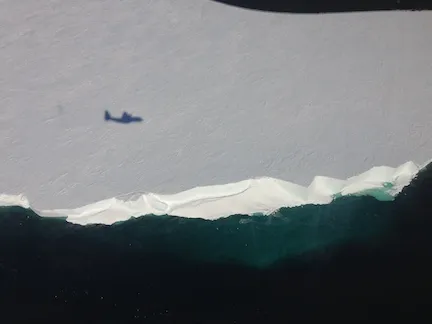
The ‘bird’ has flown! Voices are raised in celebratory cheers from the southernmost continent to across the U.S. Our first ALAMO float is deployed! Now we can begin to answer some of the big questions on this mysterious ice/ocean interface.
Scientists at Columbia University’s Earth Institute will present important findings at this year’s meeting of the American Geophysical Union, the world’s largest gathering of earth and space scientists.
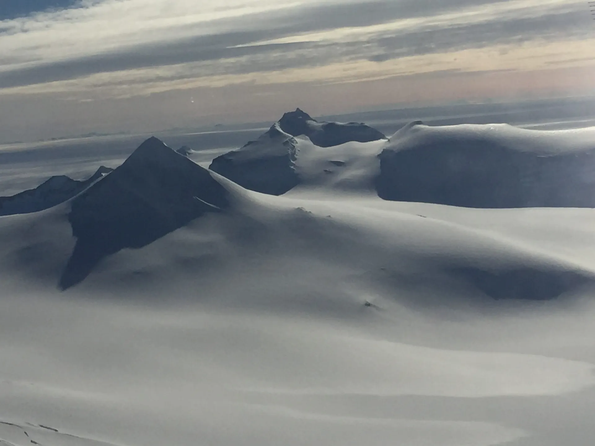
The Antarctica Peninsula has been referred to as Antarctica’s third ice sheet. Following behind the East and West Antarctic ice sheet in size, one might be inclined to minimize its importance in the effects of melting Antarctic ice, on changes in sea level and other impacts, but that would be an imprudent mistake. The peninsula is Antarctica’s most northern spit of land; like a crooked finger it stretches out beckoning towards the southern tip of South America and her warmer climate.
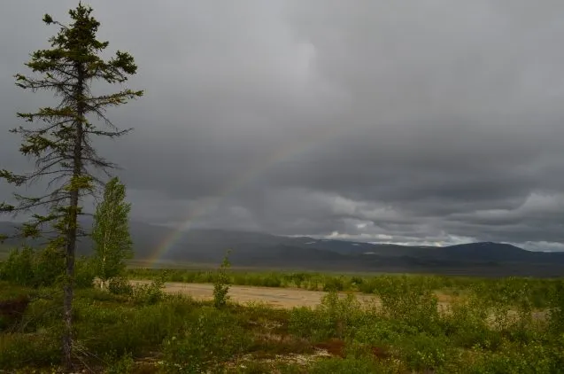
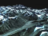
In northern Alaska’s Brooks Range, the earth as most of us know it comes to an end. The northern tree line-a boundary that circles all of earth’s northern landmasses for more than 8,300 miles, and forms the planet’s biggest ecological transition zone–runs through here. Scientists from Columbia University’s Lamont-Doherty Earth Observatory are studying how climate may change it, and the tundra beyond.