Earthquakes are among the most destructive forces on the planet. Yet anticipating the timing and impact of future earthquakes remains elusive. The mission of Lamont-Doherty Earth Observatory’s Anticipating Earthquakes initiative is to transform how we understand and respond to earthquakes, helping communities improve resilience and mitigate impacts.
About Earthquakes
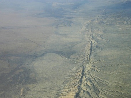
Most earthquakes occur when blocks of rock under extraordinary pressure slip past each other along faults in the Earth. In California, for example, the North American and the Pacific plate move past each other along the San Andreas Fault, one of the most hazardous faults in the world. But not all are natural: recently, human activities, such as injecting wastewater underground, have been connected to numerous earthquakes in regions where seismic activity is otherwise rare.
Earthquakes can kill thousands of people as structures collapse, landslides are triggered, and tsunamis form. In the last two decades alone, a surge of huge, so-called “great” earthquakes caused hundreds of thousands of fatalities and billions of dollars in economic losses as shaking and associated landslides and tsunamis devastated cities. Nearly all of these recent great earthquakes upended previously held ideas about the way earthquakes work.
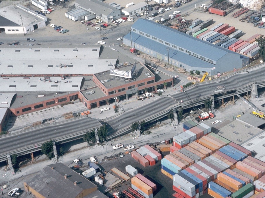
Aerial view of collapsed sections of the Cypress Street viaduct of Interstate Highway 880 in Oakland, California, damaged as a result of the magnitude 6.9 Loma Prieta earthquake on October 17, 1989. Credit: USGS
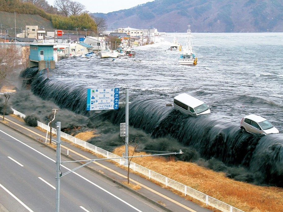
Miyako City, Iwate Prefecture, Japan, hit by a tsunami triggered by a MW 9.0 earthquake on March 11, 2011. Credit: Headquarters for Earthquake Research Promotion
Mission
The Anticipating Earthquakes initiative aims to improve understanding of the physical processes that underlie earthquakes and govern how they evolve. By developing deeper knowledge about how faults work and devising novel monitoring techniques, scientists can better anticipate the size and behavior of earthquakes likely to occur in a region. This information is vital to improving local risk assessments and disaster planning, such as building codes and emergency response plans, that can help communities survive earthquakes.
Tackling this critical challenge requires a multifaceted, multidisciplinary approach including monitoring seismic activity, imaging faults, conducting laboratory experiments, and building computer models that can more accurately simulate earthquake behavior.
Capabilities
Lamont-Doherty Earth Observatory has broad expertise and a distinctive suite of novel analytical capabilities in earthquake seismology, active-source geophysics, rock mechanics, field geology, and physical models, making us global leaders in the field.
Our rich history of breakthroughs in earthquake science have revolutionized understanding of how our planet works. Among our firsts:
- Our scientists were the first to provide definitive seismological evidence to support the theory of plate tectonics and continental drift.
- We developed the first maps to show the potential of the circum-Pacific to produce major earthquakes in the area known as the “The ring of fire.”
- We discovered that the inner core of the Earth rotates at a different speed than the rest of the planet.
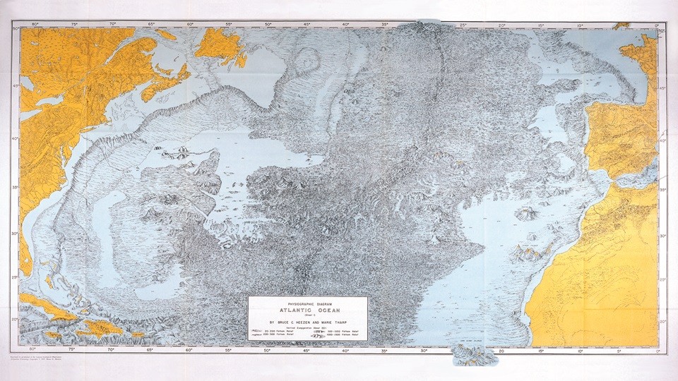
With a powerful combination of research strengths and facilities, we are able to make major advances in understanding faults and our ability to anticipate earthquakes:
- Lamont-Doherty Earth Observatory’s R/V Marcus G. Langseth is the world’s premier academic seismic research vessel, with 3D mapping capabilities for imaging megathrust faults and other structures deep below the ocean floor that can create destructive great earthquakes and tsunamis.
- We operate a network of seismometers throughout the Northeastern United States for detecting and publicizing earthquakes in the mid-Atlantic region, including New York and Washington, D.C. metropolitan areas.
- In the Lamont Rock & Ice Mechanics Lab, we subject rocks to pressures and temperatures that simulate conditions deep in the Earth where earthquakes start. We create physical models of fault zones that allow us to take earthquake physics from the lab to real-world scales.
- Our Ocean-Bottom Seismology Laboratory deploys cutting-edge seafloor instrumentation in all of the world’s oceans to monitor earthquakes.
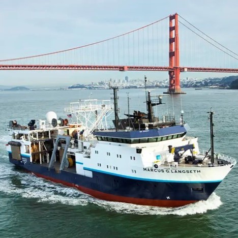
LDEO’s R.V. Marcus G. Langseth collects multichannel seismic data, including 3D surveys, to image faults that lie beneath the ocean floor such as subduction megathrusts. Credit: LDEO
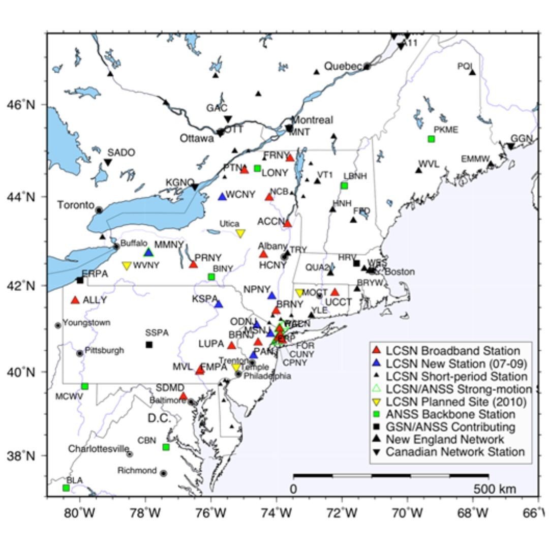
Map of stations of the Lamont-Cooperative Seismic Network (LCSN) and other networks in the northeastern U.S. that monitor seismic activity in real-time. Credit: Won-Young Kim, LDEO
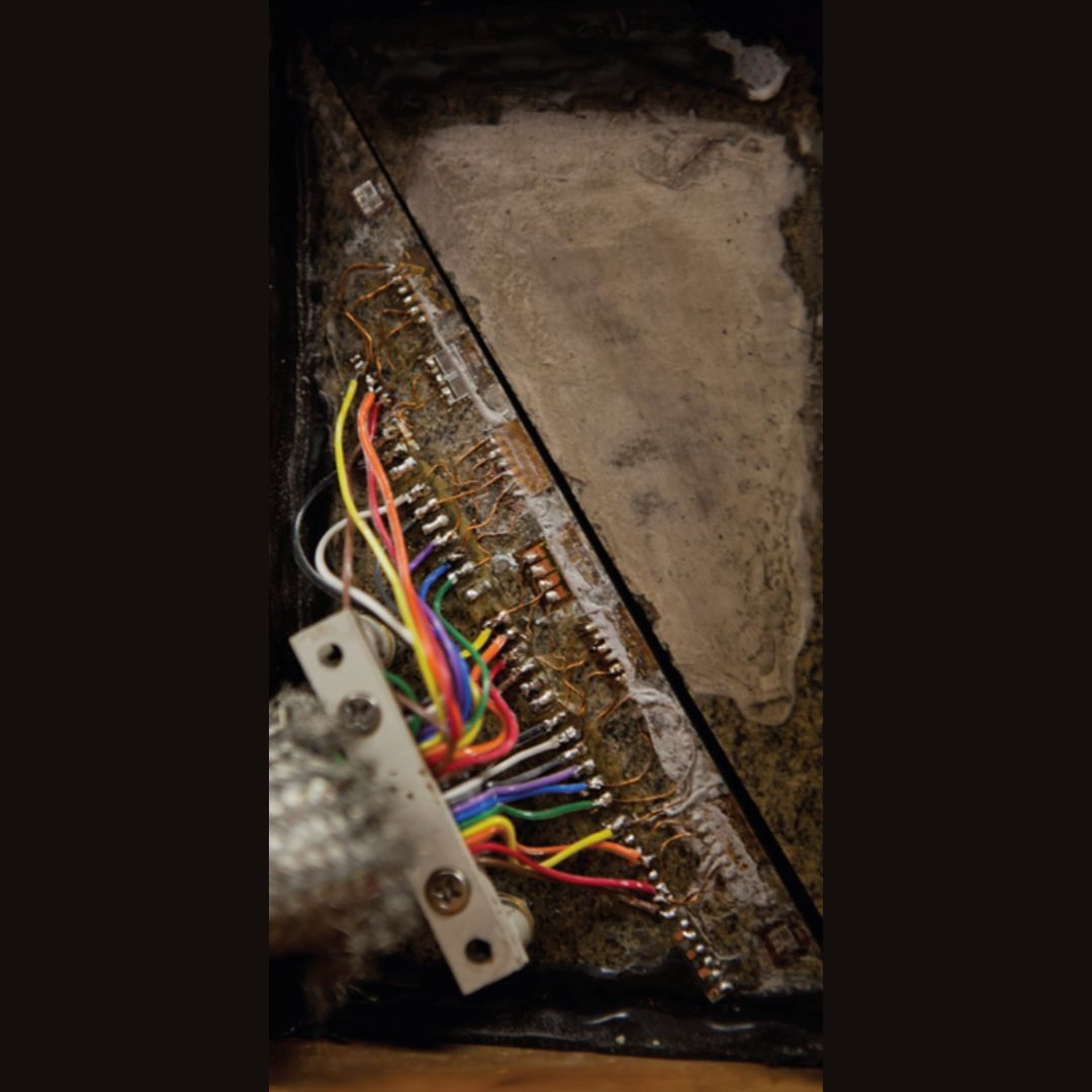
Experimental set-up at the Lamont Rock & Ice Mechanics Lab to measure frictional properties of rocks and ice. Credit: Rock & Ice Mechanics Lab, LDEO
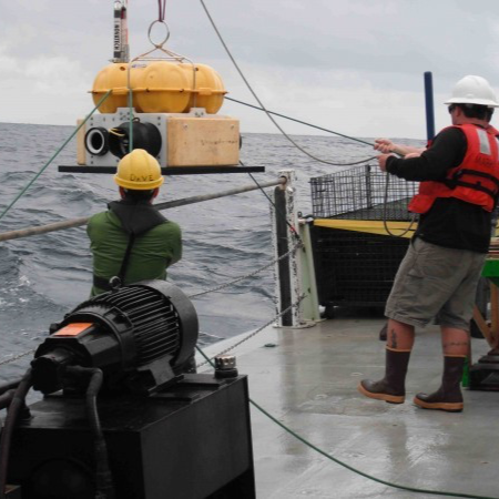
Ocean floor instruments developed by the Lamont Ocean-Bottom Seismology Laboratory measure shaking and deformation on the ocean floor. Credit: OBS Lab, LDEO
Research in Action
- Lamont scientists travel the world to tectonic hotspots such as east Africa, western Pacific islands, the eastern Pacific Ocean, Bangladesh, and northern America deploying seismic and geodetic equipment on land and on the ocean floor to study major earthquake faults in detail. These focused studies provide critical knowledge about fault behavior within high-density population zones that are poorly characterized by global monitoring. They also provide an opportunity to increase local capability for hazard assessment and response.
- Our scientists and engineers in the Rock & Ice Mechanics Lab are investigating the physics of earthquakes through experiments such as understanding fault slip in subduction zones, including the 2011 Japan tsunami fault. We are also leading studies of how wastewater disposal leads to human induced seismicity, and how small stress changes such as tides can trigger fault slip.
- The Precision Seismology group is developing “big data” computational tools to image seismicity and active faults with unprecedented resolution in real-time, in terrestrial and submarine environments worldwide. These tools have discovered streaks and patches of repeating earthquakes that have provided a fundamentally new view of the distribution of seismic activity on an active fault.
- Lamont’s marine seismologists are using the R/V Langseth to improve understanding of tsunami-producing earthquakes by imaging the megathrust faults that produce them and contrasting those faults with similar faults that don’t seem to produce such earthquakes.
- Our Global CMT Project tracks earthquakes, landslides, and other seismic activity in real time, providing quick data about location, timing, direction of movement and other forces for researchers worldwide.
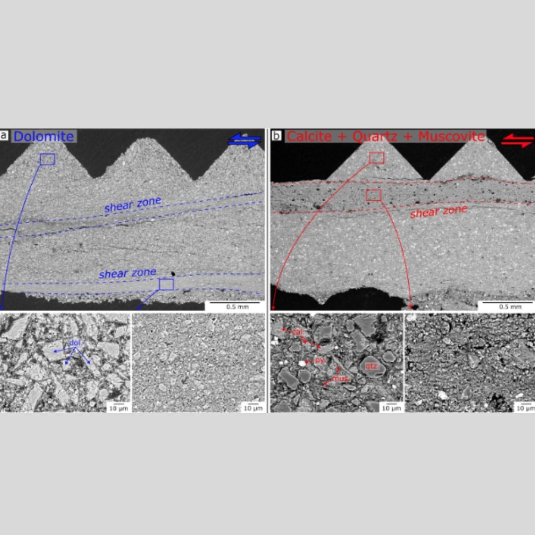
Backscattered-electron images of sheared gouges produced by the Rock & Ice Mechanics Lab. Credit: Jacob Tielke, LDEO
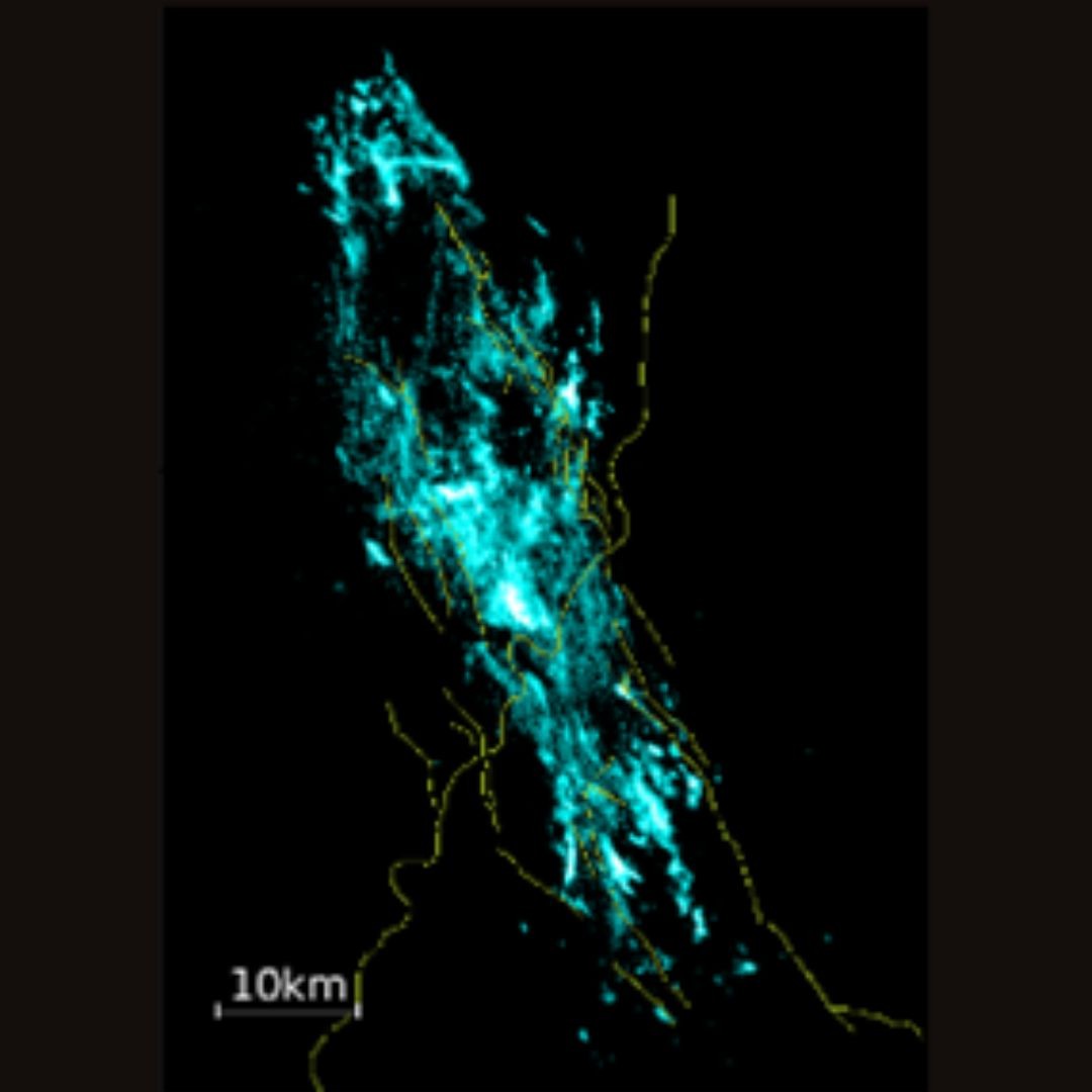
Active faults illuminated by millions of aftershocks of the 2016-2017 Central Italy Earthquake sequence, detected and precisely located by the Precision Seismology group. Credit: Felix Waldhauser, LDEO
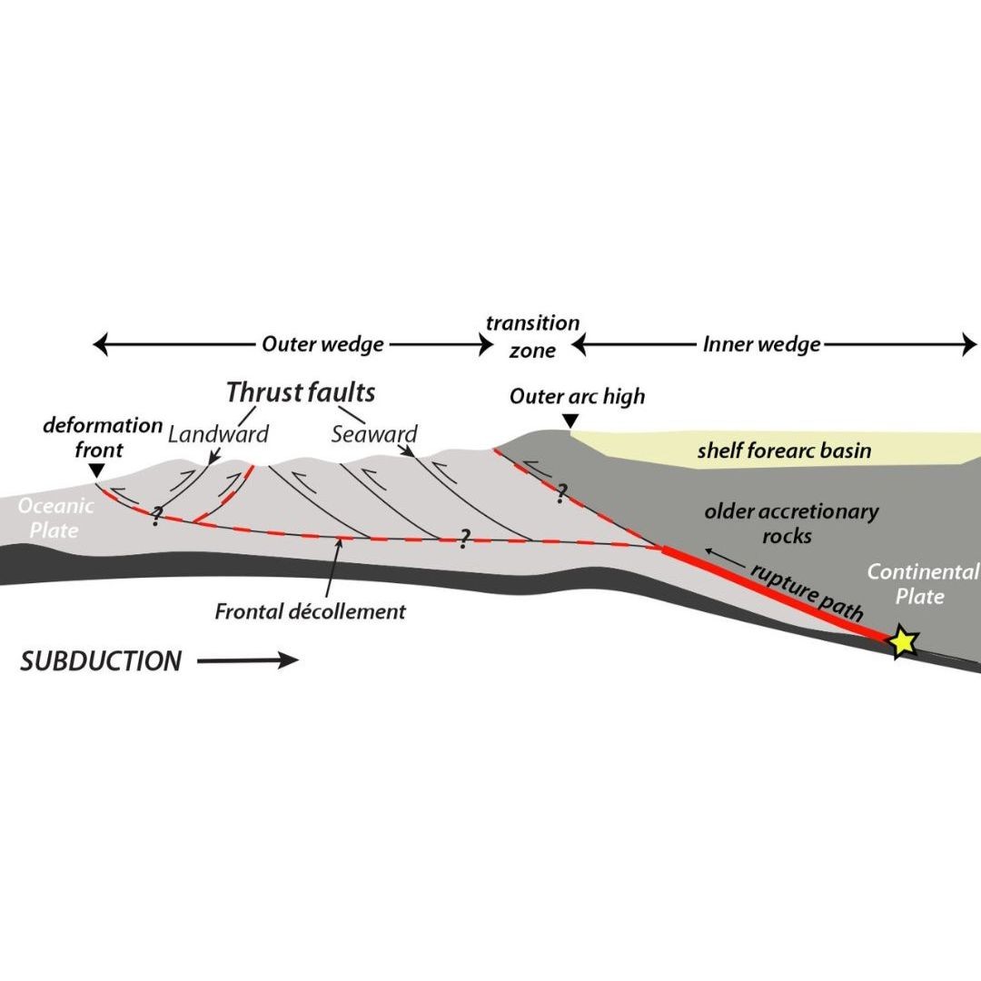
A schematic cross-section of the Cascadia Subduction Zone shows the ocean floor plate (light grey) moving under the North American continental plate, along with other features. Credit: USGS
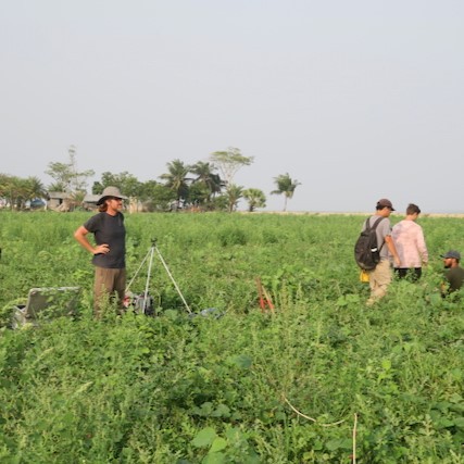
Team in Bangladesh setting up sites to collect magnetotelluric (MT) data to help assess earthquake hazard in this densely populated country. Credit: Mike Steckler
Earthquake News from State of the Planet
Shaking From April’s New Jersey Quake Went Oddly Far, Raising Questions on Regional Hazard
An earthquake on April 5, 2024, was felt at surprisingly long distances. What does it mean for assessing regional hazard?
The Measure of a Man: Jerome M. Paros ’63GSAS’ Life of Invention and Philanthropy
Jerry Paros’ inventions have improved the measurements of geophysical phenomena such as tsunamis, and enhance our ability to understand the complex earth, air and ocean processes that produce climate change.
Finding an Undocumented Earthquake That Moved a River
Researchers offer a behind-the-scenes look at their recent discovery of an earthquake that shifted the course of the Ganges.


