
Researchers at Lamont-Doherty Earth Observatory (LDEO) develop, steward, and host a globally significant portfolio of open data systems, physical collections, laboratories, and research platforms that support discovery across the Earth and planetary sciences. These community resources are designed to ensure the long-term preservation, accessibility, and reuse of data and samples, enabling research that spans disciplines, scales, and generations.
Together, these resources underpin fundamental science, inform societal decision-making, and advance understanding of Earth, the oceans, and other planetary bodies. Many are developed in close partnership with national and international agencies and are used daily by researchers, educators, policymakers, and students worldwide.
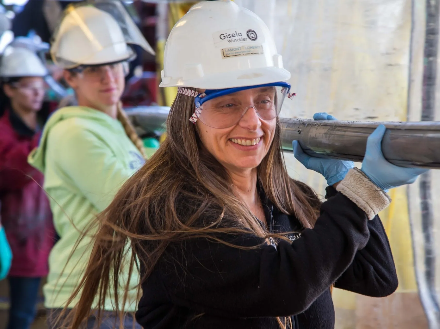
 and colleagues in a lunar sample vault at the Johnson Space Center. Photo courtesy of Kerstin Lehnert")
Astromat is a NASA-funded data archive that curates, preserves,and disseminates laboratory analytical data acquired on samples from past, present, and future NASA missions, and aims to ensure the long-term value of astromaterials samples data to maximize their impact on scientific discovery and knowledge.
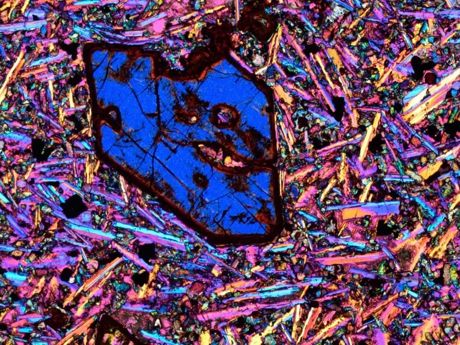
EarthChem archives, curates, and disseminates geochemical, geochronological, and petrological data for terrestrial samples, with a strong emphasis on igneous and metamorphic rocks. Its synthesis database, PetDB, contains approximately 7.5 million geochemical measurements, many derived from oceanic crust and mid-ocean ridge basalts (MORB). Together with SESAR, EarthChem advances open, FAIR (Findable, Accessible, Interoperable, Reusable) principles by linking physical samples to their analytical data, enabling researchers to move seamlessly from sample discovery to data access and interpretation—accelerating insight and supporting more integrated, data-driven understanding of Earth systems.
GeoMapApp is a freely available, interactive data exploration and visualization platform that lowers barriers to accessing and working with complex Earth science data. Designed for a broad user community—from students and educators to researchers and decision-makers—it enables users to easily discover, visualize, analyze, and integrate diverse marine, geophysical, geological, and environmental datasets within a single, intuitive interface. By reducing the need for specialized software or advanced technical expertise, GeoMapApp democratizes access to high-value datasets and supports learning, exploration, and scientific discovery across disciplines and experience levels. GeoMapApp features hundreds of built-in research-grade data sets, and provides capabilities for users to import their own data.
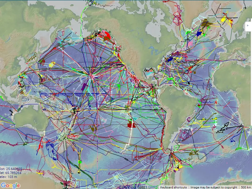
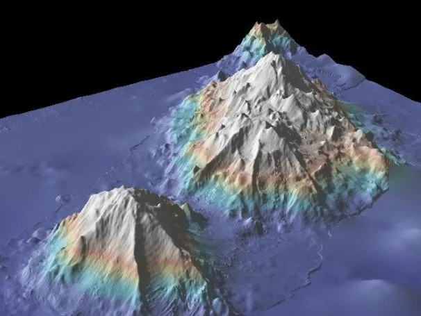
GMRT is a multi-resolutional compilation of edited multibeam sonar data collected by scientists and institutions worldwide, reviewed, processed, and gridded by the GMRT team, and merged into a single, continuously updated global elevation model. Rooted in the legacy of Tharp and Heezen and the pioneering Ridge Multibeam Synthesis, GMRT reflects decades of tool development and collaborative innovation, built by generations of researchers committed to revealing the structure of the seafloor. By integrating contributions from diverse platforms and expeditions into a coherent, accessible framework, GMRT transforms individual datasets into a shared global resource—advancing discovery and making detailed representations of the ocean floor available to researchers and educators worldwide in the ongoing effort to better understand our planet and its marine resources.
MGDS is a trusted, long-standing data repository that provides free public access to a uniquely curated collection of marine geophysical data and metadata documenting the formation and evolution of the seafloor and sub-seafloor. As a cornerstone of LDEO’s commitment to data preservation, MGDS safeguards irreplaceable academic seismic datasets collected across the global oceans—many acquired over decades aboard Lamont research vessels—ensuring their integrity, accessibility, and continued scientific value. The repository also integrates data from submersibles and a wide range of vessel and platform operators, bringing together otherwise distributed and heterogeneous datasets into a coherent, accessible framework. These records represent not only a singular archive of Earth’s subsurface structure, but also an enduring foundation for new discovery, enabling researchers to revisit, reinterpret, and integrate legacy data with emerging technologies and modern datasets.
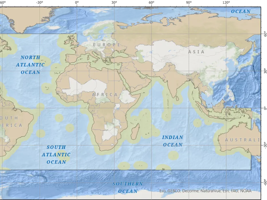
The Nippon Foundation–GEBCO Seabed 2030 Project is a global initiative to map the entire ocean floor by 2030, with all bathymetric data made freely available in the GEBCO global compilation to support scientific research, inform policy decisions, and enable sustainable ocean use. Guided by the leadership of the International Hydrographic Organization (IHO) and UNESCO’s Intergovernmental Oceanographic Commission (IOC), and made possible through the support of The Nippon Foundation, Seabed 2030 exemplifies the power of international collaboration to unite and mobilize access to seafloor data from across nations, sectors, and generations. The Atlantic and Indian Oceans Regional Center, based at Lamont-Doherty Earth Observatory, plays a central role in this effort—compiling data, coordinating regional contributions, and advancing partnerships to provide a shared global framework for integrating diverse datasets.
The Rolling Deck to Repository (R2R) program manages underway data from the U.S. Academic Research Fleet to ensure the preservation, documentation, and open access of these critical national oceanographic assets. By standardizing data collection and workflows across vessels, R2R effectively transforms the fleet into a coordinated, mobile ocean observing system—continuously collecting valuable environmental and geophysical data as ships transit and operate around the globe. Data from each cruise are submitted directly by vessel operators, ensuring consistency and completeness independent of individual science parties. R2R generates essential documentation and standardized data products for every expedition, making them easy to discover, access, and reuse through the R2R web portal.
The U.S. Antarctic Program Data Center (USAP-DC) supports investigators funded by the National Science Foundation in documenting, preserving, and disseminating their research results. We provide a central USAP Project Catalog for all projects funded by the NSF Antarctic program and a Data Repository for research datasets derived from these projects. Data managed include the NSF research related glaciology data collection formerly managed through NSIDC. We register datasets in the Antarctic Metadata Directory (AMD) to comply with the Antarctic Treaty and represent the U.S. in the Scientific Committee on Antarctic Research (SCAR) activities.

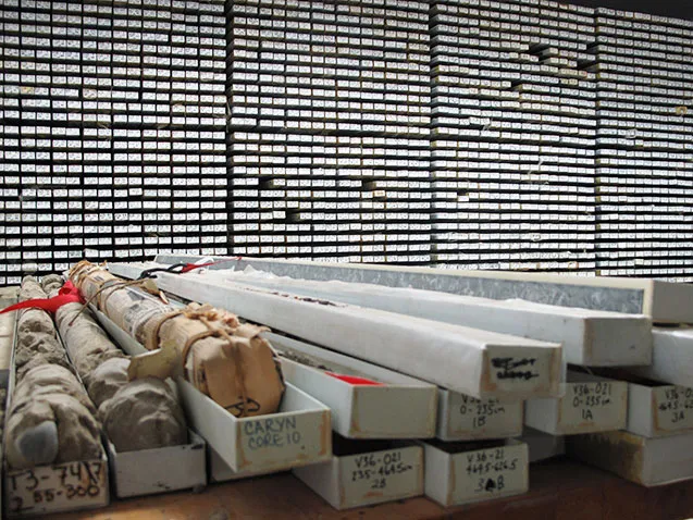
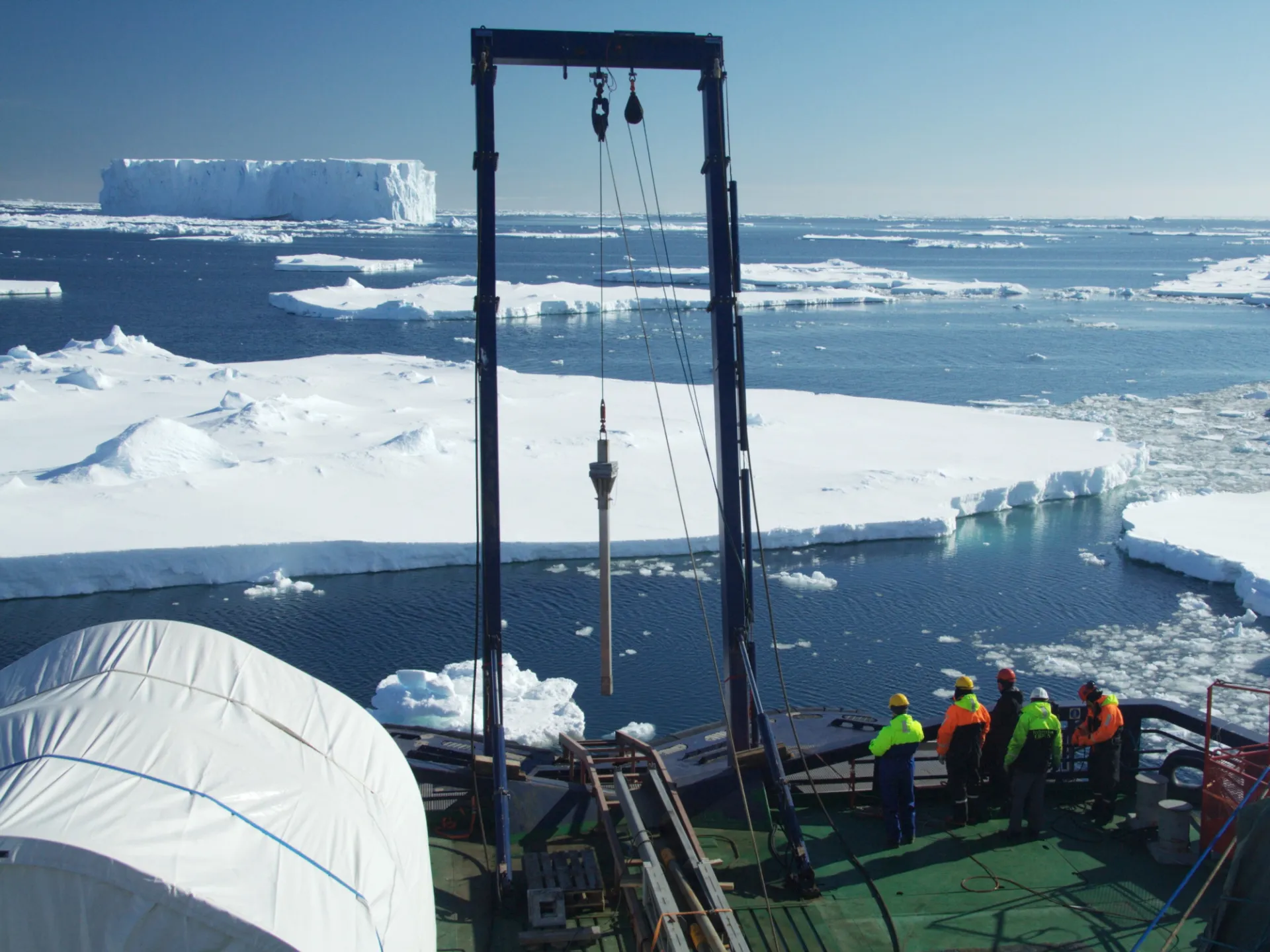
The Core Repository houses one of the world’s most unique and scientifically important collections of deep-sea samples, with sediment cores spanning every major ocean and sea. Built on the vision of Lamont’s founding director—who championed the systematic collection of “a sample a day” to create a continuous record of Earth’s history—this repository represents decades of sustained exploration and discovery. In addition to the physical archive, a comprehensive database captures detailed information on each core, including geographic location, core length, mineralogy and paleontology, lithology, structure, and full-text megascopic descriptions. Together, these samples and data form an unparalleled record of Earth’s past, preserved for ongoing and future research. Both samples and associated data are openly available to the global scientific community upon request through the curator.
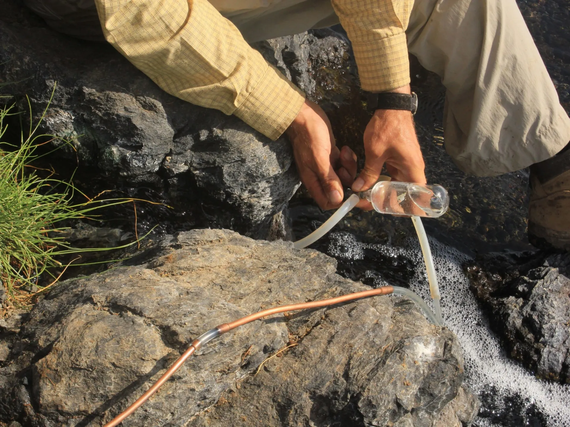
SESAR (System for Earth Sample Registration) provides a global framework for identifying, cataloging, and tracking physical samples across the Earth, ocean, and polar sciences, ensuring that samples remain discoverable, uniquely identifiable, and persistently linked to their metadata and associated data products. By assigning International Geo Sample Numbers (IGSNs), SESAR enables researchers to reliably locate, cite, and integrate samples collected across decades of field programs and expeditions. This infrastructure is critical for navigating the vast and distributed landscape of existing physical collections, reducing duplication of effort, and unlocking new value from previously collected materials through reuse, reanalysis, and cross-disciplinary synthesis.

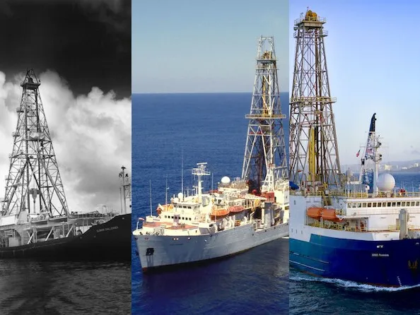
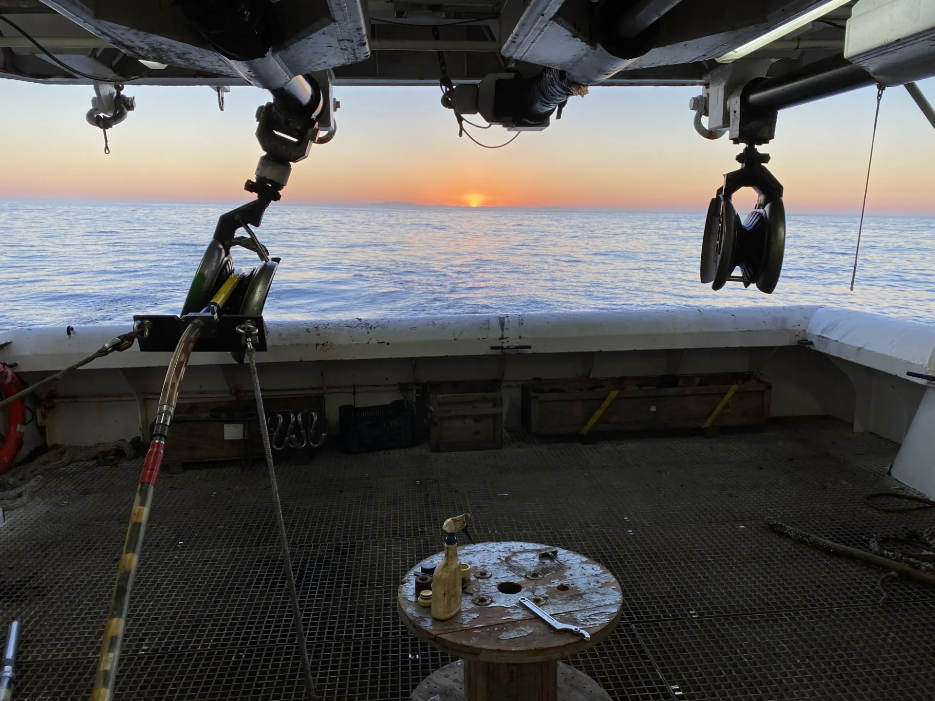
Scientific ocean drilling—the collection and analysis of marine sediment and rock cores and the monitoring of subseafloor environments via borehole observatories—remains one of the most powerful approaches for reconstructing Earth’s history, providing direct records of past climate, ocean circulation, tectonic processes, and biosphere evolution. Lamont scientists have a long and distinguished history of participation in this effort, which was founded in the 1960s as a consortium of Lamont and other U.S. academic institutions. More recently, Lamont has managed the National Science Foundation-funded U.S. Science Support Program (USSSP) and Scientific Ocean Drilling Coordination Office (SODCO), which facilitate the participation of U.S.-based scientists in what is now a complex international scientific ocean drilling collaboration. These offices work closely with the research community to plan and implement expeditions, innovative research, workshops, training programs, and science communication activities, while ensuring that the resulting data and samples are effectively stored, curated, and made accessible to the science community and public. Through these efforts, USSSP and SODCO play a central role in enabling discovery, building community capacity, and advancing the next phase of U.S. leadership in global ocean drilling.