Lamont in the Media
June 17, 2026
A Snapshot of Continental Crust in the Making
Earth & Climate Science News

Up to now, it has been a mystery why much of the fresh water resulting from the melting of Antarctic ice shelves ends up in the depths instead of floating above saltier, denser ocean waters. Scientists working along one major ice shelf believe they have found the answer.
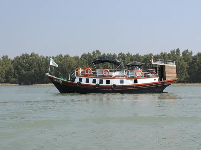
After helping Chris an Dan with soil salinity and reflectance measurement, Humayun, Liz and I moved onto the smaller M.B. Mewl to sail through the Sundarban Mangrove Forest to service our GPS station at Hiron Point.

Humayun, Liz and I headed to Khulna in SW Bangladesh a day after Chris and Dan. Along the way, we stopped at our sediment compaction meter for surveying and removing the GPS, and getting feasted by the family that hosts the system.
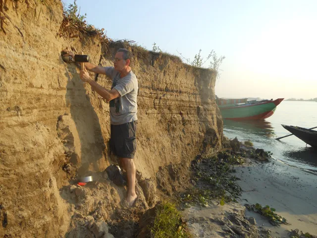
I’m back in Bangladesh with a small team after a year and a half away. One different is a police escort as a result of the attacks last year. We start by successfully sampling river sediments to correct the date of an earthquake that caused a river to shift over 3,500 years ago. We also will be fixing broken equipment, visiting the ever changing rivers and hopefully meeting with the public and government officials about the earthquake hazard.
S. George Philander of Princeton University and Mark A. Cane of Columbia University’s Lamont-Doherty Earth Observatory, who untangled the complex forces that drive El Niño, the world’s most powerful weather cycle, have won the 2017 Vetlesen Prize for achievement in earth sciences.
Researchers studying the West Antarctic Peninsula marine ecosystem will recognize President Obama’s efforts to combat global warming by collecting climate data at an oceanographic station they named for the 44th president.
Rainfall patterns in the Sahara during the six-thousand-year “Green Sahara” period have been revealed by analyzing marine sediments, according to new research.
A new pilot program led by the Lamont-Doherty Earth Observatory aims to provide earlier and more accurate warnings of damaging ground-shaking from earthquakes and the imminent arrival of tsunamis.
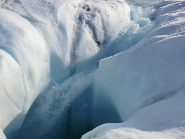
An improved technique developed by a graduate student at Lamont-Doherty Earth Observatory and her colleagues is making it possible to use airborne ice-penetrating radar to reveal meltwater’s life under the ice throughout the year.
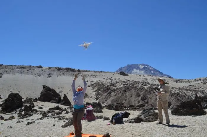
Lamont-Doherty Earth Observatory scientists are loading drones with high-tech instruments and using satellites and undersea cables that are interacting with sensors in some of the most remote locations on Earth to gather data in real time and uncover the secrets of our planet.
The Earth Institute digs into the past, tracks the present and models the future of climate. We explore the broader issues surrounding climate change, seek ways to apply our knowledge to real solutions, and nurture collaboration among faculty and researchers in the natural sciences, social sciences and humanities, law, public health, engineering, architecture and urban planning.
When a fault slips, the temperature can spike by hundreds of degrees, high enough to alter organic compounds in the rocks and leave a signature. Lamont scientists have developed methods to use those organic signatures to reconstruct past earthquakes and better understand what controls them.