‘Ghost Ice Shelves’ and the Third Antarctic Ice Sheet
The Antarctica Peninsula has been referred to as Antarctica’s third ice sheet. Following behind the East and West Antarctic ice sheet in size, one might be inclined to minimize its importance in the effects of melting Antarctic ice, on changes in sea level and other impacts, but that would be an imprudent mistake. The peninsula is Antarctica’s most northern spit of land; like a crooked finger it stretches out beckoning towards the southern tip of South America and her warmer climate.
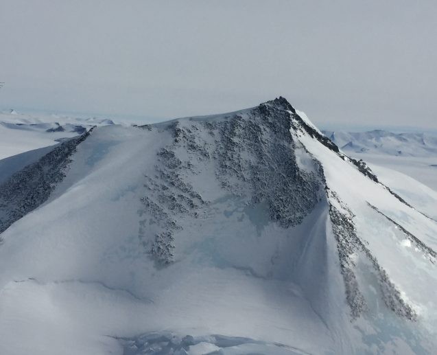
The Antarctica Peninsula has been referred to as Antarctica’s third ice sheet. Following behind the East and West Antarctic ice sheets in size, one might be inclined to minimize its importance in the effects of melting Antarctic ice, on changes in sea level and other impacts, but that would be an imprudent mistake. The peninsula is Antarctica’s most northern spit of land; like a crooked finger, it stretches out beckoning toward the southern tip of South America and her warmer climate. In prior time, the edges would have been completely buffered from contact with the surrounding ocean by an extensive series of ice shelves—some are now “ghost shelves.”
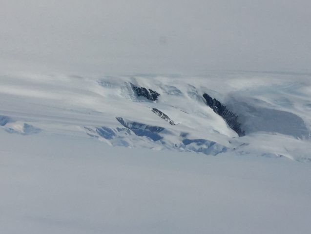
Today this thin extension of ice-covered mountains is the section of Antarctica most exposed to the warming ocean; the water literally surrounds the land, chafing against the ice where it spills from land into the ocean. This contact between the peninsula ice and warming ocean water has resulted in a series of “ghost ice shelves,” and their loss is having a measurable effect on land ice loss.
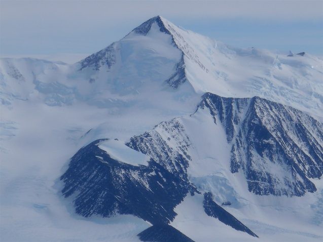
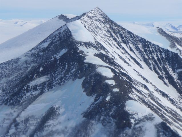
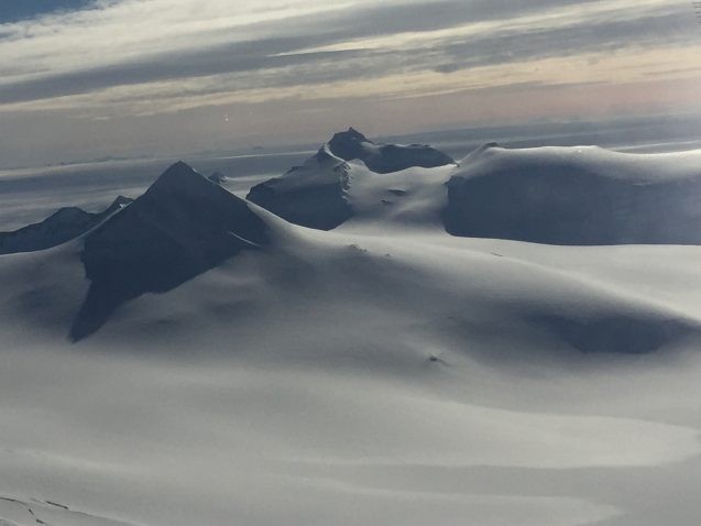
The topographic relief on the peninsula is breathtaking. With mountains topping out at 7,000-8,000 feet, it offers a profound contrast to the flattened ice shelves and gentle sloping regions that carry ice in the areas we have surveyed around the Amundsen Embayment. The ice mounds high on the tops of the peninsula peaks, in some regions burying them almost entirely, and in others the ice is sharply cut back on the exposed rock to show meters of stacked ice layers and sections of older blue ice peering out under the newer layers.
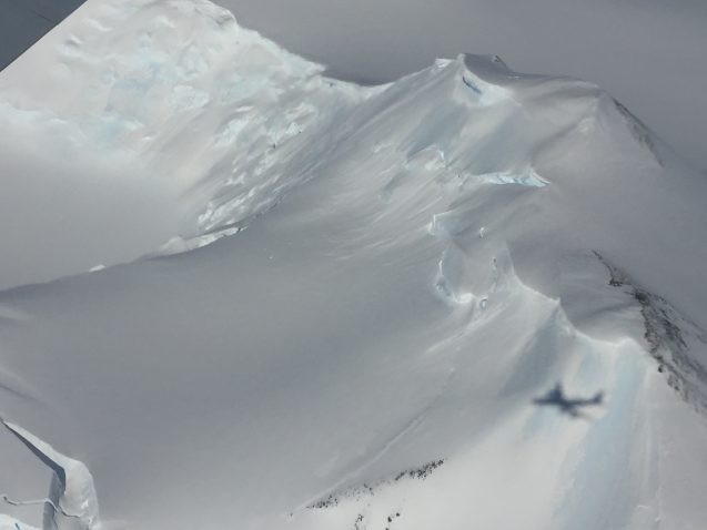
Like other regions of Antarctica the ice is slowed in its descent from land to the ocean by the presence of ice shelves. But along the peninsula, these ice shelves have been undergoing change and loss over many years. Some, like Prince Gustav Ice Shelf, are already gone—”ghost shelves”—just a glaciologist’s footnote. Once the most northern ice shelf on Antarctica, Prince Gustav Ice Shelf was situated alongside Larsen A until it began a long decline and finally disappeared in the mid-1990s, the first of the peninsula ice shelves to be lost. Others, while remaining attached to the shoreline, are significantly reduced from their earlier size, like Wordie Ice Shelf, a small portion of which remains resting along the western base of the peninsula, sitting just north of the rapidly thinning and retreating ice on the George VI Ice Shelf.
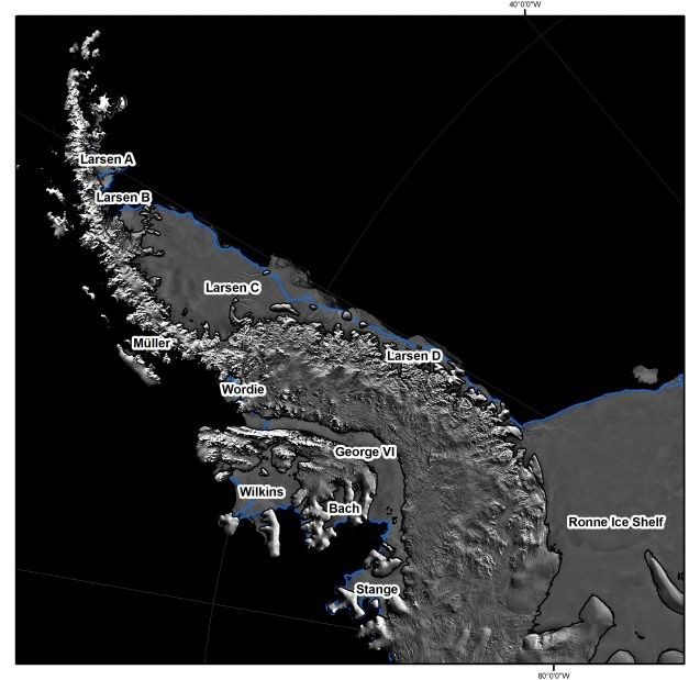
Surveying the Antarctic Peninsula and her ice shelves is a multi-flight mission for IceBridge. Over the course of approximately a half dozen missions, the instrument teams will survey along the edges from the southwestern end at Stange Ice Shelf up and around to the southeastern edge at the Larsen D ice shelf. The peninsula center will also be covered, with a dense series of flight lines taking us between the towering peaks where the glacial terrain begins and ends with buffering ice shelves at sea level.
Lamont’s role in the larger IceBridge project is the collection of gravity measurements. While the other instruments tell us details about the changes occurring now, such as loss of ice elevation and changes in ice thickness, the gravimeter is the only instrument we carry on board that can give us the critical information needed to build models of future change. Understanding the space that lies under the ice shelves, how ocean circulation patterns might direct warm water into that space, and how the cavity space is shaped where the ice goes afloat (the grounding line) is all crucial information for predicting the future stability of each ice shelf, and ultimately the ice on the Antarctic Peninsula.
IceBridge: Since 2009, the NASA IceBridge project has brought together science teams to monitor and measure each of the ice features in order to improve our understanding of changes in the climate system and our models. Lamont-Doherty, under lead scientists Jim Cochran and Kirsty Tinto, has led up the gravity and magnetics measurements for these campaigns. You can read about earlier IceBridge expeditions to Antarctica and Greenland on State of the Planet, here and here.
Two other project links: http://www.ldeo.columbia.edu/icebridge
http://www.ldeo.columbia.edu/res/pi/rosetta
Save
Save
