A Recovery Mission
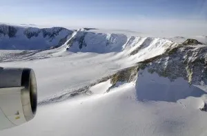
Recovery Glacier is a section of Antarctic ice that lies east of the peninsular arm of West Antarctica, tucked behind the Transantarctic Mountains, a dividing line that separates west from east. We know from satellite data that Recovery and its tributaries have a deep reach, stretching well inland. But there is a lot we don’t know about Recovery because the remoteness of the area has limited the number of surveys.
Last year IceBridge had its first flights into East Antarctica when it flew some missions into the Recovery Glacier area. Recovery is a section of Antarctic ice that lies east of the peninsular arm of West Antarctica, tucked behind the Transantarctic Mountains, a dividing line that separates west from east. We know from Satellite data that Recovery and its tributaries have a deep reach, stretching well inland to capture ice and move it out into the Filchner Ice Shelf draining a large section of the East Antarctic ice sheet. But there is a lot we don’t know about Recovery because the remoteness of the area has limited the number of surveys.
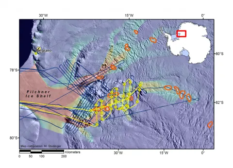
Several recent works have showed us that this area is important. Satellite measurements of the ice surface show small patches along the trunk of the glacier that are changing elevation more than their surroundings. These patches have been interpreted as lakes that lie under the ice sheet, coined the Recovery Subglacial Lakes. The lakes appear to drain and refill over time as the surface elevation over the lakes changes. To learn more about them and what they might tell us about the behavior of the glacier, we need to look under the ice.
But there is more we need to understand about this remote area, including simply needing to know the size and shape of the channel that delivers this ice out to the ice shelf and towards the Weddell Sea. Last year’s mission gave us some data points to outline the channel, but this year will help us provide a more complete imaging of what lies below this East Antarctic ice conveyor belt.
We will fly cross sections along the lines of the retired ICESat satellite tracks, allowing us to compare the laser measurements we make of ice surface elevation to those made during the satellite mission. We will end the day flying along the Recovery channel to get another look at one of the interpreted lakes. Combining last years’ data, ICESat data and this year’s data will give us a better picture of the area that has been carved beneath the Recovery glacier, the amount of ice that can be moved through the glacier and its tributaries, and how the lakes under the ice might fit into the larger story.