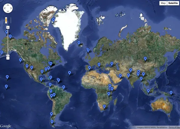
An Interactive Map of Scientific Fieldwork
Earth Institute scientists explore how the physical world works on every continent -- over and under the arctic ice, in the grasslands of Mongolia, on volcanoes in Patagonia, over subduction zones in Papua New Guinea, and on the streets of New York City.
Note: The map referenced in this article is no longer available. Visit Columbia Climate School Research Projects for current information.
Earth Institute scientists explore how the physical world works on every continent — over and under the ice in the arctic, in the remotest regions of Antarctica, in the grasslands of Mongolia and forests of Eastern Turkey, from volcanoes in Patagonia and subduction zones in Papua New Guinea to the streets of New York City.
Take a look at our new interactive map, which pinpoints research around the world. Using the satellite view, zoom in to have a closer look at the landscape. Click on the blue markers to read about what’s going on, and find links to research blogs, scientific reports and more detail about the work. Use the map’s features to slide north and south to see more projects in the arctic and Antarctic.
The communications staff at the Earth Institute and the Lamont-Doherty Earth Observatory will update the map regularly as new projects come up. For a more detailed look at the projects, visit our “Scientific Fieldwork Guide“.