Imaging the Cascadia Subduction Zone
In the research expedition now underway, we will investigate the Juan de Fuca plate before it disappears under North America to understand why earthquakes happen where and when they do within the Cascadia subduction zone off the Pacific Northwest. Our ship, the R/V Marcus G. Langseth, is one of 25 research vessels available to U.S. scientists for oceanographic research.
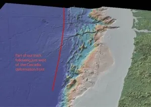
Off the coast of Washington and Oregon, the Juan de Fuca plate dives under North America, slowly descending back into the mantle from which it was formed only 8 to 10 million years ago–very young in the context of earth history!. As the plate descends, stresses accumulate within the fault zone dividing these two tectonic plates which will eventually result in a large megathrust earthquake like the devastating Tohoku earthquake offshore Japan in 2011.
In the research expedition now underway, we will investigate the plate before it disappears under North America to understand why earthquakes happen where and when they do within this Cascadia subduction zone.
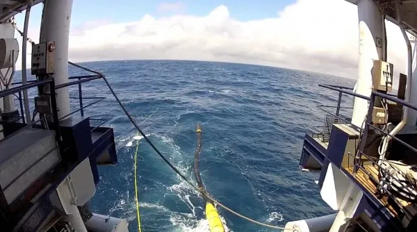
During our cruise we are using sound to probe the sub-seafloor, to generate images that tell us about the properties of the oceanic crust and mantle that lie beneath. Our soundings can penetrate through the several kilometers of sediments that cover the Juan de Fuca plate, into the 6 kilometers thick crust and below, into the upper part of the earth’s mantle.

Our ship, the R/V Marcus G. Langseth, is one of 25 research vessels available to U.S. scientists for oceanographic research. The Langseth is unique among the research fleet, equipped for advanced seismic imaging, with a high quality sound source and long arrays of listening devices, or hydrophones, which trail behind the ship listening for the echos returned from the seafloor and below.
Our program is complex. Part of our science team is on a companion ship nearby, the R/V Oceanus, deploying ocean bottom seismometers, which are also listening to the Langseth’s soundings. On land, just prior to our cruise, a series of seismometers were set out by our colleagues in the mountains of coastal Oregon and Washington to also record our soundings. With these arrays, extending hundreds of kilometers offshore and onshore, we hope to see deep into the subduction zone in two regions with quite different properties, one along the Washington margin where there are relatively frequent small magnitude earthquakes ,and the much quieter central Oregon margin.
This expedition features a cast of scientists and graduate students from the U.S., Canada, France, China, Spain and Serbia. We are accompanied by expert science technicians who deploy the advanced seismic equipment, marine mammal observers who let us know when marine mammals are nearby, and the crew who ensure the safe operation of our ship, day in and day out, for the 26 days we will be out on the cloudy Northeast Pacific.