
Wiring the Spirit's House
Lamont scientists Terry Plank and Einat Lev worked with partners in Chile to install a new suite of sensors on the summit of Villarrica, bringing real-time monitoring to one of Chile’s most active volcanoes.
The problem of the moment was power.
On the crumbly rim of Villarrica, one of Chile’s most active and dangerous volcanoes, a 12-person field team led by Columbia scientists Terry Plank and Einat Lev worked under a strong sun to bring a set of new monitoring sensors online. Dozens of components had been packed, shipped, assembled, tested and finally hauled by helicopter to the mountain’s 9,300-foot summit, where they were now being wired into place.
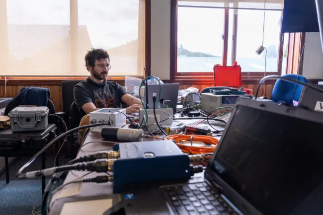
Everything had gone smoothly when the team tested the power system earlier that week at the headquarters of Chile’s Southern Andes Volcano Observatory (OVDAS) in Temuco, a few hours’ northwest of the volcano. But here on the summit, it had come to life, fed power to the instruments, and then gone mysteriously dark.
Plank shrugged it off. “There are always last-minute issues,” she said. “That’s the nature of fieldwork.” Plank is a geochemist and Lev is a geophysicist. Both are experienced volcano researchers at the Lamont-Doherty Earth Observatory, which is part of the Columbia Climate School.
Plank and Lev lead a project called Anticipating Volcanic Eruptions in Real Time, or AVERT, which has installed multi-sensor monitoring systems on Alaska’s Okmok and Mount Cleveland volcanoes and on Poás in Costa Rica. The goal of AVERT is to give volcano observatories faster, fuller views of restless volcanoes and to make those data openly available. “We’re trying to find new ways to measure the rumblings before volcanoes erupt and provide better forecasts for eruptions,” said Plank.
On this expedition, the two Lamont scientists were joined by Conor Bacon, a former Lamont postdoc, and Maarten de Moor of Costa Rica’s volcano observatory, both longtime AVERT collaborators. The team worked closely with Chilean scientists and field engineers, whose knowledge of the mountain guided the placement of the instruments and helped determine how rugged the system needed to be.
Working on a volcano is never easy, for obvious reasons. This is why scientists rarely probe the innards of active ones. Eleven years earlier, almost to the week, Villarrica had shown how quickly the calm could shatter. Around 3 a.m. on March 3, 2015, the volcano erupted in a plume of black ash and a burst of lava fountains that rose nearly a mile into the air. The actual eruption lasted only 20 or 30 minutes, but it sent lahars—fast-moving flows of water, ash and volcanic debris—racing down the mountain, damaging roads and bridges and forcing evacuations in the towns below. No one was hurt, but Chilean authorities had to evacuate more than 3,000 people from their homes.
Villarrica has a long record of these dangerous, lahar-forming eruptions. Lake sediment records show at least 22 over the past 600 years, with episodes in 1971, 1984–85 and most recently, 2015. In the twentieth century, eruptions here have killed nearly a hundred people.
There had been weeks of precursors before the 2015 eruption, but the hard part was knowing when those warning signs had crossed into active eruption. “Everyone expected OVDAS to say, ‘OK, the eruption is going to start,’ and that is very difficult to do,” said Alvaro Amigo, head of the National Volcanic Network at SERNAGEOMIN, Chile’s geological survey. The most useful signals of an eruption can be subtle ones, scattered across different kinds of data and difficult to interpret in time.
The most active volcano in Chile
Villarrica was not chosen at random. Chile is a country of more than 90 active volcanoes, but when Plank and Lev consulted OVDAS and asked which volcano should be the highest priority, the answer was immediate. “Villarrica is the most active volcano in Chile, and it’s the highest risk at the same time,” Amigo said. It sits amid a landscape of lakes, mountains, snow and hot springs, making it, according to Amigo, one of the most touristed places in southern Chile.
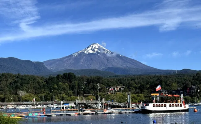
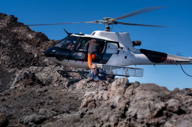
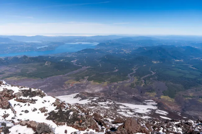
Rising above a broad, blue lake and the tourist town of Pucón, in south-central Chile, Villarrica is a picture-perfect volcano: a steep, symmetrical cone with a persistent plume at its summit; the kind of volcano a child might draw. A ski resort stands on the volcano’s lower slopes. Quiet and mostly empty in March, the resort became the field team’s staging area for helicopter flights to the crater.
The indigenous Mapuche people call the volcano Rukapillán, often translated as “house of the spirits” or, less generously, “the demon’s house.” The latter seemed more appropriate that week: the volcano would send up a deep “whomp,” felt as much as heard, followed by a thick white plume of sulfurous gas to remind us, periodically, whose house we had entered.
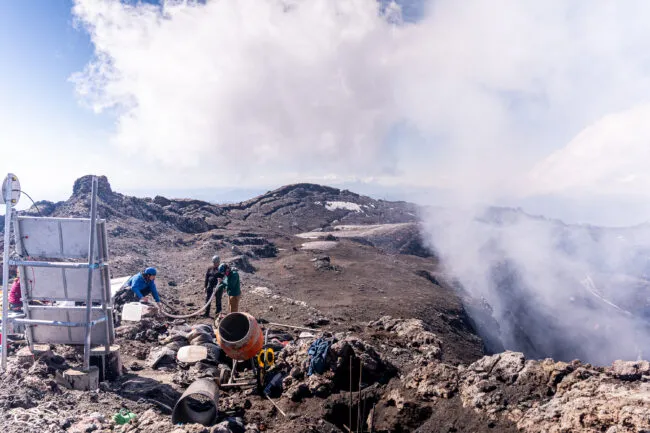
The power-system troubles were only the latest delay during that weeklong expedition last March, which marks summer’s end in the Southern Hemisphere. The timing between seasons made work on the summit possible, though still not easy. In a few weeks, the bare, wind-scoured crater rim could be under six feet of snow and ice. Over the previous days, the team had negotiated washed-out roads, helicopter delays and weight limits, broken tools, software snags and the constant practical problem of building delicate electronics on a mountain of sharp rock, high winds and corrosive gas.
Hiking, hauling and digging in the thin air was no small feat. But volcanoes rarely announce an eruption with a single warning sign. “A volcano doesn’t just shake and inflate,” Lev said. “It can also send out heat, change its appearance or release different gases, and scientists do not always know which signals will matter most.” For Villarrica, Plank and Lev wanted to capture the volcano’s every utterance. Not with a few sensors, but with a suite of them, clustered near the crater and designed to send data off the mountain in near-real time. “Most observatories don’t even try to put instruments right on the rim, and yet, there are unique signals that can be picked up when instruments are that close to the action,” Plank said.
By the end of the campaign, if everything came together, Villarrica would become the most wired remote crater rim on the planet.
No single signal is enough
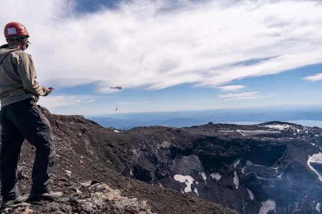
Each day that we worked on the rim, we could see dozens of people hiking across the crater and peering inside, moving like tiny specks along the ridgeline toward the summit. Even in the low season, the volcano was still a draw.
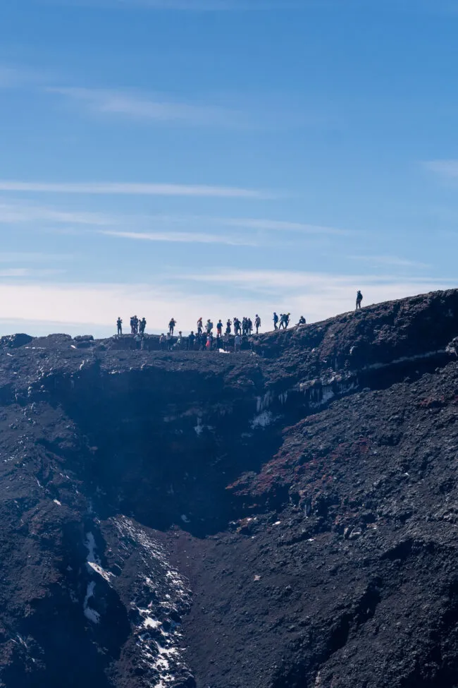
For Lev, those visitors made clear the purpose of AVERT. “Soon we’re going to have cameras right at the rim,” she said. “This way, we can tell whether there’s a reason to close the area to hikers or not.”
During the fieldwork, Villarrica was officially at a green alert level, the lowest it could be. But “green” still felt like cold comfort. At one point, the OVDAS crew asked the helicopter pilot to hover over the crater to observe what Plank later described as “a tiny speck of orange”: the open lava lake, glowing hundreds of feet below the rim. The volcano seemed sleepy at times, until sulfurous gas would drift across the work sites and send the team scrambling for respirator masks.
Volcanoes do not announce eruptions in the same way. Some swell as magma pushes upward; others shake with a quickening seismic drumbeat. AVERT is built around the idea that no single signal is enough to predict an eruption. On Villarrica, the instruments worked like a suite of human senses: they could feel the ground move, hear low-frequency explosions, see both thermal and visible changes in the crater, and smell shifts in gases escaping from the plume and the soil. Together, they were meant to give OVDAS scientists a closer, fuller read of the volcano’s behavior in near-real time.
Because Villarrica has an open conduit that links the lava lake to magma deep below, Plank and Lev were especially interested in what the volcano was exhaling. One key instrument was a MultiGAS sensor, custom-built by de Moor, that would periodically draw in gas from the crater plume and measure levels of sulfur dioxide, carbon dioxide, hydrogen sulfide and water vapor. (Plank called it “a breathalyzer for the volcano.”) The plume chemistry could matter for anticipating explosive events. Before Villarrica’s 2015 eruption, for example, the ratio of carbon dioxide to sulfur dioxide spiked, one possible sign that magma was moving up the system. Carbon dioxide is less soluble than sulfur dioxide, so it starts to fizz out of rising magma first. The sulfur dioxide stays dissolved until the magma gets closer to the surface.
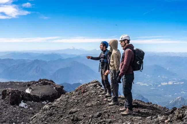
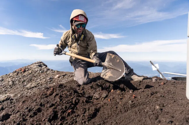
Getting all the sensor data off the mountain required another system entirely: heavy-duty batteries, solar panels, radios, antennas, cables and rugged equipment cases. The spirits’ house was a formidable antagonist, with a library of ways to destroy the instruments before any data could make it off the summit: acid gases, glassy ash and dust, extreme winds, freezing temperatures and crushing snow and rime ice that can entomb everything for months. There’s also the occasional explosive burst capable of throwing lava bombs of all sizes high into the air. Picking up one such bomb from a past eruption, Lev put the challenge plainly: “You don’t want this landing on your solar panel.”
This was where the Chilean field engineers mattered most. They understood the top of Villarrica not just as a scientific marvel, but as a work site. They helped choose sites, move loads, anchor structures, solve practical problems and think through what the volcano would do to anything left there over winter.
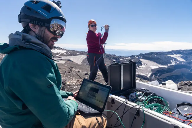
By the team’s second day on the summit, the work had become a race to get enough of the system checked before key team members had to leave. “Everything’s happening all at once now,” Bacon said, as cables were threaded through protective tubes and prepared for burial in the crater rim. On the far side of the crater, de Moor and a small crew brought the MultiGAS sensor online. When the CO2 and SO2 peaks began to appear on his laptop screen, de Moor smiled broadly. “Good news!” he said over the radio. “It’s working really well!”
Still listening
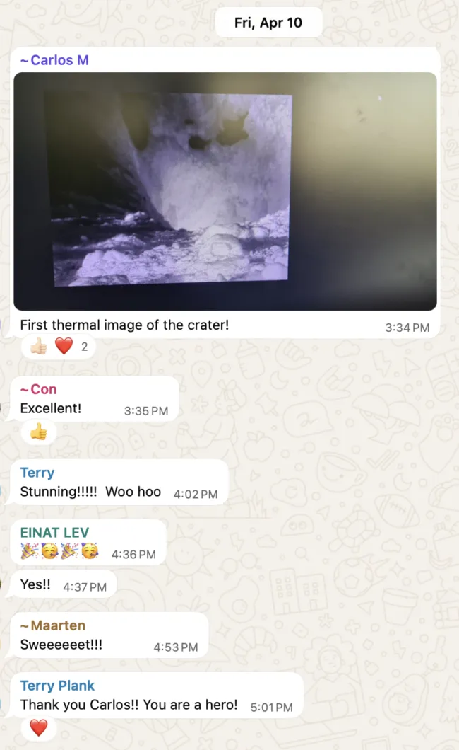
After Plank, Lev and the rest of the team left Chile for home, the work on Villarrica did not end. In the weeks that followed, the Chilean team returned to the crater to ensure all the instruments were operational and transmitting. Photos and messages from the summit showed how quickly the mountain had changed. The black, dusty rim where the team had dug holes and mixed cement was now white with snow and rime ice. Solar panels, cameras and sensor mounts were crusted over in frozen layers. “Ice embraces everything up there,” Carlos Melgarejo, SERNAGEOMIN’s lead engineer on the project, wrote in the team’s WhatsApp thread.
But there was positive news too. The radio link was still working, sending data to a field station miles away. Then came the first thermal camera image of the crater. A few days later, the first image from the visual camera arrived. The messages back and forth were brief, but they carried the relief of a project accomplishing its goal: “Excellent!” “Stunning!” “Bravo Carlos!”
Months later, the sensors have done what the team hoped they would do: survive. They have continued sending data from the top of Villarrica to OVDAS and to an open AVERT data portal. The instruments will remain with OVDAS, becoming part of the observatory’s long-term capacity. Like adding a new satellite to a weather network, the new instruments should make forecasts of future eruptions more accurate. For the scientists responsible for keeping tabs on the spirit’s house, having more warning signs to work with means having more time to understand what the volcano is doing, and more time to act.