How the Toe of Italy’s Boot Evolved
Nano and I have arrived in the Crotone Basin, where we’re staying in a place that Italians call an “agriturismo,” which is like a bed and breakfast that also serves lunch and dinner. Our little place is unique even among agriturismos. It is called Canciumati (can-chew-ma-tea), a house with four generations living under one roof…. read more
Nano and I have arrived in the Crotone Basin, where we’re staying in a place that Italians call an “agriturismo,” which is like a bed and breakfast that also serves lunch and dinner. Our little place is unique even among agriturismos. It is called Canciumati (can-chew-ma-tea), a house with four generations living under one roof. The family rents three rooms on the first floor to tourists, visitors, and friends, that remain unoccupied most of the year. For income, the family depends on the olive grove that surrounds the property, which also supplies the olives and olive oil we’ve been relishing. Calabria’s hot, dry summers and cold, wet winters provide the perfect conditions for the trees to flourish.
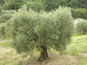
Last year, Nano and I visited an agriturismo that has a 2000-year-old olive tree on its property! For the first part of our field season, Nano and I will be in the Crotone Basin in the forearc of a subduction system. Usually, the forearc is found below sea level, but in Calabria parts of the forearc are located 1200 meters above sea level. What difference does that make? I’ll put it this way: one million years ago, before Calabria began to rise, Italy did not have a toe to its boot, and only a few islands would have existed between Salerno and Sicily!
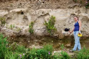
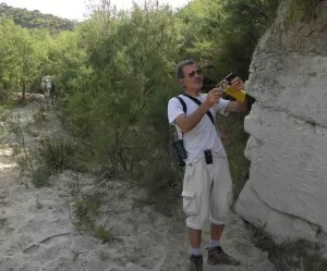
We are trying to determine how and why this uplift began. Nano and I have identified a surface that we think existed near sea level one million years ago. This surface is a geological “contact” between the granite bedrock of Calabria and a fluvial conglomerate, or river deposit, on top of it. A contact is the surface where two different types of rock are touching. Contacts can be sedimentary, related to changes in deposition (a clay bed on top of a sandstone bed) or tectonic, related to faulting. The sedimentary contact we are measuring is now high above sea level and has been eroded and dissected by rivers, so it is only present in small pieces. To map this surface, we are walking up river gorges, climbing mountains and traversing numerous goat and cow paths until we see the contact. Then we record our location with GPS (latitude, longitude, and elevation), take pictures, sketch and record interesting features and move on to find another contact.
When we put all our points on a map, we will be able to see the shape of the surface. The shape (or morphology, as geologists call it) of the surface will reveal much about how the land was uplifted: if the surface we map is now flat, then the land must have risen straight up. This is like submerging a piece of ice in water and then letting go, the ice will rise straight up to the top. If the surface we map is now tilted, then the land rose faster on one side than the other. It’s like opening a cooler. When you grab the handle and start to pull it open, the side by your hand raises high into the air while the side connected to the hinge remains close to its original starting height.