Highlights from the 2019 Lamont Open House

This year’s Open House attracted more than 3,000 visitors and, just like research at Lamont, covered a vast range of subjects and regions, from under the sea to the surface of the moon.

By
Earth Institute
October 08, 2019

On Saturday, October 5, Columbia University’s Lamont-Doherty Earth Observatory opened its doors to the public once again. Open House is a tradition that dates all the way back to 1949, allowing scientists at Lamont to share their research with the rest of the world via interactive, hands-on demonstrations and engaging talks. This year’s Open House attracted more than 3,000 visitors and, just like research at Lamont, covered a vast range of subjects and regions, from under the sea to the surface of the moon. Below you can see a few examples of all the fun we had. 
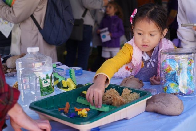
interactive activity about storm surge
At this activity focused on the Jamaica Bay Wildlife Refuge, kids learn how wetlands and other natural obstacles can help prevent flooding and storm surges in coastal areas. Photo: Kyu Lee

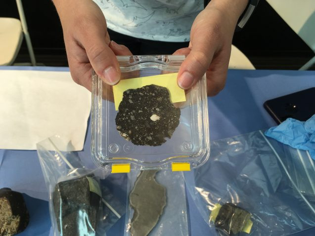
moon meteorite
One exhibit let visitors touch rocks from outer space. Shown here is a slice of a meteorite that sprayed off of the moon during a collision and later landed on Earth. Photo: Sarah Fecht

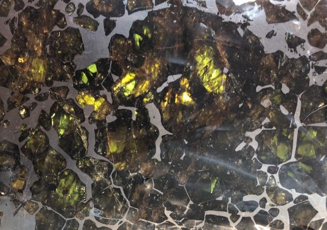
meteorite slice
Closeup of a slice of pallasite meteorite. Made of olivine and metal, this meteorite is believed to have come from the boundary between the core and mantle of a small planet. Photo: Phebe Pierson

All types of eruptions at Volcano World during the Lamont-Doherty open house. #LamontRocks pic.twitter.com/npY9XEKDZJ

— Brett Carr (@brettbcarr) October 5, 2019

The demonstration in the gif above shows the land deformations that can build up along subduction zones, where two tectonic plates collide and one sinks under the other. Lamont’s Mike Steckler, Leonardo Seeber, and Bar Oryan are part of a team that’s studying these processes in Bangladesh, to better understand the chances of a large earthquake striking in this densely populated region. Image: Bar Oryan
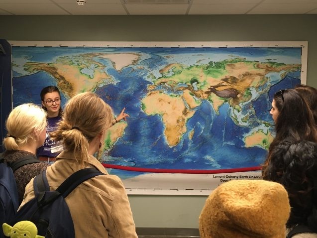
core map
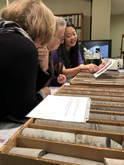
Lamont-Doherty’s Core Repository is one of the most extensive collections of deep sea sediment cores in the world. Here, a Barnard College undergraduate shows off a map of hundreds of sites where Lamont scientists have drilled into the seabed to collect the cores, which provide a window into past climate conditions. Photo: Sarah Fecht

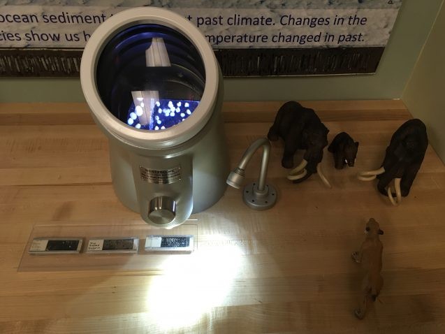
sediment cores
These deep sea cores contain sediments that were deposited 230 million years ago. The layers within the core samples contain a record of plate tectonics, volcanic eruptions, global climate change, and more. Photo: Phebe Pierson

microfossils under microscope
The tiny fossils under this microscope came from a deep sea sediment core. Their shells provide clues about the temperature, acidity, and CO2 conditions in the ocean millions of years ago. Photo: Sarah Fecht

At Open House today: Our Adaptmap online mapper outlines #adaptation measures for #JamaicaBay; a 3-D topographical model brings the bay alive. #LamontRocks pic.twitter.com/gvikvdG40B

— CIESIN (@ciesin) October 5, 2019
child in inflatable raft
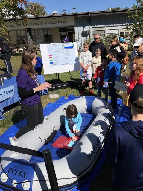
A scientist volunteer in the Biology and Paleo Environment exhibit shows visitors a raft similar to the ones they use when heading out to take core samples from the bottoms of lakes. Photo: Phebe Pierson

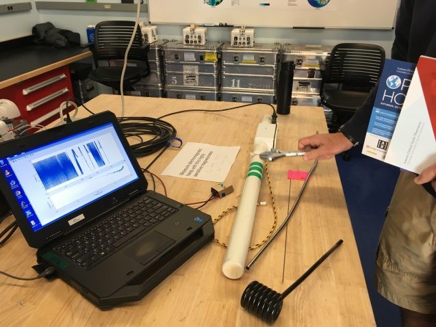
magnetometer demo
A visitor waves a wrench to disrupt the readings from a magnetometer, which researchers in Lamont’s Electromagnetic Geophysics Lab use to measure the electrical conductivity through the earth. This information, combined with magnetic field measurements, has helped the team to study water flow under the Antarctic ice sheet and to discover a freshwater aquifer under the sea. Photo: Sarah Fecht

Lab-mate Kailani has a very captive audience for measuring temperature and salinity in our #HudsonRiver exhibit at the Open House. #LamontRocks
🌍🌊😀 pic.twitter.com/byb3FEnrZR

— Elise Myers (@elisemmyers) October 5, 2019
tree cores
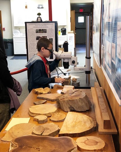
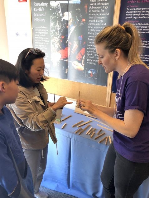
Visitors to the Tree-Ring Lab learned about how dendrochronology—the study of tree-rings—works. Scientists drill a small core from a tree’s trunk and use markers within the tree-rings to learn about the history and climate of the tree’s native area. Photo: Phebe Pierson

tree ring lab
A young boy views tree rings up close under a microscope in the Tree-Ring Lab. Photo: Phebe Pierson

@jim_gaherty⁩ talking about earthquakes to a packed house. #lamontrocks@LamontEarthpic.twitter.com/z5LKvjd8M2

— Donna Shillington (@djshillington) October 5, 2019
robin bell
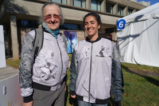
Geophysicist Robin Bell shows off a jacket she designed depicting a lunar landing and a gravimeter used to measure the moon’s gravity. Photo: Kyu Lee

heat flow experiment
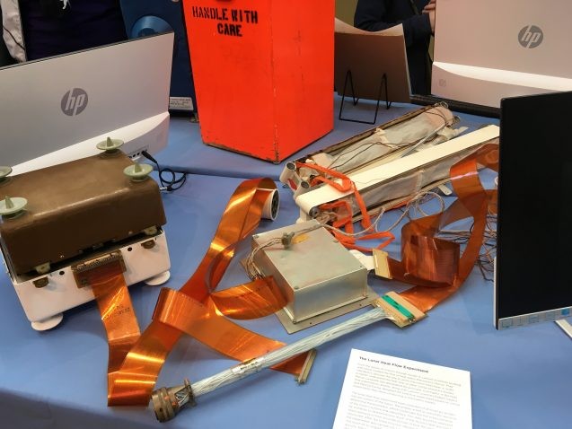
In July of 1971, Lamont’s lunar heat flow experiment landed on the moon with Apollo 15. Set up by astronauts on the moon’s surface, the experiment allowed scientists to measure how heat flows within the moon, in order to learn more about its geological history. The equipment remains on the moon to this day. Photo: Sarah Fecht

Future scientists glued to glaciers on the goo flue with @goodnesglaciers and @Martin_Wearing at #lamontrocks’ open house 2019! pic.twitter.com/twnVFA6tVl

— Elizabeth Case (@elizabeth_case) October 6, 2019
students and poster
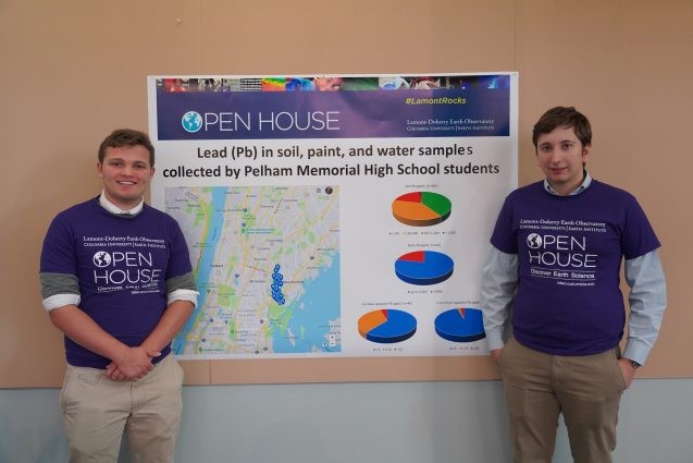
Daniel Dusevic (right) and Andrew Terraciano, juniors at Pelham Memorial High School, stand in front of a poster that details their yearlong project testing dozens of households in Pelham, Bronx for lead contamination in soil, paint and water. Photo: Kyu Lee

volunteer showing seeds
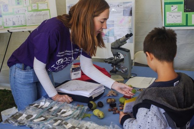
A volunteer in the Biology and Paleo Environment tent shows a future scientist samples of seeds and leaves from different kinds of plants found in bog environments. Photo: Phebe Pierson

Seismometers at @LamontEarth are sensitive enough to detect your footsteps next door. #LamontRocks https://t.co/b369Vf4PBp pic.twitter.com/xciTaGNm3Z

— Earth Institute (@earthinstitute) October 5, 2019
soil samples
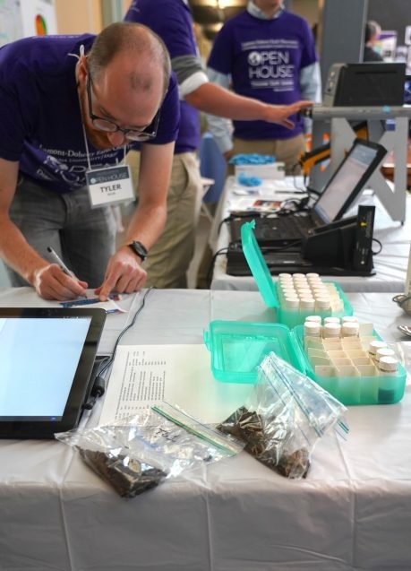
As part of a study on lead contamination in soils, researchers encouraged participants to bring samples from their backyard in ziplock bags to be tested on site. Levels could be determined in a few minutes. Photo: Kyu Lee

glacier erratic
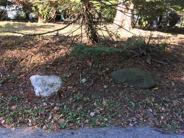
During the last ice age, about 18,000 years ago, New York was buried under a mile or so of ice. Lamont glacial geologist Mike Kaplan led a tour explaining how we can spot the traces left behind by the ice sheet as it retreated. One way is by looking for glacial erratics — rocks that don’t quite belong. Since the area around the campus is mostly made up of dark volcanic rocks, the white rock in this photo was likely carried into the area by the advancing ice sheet, and left behind as it retreated. Photo: Sarah Fecht

glacial erratic
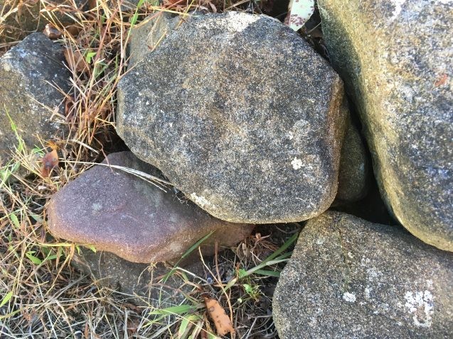
One of these rocks is not like the others. Can you spot the glacial erratic? Photo: Sarah Fecht

coke mentos eruption
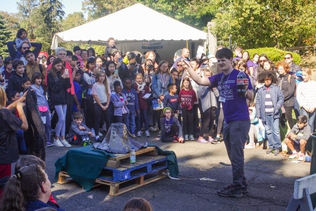
Henry Towbin, who studies magma at Lamont, shows visitors how a Plinian volcanic eruption happens, using Mentos candy and Coca-Cola. Photo: Phebe Pierson

Lamont Open House was a blast!#LamontRocks pic.twitter.com/xY3SP0ui4e

— Kevin Uno (@kevin_t_uno) October 5, 2019