Cruising up the Brahmaputra
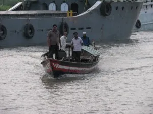
Rejoining the ship, we sailed up the Padma and Jamuna (Brahmaputra) Rivers. Hurrying to our primary area with the help of pilots, we finally collected good seismic data.
The Meghna River and its tributaries in NE Bangladesh are very muddy. They carry a lot of water in this very rainy area of many haors, ponds and marshes. The largest is the inland lake that forms every summer. However, as we discovered, the muddy sediment is rich in organic matter and we could not get good data. We only were able to image south of the lake after most of the sediment had been deposited. Despite the problems, we remained optimistic because the Jamuna, as the Brahmaputra is known in Bangladesh, carries mostly sand and silt. However, time is growing short and there is no time to collected data over the entire length of the river. The most important area is in the north, so we must rush upstream to have sufficient time to collect seismics there.
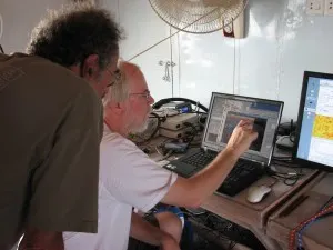
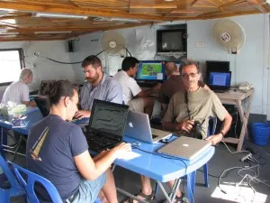
I rejoined the Kokilmoni in Mawa Ghat (port) and the next morning headed up the Padma to the Jamuna. To navigate these rivers, you need a pilot to steer through the many sand bars and channels. That means we sail from pilot station to pilot station and are less free to stop where we want. Yesterday was Mawa to Aricha, at the confluence where the Ganges and Jamuna join to form the Padma. Making good time, we decide to make use of it be deploying the seismic system. This was the test – can we collect good data in the large sandy rivers? Can we deploy and retrieve the streamer in the strong current? The boat slowed to the point of sliding backwards in the current and deployed the equipment. Initially, there was some electrical noise that obscured everything, but we found the source and unplugged it. For the first few minutes we were all squinting at the screen to see if we could see reflectors. Uncertain at first, it soon became clear that we were getting good data and a saw a strong reflector that probably marks the river level at the height of the last ice age when sea level was 120m lower. Success. After an hour we pulled in the streamer and headed to port, satisfied that that we could image here and anxious to head north as quickly as possible.
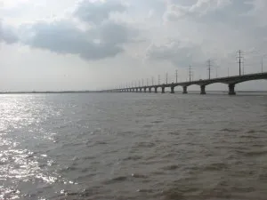
Today, we entered the Jamuna and are heading north to Sirajganj, just north of the only bridge over the river. Brahmaputra means Son of Brahma, an appropriate name for this mighty river. The river looks different from when I was hear at low water. Then there was exposed sand on the banks of all the islands. More sand then I had ever seen. Now it is all submerged and just the island tops and vegetation are seen. The sand is all below water and shifting, which is why we need pilots. We have made very good time and have only hit one sand bank. Enough time that we are now collecting more data and just passed under the bridge, which has many published borings drilled before construction. These wells will let us correlate our reflectors to actual rocks.