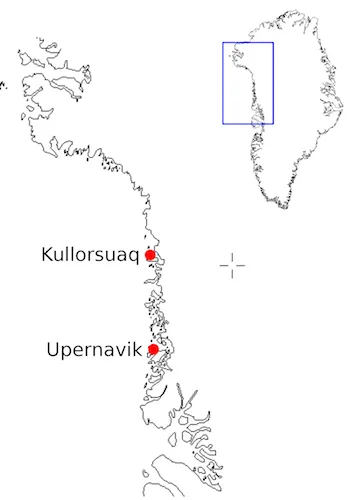
The Changing Upernavik Waterfront
Project Background: Changing conditions in Greenland’s northwest glaciers over the last decade have led to a range of questions about water temperature and circulation patterns in the fjords where ocean water meets the glacial fronts.
Leveraging Local Knowledge to Measure Greenland Fjords: Understanding the Community
Project Background: Changing conditions in Greenland’s northwest glaciers over the last decade have led to a range of questions about water temperature and circulation patterns in the fjords where ocean water meets the glacial fronts. We can use satellites to measure the loss of elevation, the acceleration of ice flow, or the retreat of ice from a glacier, but we can’t use satellite measurements to collect water column temperature profiles. Water column profiles would allow us to better determine how much melt is possible at the glacier connection to the ocean, and help us pinpoint why neighboring glaciers are behaving differently.
The Leveraging Local Knowledge project will work with members of local Greenlandic communities to collect water measurements in the fjords. This will assist in determining if warming Atlantic Ocean water is circulating up through Baffin Bay where it enters the fjords to lap against the frozen glacier footholds, causing them to loosen their hold on the rock below. Alison Glacier (74.37N and 56.08W) is selected as the project focus. Emptying into Melville Bay to the east of Kullorsuaq Island and has been undergoing dramatic change over the last decade.
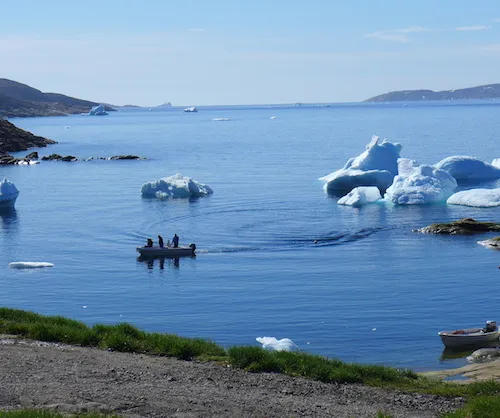
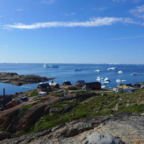
Our Journey: Our research trip to the small village of Kullorsuaq is a journey that will start 200 kms to the south in the community of Upernavik, located 800 kms north of the Arctic Circle. Flying in on a small 37 seat Dash 7 airplane we overlook a coastline that is lined with glaciers flowing into a bay that is dotted with islands. Most are uninhabited, but Upernavik is home to a population of 1500 permanent residents. An island community, the main employment is fishing with the waterfront sporting a range of both commercial and smaller independent fishing boats.
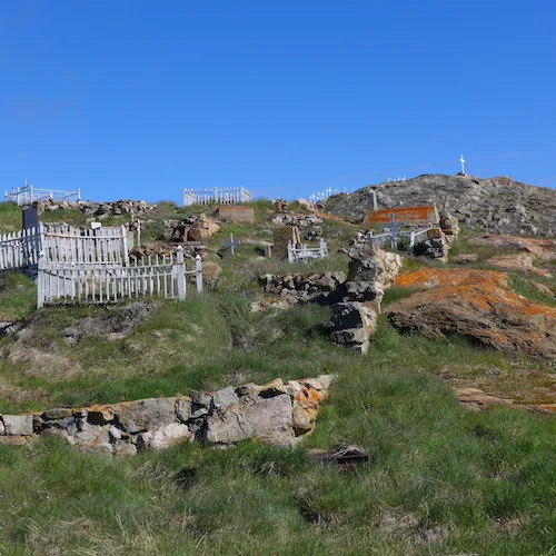
Upernavik town was established by the Danes in the late 1700s but trade and a religious mission in the early 1800s cemented it as a permanent settlement. The southern end of the island is dotted with a cross covered graveyard representing the religion the Danish settlers brought and the practice of the current community. Christmas, Three Kings Day and other religious holidays are all causes for the community to celebrate. This week the priest will visit Upernavik to celebrate three weddings (Friday and Saturday) and the Confirmation (Sunday). With all such events scheduled for when the priest can preside the parties and celebrations will involve the whole community for days. Celebration and gatherings are a large part of this community’s practice.
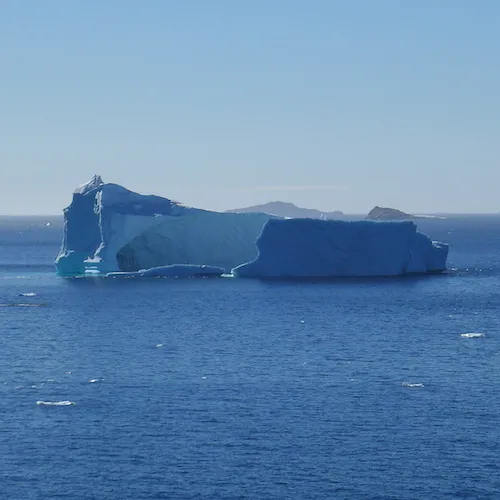
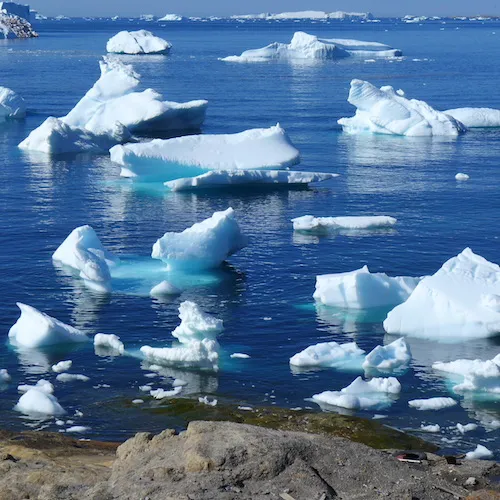
The Setting: The icebergs being sloughed from the neighboring glaciers dominate the horizon, littering the waterfront with ice ranging from house-sized blocks to looming masses that appear as large as the neighboring islands. Looking around at the open water it is hard to imagine the origin of these large masses of ice. The closest blocks of ice move during the course of the day, shifting back and forth from north to south and back again. With the shifting and changing of the icebergs the sound of the settling and collapsing of ice is drilled into our consciousness – the sharp crack of the ice as if fractures and the larger canon-like rumble as sections break and fall into the water.
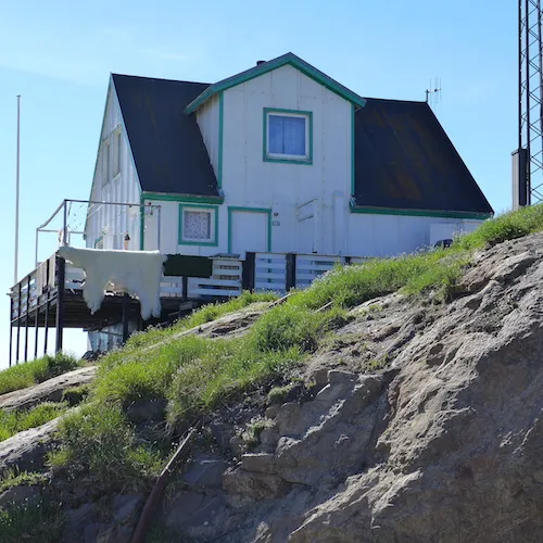
Our local host, a Dane who has lived in Upernavik for 40 years, has fully blended himself into the community where he and his family are well known and liked by both the Inuit and the Danish population. When he learns of our project he observes that in his time here ice cover has significantly changed. He recalls his early years here when the ice in May was so solid in the bay that visiting boats had to drop dynamite on the ice to open a pathway. He points to the open water and the line of haze that hangs on the horizon offering a cause, ‘global heating’.
Other changes have hit Upernavik. We meet a Danish couple who had spent 4 years living in the community, now returning after 30 years to ‘close out their memories’. They spoke with fondness of this lost time when they raised their small children as they worked as a teacher and a nurse. With a team of 10 dogs ‘Lars’ had hunted Greenlandic seal and still had a sharp eye picking a bobbing seal head out on the horizon. They spoke of the people numbering 900 while the Greenlandic dogs had numbered 3000, many times more than the dogs are now. Dogsleds were an important part of that older Upernavik when individual hunting and fishing were the mainstay of the community. While hunting and fishing are still important today Lars notes that things have changed becoming less rugged for an individual. Whether the changes in ice cover have played a part in this is hard to determine.
In our few days here in Upernavik we learn that residents are happy to help, they have networks that reach from one island community to another. Names and contacts are offered freely – “try this person for a place to stay”, “this teacher may be interested in helping you”. It is this networking of local people that we will rely on for the project. Their overall interest in what is happening to their community will be an important part of its long term success.
Leveraging Local Knowledge to Measure Greenland Fjords:
Dave Porter and Margie Turrin are in northwest Greenland working with local community members to collect water column temperature profiles. The project is funded by a Lamont Climate Center grant with support from the NASA Interdisciplinary Program and logistical support from NSF.
http://www.ldeo.columbia.edu/~dporter/Kullorsuaq/