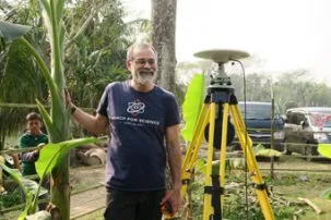
Installing GPS Around Barisal, Bangladesh
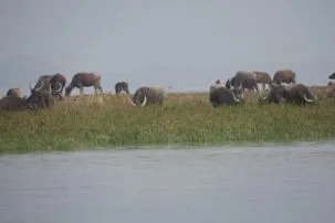
Getting to remote sites started to prove challenging, and involved many forms of transportation by land and water.
Overnight, our last team members arrived: Céline Grall, who just left Lamont for a permanent research position in France, and Abdul Muktidir Sober, a GPS specialist from the Institute for Water Modeling (IWM). Since they left Dhaka late in the evening, they only arrived in Barisal, Bangladesh at 5 AM. We let them sleep in.
The rest of our team consists of Hasnat Jaman, a professor at Barisal University and his students Saiful Islam and Nahin Rezwan, Shaikh Nahiduzzaman (Nahid) from IWM, Ershadul Mondal from the Survey of Bangladesh (SoB), Masud Rana, a student from Dhaka University (DU), and myself. Nahid and Masud were with me on the trip this past summer. I have been in the field with Hasnat several times back when he was a student at DU.
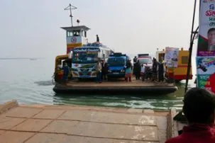
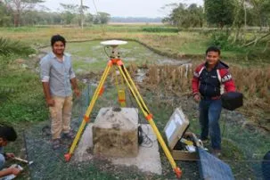
Following up on our first successful day, we attempted to install three GPS to the north of Barisal. We decided to go to the farthest site first, the other two being near the main road and easy to get to. All of monuments at these sites were set up by the SoB in 2002. Resurveying them will give us a measure of how much the land has sunk over the last 18 years. To reach the site, we needed a ferry to cross the Arial Khan River.
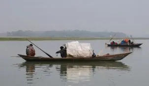
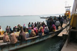
Since no car ferry was there, we debated whether to take one of the frequent people ferries and hire a vehicle on the other side. While we talked, the car ferry appeared. However, when we talked to the operator, we found it was not due to leave for two hours. We negotiated a sooner crossing, but could not arrange anything for the return trip to avoid a long wait on the way back.
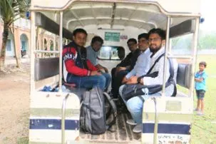
We gathered everything we would need and took a crowded people ferry. While we were crossing, the car ferry also started crossing, but we probably made the correct decision. On the other side, we were able to rent a laguna, a covered pickup truck with two rows of seats facing each other in the back. The seven of us piled in with the equipment for the hour-long ride the rest of the way to the site.
It was at a school where we were welcomed warmly with tea and cookies. We found the monument, but it was next to a tree and a corrugated tin building. When SoB measured this site, they used a 10-meter pole for the antenna, something we don’t have. They cleared a wood pile, some vegetation and a tin canopy, but the site will still be of poor quality.
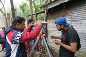
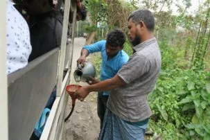
We set up the GPS anyway, continuing to train Hasnat and his students on all aspects of the set up. The school set up barricades to keep the children away. With our work done, we got back into the laguna for the long ride back to the ferry. After the crossing, we had snacks and tea with fresh hot milk while waiting for our cars. It was a treat where most rural town have only powdered milk or sweetened condensed milk. It was now after 3 PM and we could only do one more site before dark.
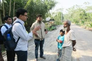
This site, off the main road, was not near a facility. Nahid and I went to find the local district chairman to arrange for guards to protect the equipment. We went to his office by foot and then his home by motorcycle to find him. Our van picked us up and took us to the site where he quickly arranged for the site to be watched and protected. We finished by going back to the previous day’s installation and retrieved the equipment in the dark.
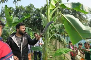
A quick check of the data we collected showed that the first day’s data looks very good. The next day went very quickly. We quickly set up a GPS at Barisal University on a monument we had installed last summer. We went to a nearby site to the west. Since it was next to a busy road and overshadowed by banana trees, Nahid and I, with Nahin, who must learn to do this, went to find the landowner. We located him, got permission to cut back the trees and arranged for two people to guard the site through the night.
Then we drove north to another site. This was in a banana field next to a school. Working with the owner, we are able to trim the large banana leaves rather than cut down any of the small trees. We finished by having tea and cookies with the headmistress of the school.
It was early enough that we decided to split up. One team went to install the GPS at another site, while I went with the team to retrieve yesterday’s instruments.
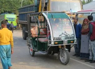
We drove to the ferry, grabbed the tools we needed and left the van. There was some problem with the ferry, which sat at the dock without going. We left it and went on a speedboat across the river for less than 50 cents extra each. On the other side, a laguna van was not available. There had been an accident involving one, so all lagunas were grounded for the time being. Instead, we took a smaller and slower three-wheeled autorickshaw.
Once we got there we double-checked that the tripod was still level and centered on the point, and remeasured the height. Everything was fine and we packed everything up and got back in the autorickshaw for the hour’s ride back to the ferry, arriving after dark.
The other team found the next site in the middle of a stand of bamboo. As the owner lived elsewhere, the area was not maintained and the plants were wild.
We went ahead and set up the system, but we are not at all sure the data will be of sufficient quality. Then on their way back, an accident blocked the road. Two pedestrians were killed, including a beloved Freedom Fighter from the 1971 War of Independence. It would be 2.5 hours before they could get by. Thus, after crossing the ferry, we went to yesterday’s other site, paid the guard and packed up. We finally met up back at the hotel around 8:30 pm. A long, but successful day.