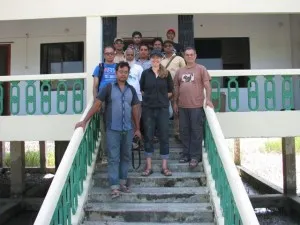
Hiron Point in Sundarban
We traveled by boat to the south part of the Sundarbans near the Indian Ocean to install a GPS at Hiron Point, this isolated facility also hosts a tide gauge recording long-term water level changes due to rising sea level and land subsidence. Our GPS will help distinguish how much of each there is in the midst of the world’s largest mangrove forest.
We sailed out of the small channel we were anchored in to the Sibsa River and then to the south. We passed the western side of Polder 32 with a good view of the embankment that protects the island then passed into the Sundarbans forest with mangrove trees on either side of the wide river. Hiron Point is close to the mouth of the river where it empties into the Bay of Bengal. Perhaps empties is not quite the right word as the river is tidal, flowing both ways. Moreover, the mud that maintains the Sundarbans probably comes from the sea. The sediment discharged by the combined Ganges-Brahmaputra-Meghna Rivers is swept westward along the coast and some of it is carried inland by tides and storms. How much is still a topic of research. We prepared the equipment in the bow while watching for tigers along the shore. We reached our anchorage after about 8 hours and enjoyed a BBQ on the top deck. Then, at last, an early night.
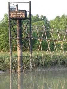
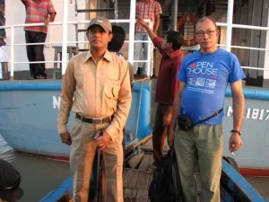
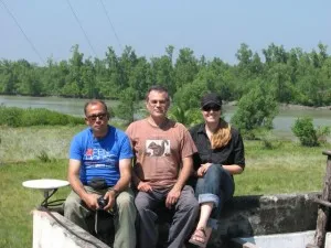
Just after 6AM we loaded the launch and headed into the channel with the forest station after watching the sunrise. We were accompanied by two armed guards, required in the Sundarbans, although we don’t expect tigers at the ranger station. The first thing we passed was the tide gauge, the reason we are putting the GPS as this particular location. It is well known and its data is available in a global repository for tide gauge data. We landed at the third dock belonging to the forest service. The path to the ranger station proudly announced the Sundarban as a World Heritage Site and through in a couple of caged tiger statues as well. We met the forest ranger and were told that there is no cell phone service, contradicting what we had been told. During the winter there is a weak signal. That was going to be a problem for downloading the data. We headed to the roof and for once, the ladder was already in place.
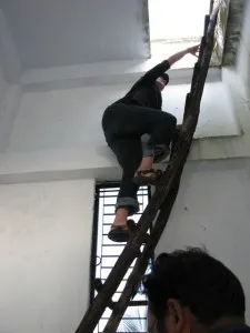
The roof had a low brick wall around its perimeter. Brick is much weaker than reinforced concrete and not considered stable enough for GPS. Our two foot threaded rod was long enough to get us 5” into the concrete is we drove the long drill bit all the way to the chuck. It would have to do. The GPS went into a secure room with communications equipment. By now our experienced team split into our familiar tasks. Sarah figured out a way to get the cables to the roof by tying them to a rope after going through the wall. After some effort, I managed to drill the wall to the maximum depth. With the poor to nonexistent cell signal, we set up a yagi directional antenna and pointed towards the closest cell phone tower some 60 km away.
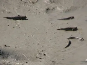
We got everything set up, but the cellular connection didn’t work. Next step is to hope that we can establish a connection in the winter and be able to seasonally download the data. Having to return regularly to download the data or come back to set up a radio link would be expensive, although the Sundarbans is a wonderful place. We said our goodbyes and headed back to the M/V Kokilmoni without having seen either a tiger or a crocodile, although we saw a lot of mudskippers, a personal favorite of mine while leaving.
We weighed anchor and headed back north to Khulna. The crew spotted a crocodile, but I missed it while uploading blogs. Going north, we had left the calm of the Sundarbans and returned to the modern electronic world of cell phones and internet. One more GPS to go, but it is in far northern Bangladesh, a 380 km drive from Khulna where we get off the boat tomorrow.