A Front Row Seat on the Ocean Floor
Ocean scientists are, in their hearts, explorers. Our group aboard the R/V Atlantis may be more infected with the exploration bug than most. The first goal of our expedition makes that clear: We aim to map regions of the seafloor never before seen by human eyes.
By Bridgit Boulahanis
Ocean scientists are, in their hearts, explorers. Our group aboard the R/V Atlantis may be more infected with the exploration bug than most. The first goal of our expedition makes that clear: We aim to map regions of the seafloor never before seen by human eyes. After a two-day transit to our survey site, the first four days of our research program are dedicated solely to mapping.
An unexplored seamount is our first mapping target. Prior to our expedition, the region was only known to be a shallow area because of satellite-derived maps. Information from satellites gives scientists the global seafloor map that we use in the absence of data of better quality. Unfortunately, this data resolution is on the order of a kilometer, which provides a general idea of the major features of a region but misses many crucial details that may be scientifically important.
With our shipboard mapping system, we can create maps at 75-meter resolution. This is similar to the difference between seeing that there is a large green feature in the middle of the island of Manhattan, and being able to pick out the exact location of the Delacorte Theater within the park.
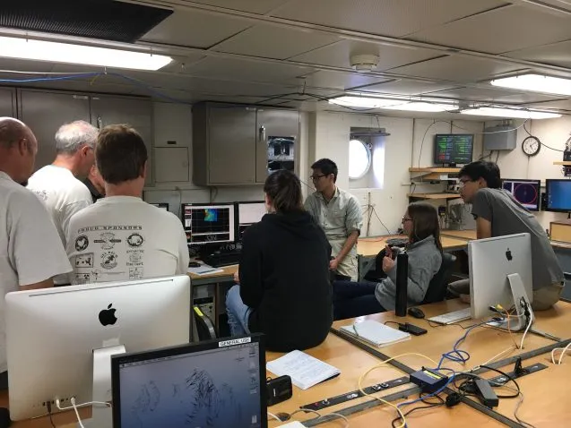
Knowing all of this, it makes sense that when the R/V Atlantis arrived on station to map what was this week dubbed, the entire science party was gathered in front of one computer. As each new swath of data came in, scientists called out features they could immediately identify and began debating the origin and age of the seamount springing up before our eyes.
This is just the first stage of exploration and discovery for our month-long expedition. Liona Seamount stands at the western edge of a long chain of seamounts extending from the East Pacific Rise at a latitude of approximately 8°20’N. Our mission, titled Off-Axis Seamount Investigations at Siqueiros (OASIS), aims to characterize this entire chain of submarine volcanoes. We will use every resource at our disposal to increase scientific understanding of these seamounts.
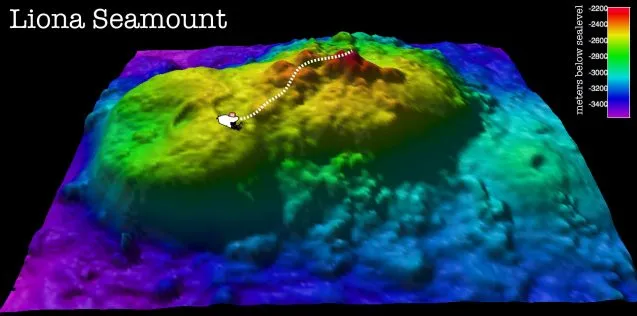
The next phase of our survey will include even higher resolution maps made by the Autonomous Underwater Vehicle Sentry. If our shipboard maps revealed the Delacorte Theater in Central Park, Sentry’s maps would allow us to see people sitting in the seats. We will also be utilizing cameras designed to be towed just above the seafloor and provide thousands of high-resolution images of the features below.
Physical samples of rocks from our seamounts are also crucial to this study, and will be brought on board through overnight dredging and collection using the research submarine Alvin.
The first round of data is already in the hands of the eight graduate students aboard, rapidly being processed and parsed for in-depth analysis. In addition to new maps covering several hundred kilometers of seafloor, we have collected magnetic data giving us the approximate age of the seamounts we are studying, and gravity data that will help us to gain a rough understanding of the structure of the oceanic crust.
The results we have gotten so far are thrilling, but no doubt some of the most exciting data of our expedition is still ahead of us.

Save
Save