Expanding Our Vision Brings the Big Picture Into Focus
1500 feet above the ground surface is where our suite of instruments normally operates, but for this flight we are taking them up higher, much higher, in fact over 20 times our normal range to 33,000 feet. Our flight plan is to repeat lines surveyed in a previous years by NASA’s Land, Vegetation Ice Sensor… read more
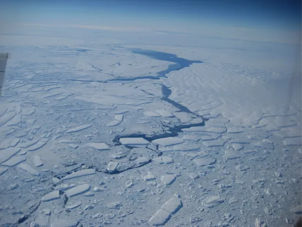
At our higher elevation we will fly faster and can cover a lot of ground. The landscape of Antarctica can be hard to get ones head around – a glacier catchment is usually too big to fit into one field of view, so we see it bit by bit, and try to build up a physical picture in the same way we build up our understanding of the system – piece by piece. We have flown several missions into the Amundsen Sea region on the west Antarctic coast in the past, but this was the first time where we could really see the context of all of these different glaciers – flowing into the same embayment, forming ice shelves, calving ice bergs, and drifting northwards through the sea ice.
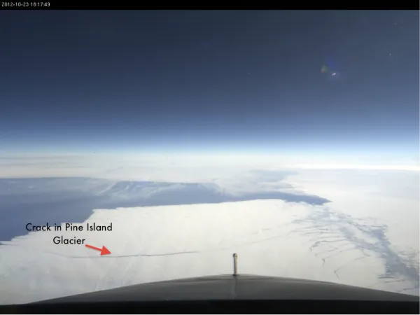
The flight offers views of some of the most noteworthy features in Antarctica. Pine Island Glacier, one of world’s fastest streaming glaciers, developed an 18 mile crack along its face in the fall of 2011 which spread further over the last few months. The crack will inevitably lead to breakage, dropping an iceberg which scientists have estimated will be close to 300 pound in size.

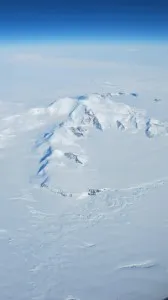
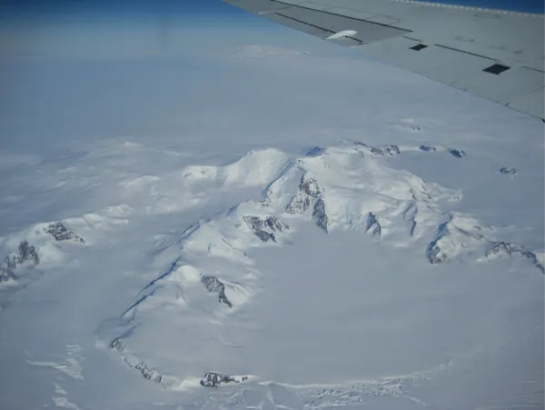
Bordering the glacier is one of two shield volcanoes we passed over during our flight. Pushing up through the Antarctic white mask, Mount Murphy diverts the ice streaming along the glacier. A steeply sloped massive 8 million year old peak, Mount Murphy pulls my thoughts back New York as it was named for an Antarctic bird expert from the American Museum of Natural History.
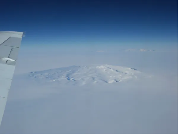
From Mount Murphy we continue to the second shield volcano, Mount Takahe. Ash from 7900 years ago found in an ice core from the neighboring Siple Dome has been attributed to an eruption from this volcano. This massive potentially active volcano is about 780 cubic kms in size. The volcano was named by a science team participating in the International Geophysical Year (1957-8) after the nickname of the plane providing their air support …an unusual name for a plane as its origin is that of a plump indigenous Māori bird from New Zealand which happens to be flightless! Regardless the rather round Mount Takahe soars high above the glacier as we move overtop.
From there we fly over the tongue of Thwaites Glacier as it calves icebergs into the Amundsen Sea. To read more about Thwaites check out my first blog of the season: http://blogs.ei.columbia.edu/2012/10/18/launching-the-season-with-a-key-mission-icebridge-antarctica-2012/
For more on the IceBridge project visit:
http://www.nasa.gov/mission_pages/icebridge/index.html
http://www.ldeo.columbia.edu/res/pi/icebridge/: