To Comilla and Back
I’ve just arrived back in Bangladesh with an engineer to install 6 new GPS stations to add to our studies of earthquake hazards and land subsidence. Our first stop was Comilla University, the westernmost exposed fold of the collision between the Ganges-Bramaputra Delta and the Sumatra-Andaman-Burma plat boundary.
I’m back in Bangladesh for the fourth time in the last two years, my eighth trip overall. It is the first time I’ve been here in October. It is about 90° and sunny. The monsoon is over, but water levels are still high. I have come to install more GPS around the country. With me is Sarah Doelger, an engineer from UNAVCO, an organization that provides technical support for research involving GPS. A number of out GPS stations in Bangladesh are systems on loan from UNAVCO. She has come along because we are establishing stations in remote areas and will use the cell phone system to call the receivers and download the data. I am also traveling around with Humayun Akhter, my partner for many years from Dhaka University, who keeps our network running, and his student Fayazul Kabir. The four of us will be traveling around the country by van and boat to install the stations to monitor tectonics and land subsidence.
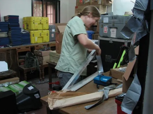
As usual, we arrived at 4 AM after a full day or traveling and had to hit the ground running. After a short rest and shower at our hotel, we spent the day unpacking, preparing the equipment and buying the last few items.
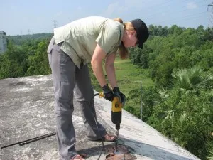
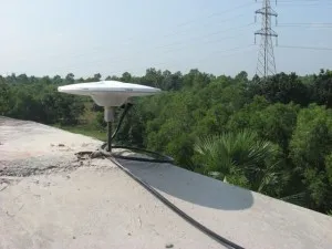
Yesterday, was our first installation. We drove east to Comilla University sitting on the last exposed hill of the foldbelt. At a little over 100 ft high, it may not seem like much, but it stands out in a country where half the land is less than 10 ft above sea level. Thanks to bad traffic, it took 4 hours to get there, including a stop for breakfast on an island in the Meghna River. We met with the registrar over tea and cookies, then finally got to work about noon. This site fills a gap in our coverage of the Burma Arc foldbelt, a continuation of the same plate boundary as Sumatra, site of the 2004 M9.3 earthquake and tsunami. Here, the subduction zone is colliding with the largest delta in the world, folding the sediments into a broad set of folds.
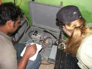
Our GPS is measuring the rate of shortening of the foldbelt as strain builds up, possibly towards an earthquake. The antenna was attached to a 2-ft steel rod we cement into the roof of a reinforced-concrete University building. This is our preferred method for a country with almost no solid rock. The receiver, electronics and backup battery were installed in the control room of the large solar panel array just below the antenna. The only hiccup was tapping into their electric system for power and meshing their 2 wire system to our 3 wire system. Their system is not grounded, as we discovered when Sarah got shocked connecting our battery. He fingers have stopped tingling. It took a while to understand what we wanted and in the end we had to ground our system into the lightning protection grounding that we set up. It was all done in about 3 hours and stopped for a well-deserved lunch at about 4 PM on the way home, further hampered by traffic jams.
This morning we packed all our stuff in a large van and are working our way through the traffic to get to SW Bangladesh for the next 3 stations. I am really looking forward to getting out of the city and its traffic and into the calmer countryside.