
The Changing Shape of Extreme Rain in the U.S.
Extreme precipitation events are among the most damaging natural disasters and a major concern in our changing climate. In the U.S., since 1980, the most destructive events alone have caused over 2800 deaths and $700 billion in damages. But what is the total area of the country affected by these events each year? And how have these patterns changed over the last several decades? In a recent study in Geophysical Research Letters, led by researchers at Lamont-Doherty Earth Observatory, which is part of the Columbia Climate School, the authors discovered some unexpected trends.
What are the trends?
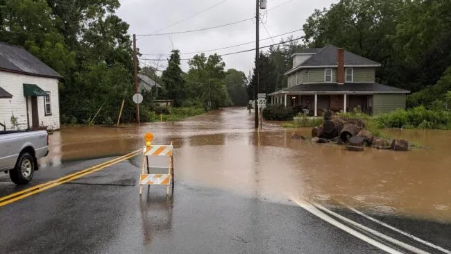
Extreme rainfall events that cover large areas, including hurricanes, atmospheric rivers and thunderstorm complexes, are a growing threat, but many studies on extreme precipitation focus on the statistics of rainfall recorded at individual locations, like weather stations. This new study takes a slightly different approach, looking at not only when heavy rainfall events occur, but also how much nearby area was affected by the same event on the same day. For example, a small-area extreme rainfall event may result in a localized flash flood in just a few towns, but large-area extreme events like Hurricane Ida in 2021 can easily cause destruction across entire states at once. Looking at the statistics of extreme precipitation events across both space and time has yielded some surprising results. For example, the average weather station in the eastern half of the U.S. is recording an increasing number of days with extreme rainfall since 1980; at the same time, we are also observing that extreme rainfall events might be decreasing in frequency. How can both findings be true?
By looking at the spatial footprints of storms over time, this study provides insight toward these seemingly contradictory trends. Across the U.S., it used to be more likely to have many small-area extreme rain events throughout the year, all happening on different days. Now, the entire country is tending toward fewer small-sized extreme rain events. In the Western U.S., the story seems to more or less end there, but in the Eastern U.S., large-area extreme rainfall events appear to grow more common as well. Combining these two effects means that the average station in the Eastern U.S. is experiencing more extreme rainfall events, but with a greater tendency toward large-scale events that affect large swaths of the country at once, instead of smaller-scale storms on different days of the year.
Such changes to rainfall patterns are alarming for a variety of reasons. Large-area extreme rainfall is more likely to lead to widespread flash flooding, potentially overwhelming emergency response across multiple localities at once. A greater watershed area getting heavy rain also increases the tendency for rivers downstream to break their banks. Finally, insurance claims that come in simultaneously are more likely to strain insurer liquidity, which can make it harder to get people the funds they need to recover from personal losses.
Why are rainfall patterns changing?
Understanding exactly why these changes are happening is still a challenge. One issue is that there are many types of storms that bring heavy rainfall, and a warming climate may affect the physics of these different storm types in a variety of ways. For example, the reason for atmospheric rivers becoming larger in width might not have anything to do with the reasons for hurricanes moving more slowly. All these different changes happening within different storm types make it difficult to diagnose a singular cause of these changing rainfall patterns.
The basic science on how storm size and speed are affected by climate change is still relatively unsettled, with many studies coming to seemingly contradictory conclusions. However, we do have some clues: First, the size of these rain events seems to be related to how intense they are, meaning the same physical processes that cause intense rainfall may be linked to the affected area of storms. The physics of changing rainfall intensity under a warming climate is a lot better studied than, say, the physics of changing storm speeds. Second, the widespread suppression of small-area extreme rain events that this study observed across the U.S. seems like a promising research avenue. If we can figure out the reasons behind these disappearing small-scale extreme rain events, it might lead us to additional insight on the increase in frequency of large-area rainfall events in certain parts of the country.
Given that extreme precipitation is one of the thorniest subfields within climate science, understanding the data we already have in weather records is critical to our ability to hypothesize about the future. Studies like this offer a fresh look at data that researchers have already seen hundreds of times, cutting up the statistics of extreme rain events in new ways to better understand the full picture of how precipitation is changing. By doing so, we can hopefully get a better glimpse of what the future is going to look like. So far, one thing seems to be clear: when it rains, it pours.
The study in Geophysical Research Letters was authored by Trinish Chatterjee, Adam Sobel, Radley Horton, all from the Lamont-Doherty Earth Observatory, and Danielle Touma of the University of Texas at Austin Institute for Geophysics.
Trinish Chatterjee is a Ph.D. candidate in Earth and Environmental Sciences who studies extreme events under a changing climate at the Lamont-Doherty Earth Observatory.