Back to Bangladesh: How Fast is the Delta Sinking?
I am back in Bangladesh once more to investigate the balance between sea level rise, the sinking of the land, and the filling of the space with sediments.
I am back in Bangladesh once more for another part of the Coastal Embankment Improvement Project Phase 1 (CEIP-1). The maintenance of the Ganges-Brahmaputra Delta depends on the balance between sea level rise, sinking of the land, and the filling of the space with sediments. Understanding this balance, as well as the shifting of the river positions through time, is needed to design the embankments (Bangladesh uses the Dutch term “polders”) that protect the land in the southwestern part of the delta.
Despite dire predictions for the future of Bangladesh, the delivery of fresh sediments from the Ganges and Brahmaputra Rivers is helping the country keep pace with sea level rise. However, the future depends on whether India and China proceed with dams and river diversions upstream. My role in this large project is to develop a better understanding of subsidence, the sinking of the delta. All deltas sink, increasing the effect of sea level rise. We are trying to understand the processes and rates.
Last summer, our team installed and rehabilitated GPS and installed rod surface elevation tables to measure both the subsidence and sedimentation rates at a number of places. I have returned to make additional measurements of subsidence. Back in 2002, the Survey of Bangladesh (SoB) installed a large number of geodetic monuments around the southern half of the country. Their positions where measured by GPS, but they haven’t been remeasured since.
I have identified 55 monuments in my field area. During this trip, I will start to reoccupy some of those sites with new GPS measurements and train Bangladeshis to continue measuring to complete the survey. With our precision GPS, I expect to be able to determine the elevation to within ~1 cm (0.4 in) to determine how much the sites have subsidence over the last 18 years. While the data from only two short campaign GPS surveys 18 years apart will not be as precise as the continuously recording GPS we have, the number of sites — 55, evenly spread across the land — will provide a broader picture than the 9 continuous sites I have.
After spending New Year’s Eve in the air, I arrived in Dhaka the following afternoon to find one of our safe-to-fly AGM batteries was taken from a GPS case in Dubai, and another one missed the connection. Between the delays dealing with the luggage and traffic, I made it to my 8:30 dinner meeting a little after 10:00 pm. Amazingly, they were just serving the soup and I was able to join in.
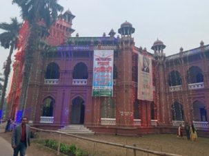
The next day was filled with meetings. I gave a talk at the project headquarters at the Institute for Water Modeling (IWM), and went to the SoB and Dhaka University (DU). I met the Surveyor General, from a line that goes back to Sir George Everest and beyond. We finished the arrangements for the trip, prepared 2 additional DU campaign GPS, renewed old acquaintances and made some new ones. My last GPS case arrived at my room about 11 pm, also minus a battery.
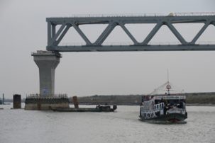
The next morning, Nahid (IWM), Masud (DU), and Mondal (SoB) converged on my hotel for the long drive south to Barisal, our base for the fieldwork. We caught a slow ferry, a barge pushed by a tugboat, for the Padma River crossing, so we arrived too late for any work. Instead, we had a planning meeting, along with Hasnat, our colleague at Barisal University (BU), and two of his students at the hotel. Having skipped lunch getting here, we had an early dinner and collapsed into bed early.
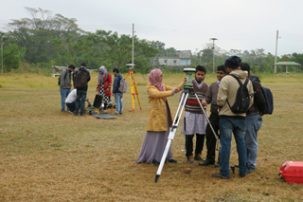
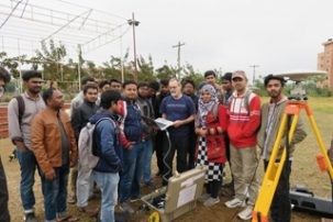
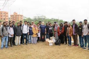
Today was our first day of fieldwork. We started by training over 20 BU students in setting up the tripod and GPS. This also gave us a chance to take out and test all of the instruments. The instrument from the SoB has internal batteries that must be switched every three hours, so it will not work for our 24+ hour observations. We have six that we can use, but three of them need new batteries now. We spent the morning doing the training in a field at the university and taking selfies.
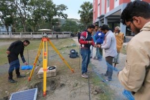
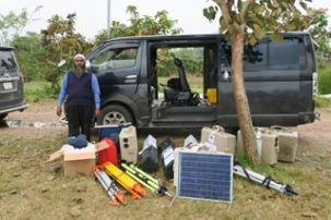
When that was finished, we headed back to Barisal to shop for materials to build a fence around each site and miscellaneous other things. We could not find appropriate batteries, but Sober, a SoB engineer who will join us tomorrow, found them in Dhaka and will bring them. Finally, well into the afternoon, we headed out to our first site to try and get it installed before dark. When we got there, we could not find the monument, only a new school building close to where it was supposed to be. I was sure it was destroyed during construction.
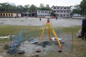
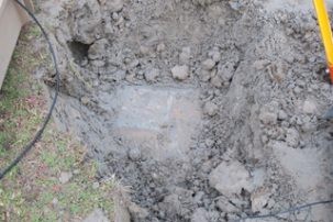
However, some of the local people told us it was still there, just buried. Poking the ground with a piece of rebar and then digging with a kodel (a cross between a shovel and a hoe), we found it! I was amazed, and the brass center point mark was clearly visible. As it was now getting late, we had Mondal, a survey specialist from IWM set up the tripod and tribrach, carefully arranging everything exactly over the mark and skillfully leveled. We carefully installed the GPS and solar panel, built a fence around the equipment and arranged for people to watch that it wasn’t disturbed. Complete success as darkness fell. A great end to our first field day.
