In New Jersey's Ancient Rocks, Hunting for Clues to a 2024 Earthquake
Geologists are combing the New Jersey countryside for signs of earthquakes past and present.
On April 5, 2024, an unusually large earthquake hit under New Jersey’s rural Tewksbury township, sending waves into Philadelphia, the New York metropolitan area and beyond. Within hours, scientists from Columbia University’s Lamont-Doherty Earth Observatory headed to the field to help understand exactly what had just happened. First out was structural geologist Folarin Kolawole, who reached the epicentral area within hours, looking for signs of ground disturbance. A few days later, another team helped lay out a temporary network of seismometers nearby to monitor aftershocks.
At magnitude 4.8, it was the biggest event in the region since a slightly larger quake hint in 1884 under the seabed off Brooklyn. This one originated at a relatively shallow 4.7 kilometers, some 50 miles from Manhattan. If it had happened closer to New York City, it could have killed people and done serious damage. Whether even larger earthquakes are possible is an open question, and the subject of ongoing research.
The quake happened near the Ramapo Fault, an ancient and—many researchers believe—largely inactive structure trending north-northeast about 185 miles through Pennsylvania, New Jersey and New York. Like the many smaller quakes that occasionally shake this area, this one was not on the main Ramapo Fault itself; rather, it seemed to lie along one of countless poorly mapped or entirely unknown secondary faults that branch from it.
The Ramapo Fault hosted numerous stupendous quakes some 200 million years ago, when tectonic forces tore Europe from North America, opening up the Atlantic Ocean. They created a shattered subterranean landscape of smaller radiating faults that even now continue to settle and readjust, producing today’s more modest events. They are like synapses in the brain. When one fires, it communicates with others; stresses released in one spot can push stresses to others. The situation evolves with each quake, but there is no clear road map of where it is headed.
Scientists are trying to clarify the picture. By analyzing aftershocks, seismologists can better understand the mechanisms driving the main event. They can also detect unknown faults and refine maps of known ones. Another major tool in earthquake analysis: examination of rock fractures and other features linked to past earthquakes. These can reveal the orientations of movements, the ages of past quakes and other information potentially useful in modern hazard analysis. Old earthquake fractures, in fact, lie all over this region, but most have yet to be studied closely, if at all.
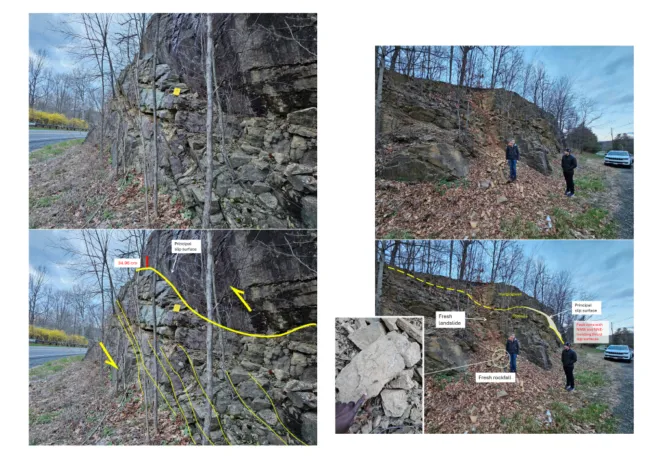
During his initial foray on the day of the quake, Kolawole and companions examined a road cut nearly right at the epicenter. They found a series of old parallel fractures, and very fresh-looking landslide that had cascaded over the rocks, almost certainly related to the quake. While they were were there, they heard what sounded like an explosion. Then the explosion continued and grew louder over 4 or 5 seconds, “like it was coming toward us,” he said. It was a magnitude 3.8 aftershock. “It was terrifying. And I’m supposed to be used to this stuff,” he said.
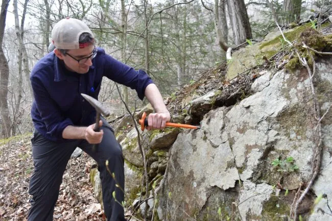
A week after the quake, Kolawole was back near the epicenter with colleagues, looking for fractures old or new. “We don’t want to look at millions of little cracks,” he said. “Are there big, clean, through-going cracks that we can tell were made by earthquakes? Are they systematic or random? Do their orientations align in the same direction or different directions?” Perhaps he would even find a newly minted fracture from last week—this would be pure-gold data.
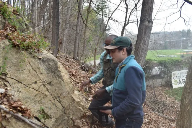
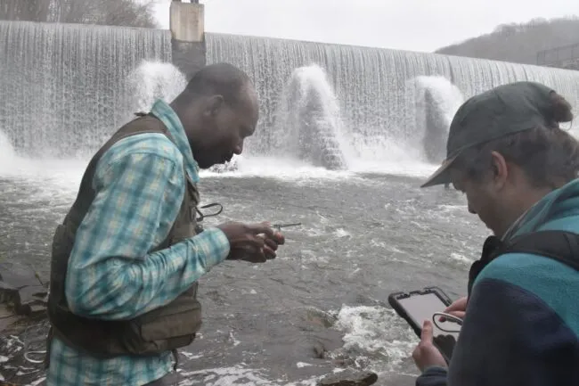
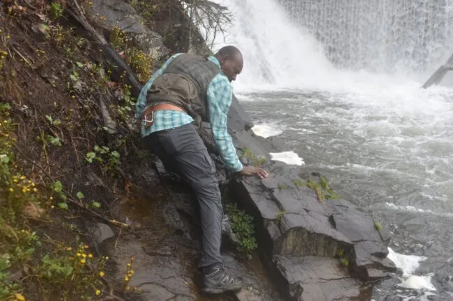
The first stop, planned with the use of geologic maps and other data, was the base of a roaring waterfall over the Lake Solitude Dam along the Raritan River. A steep scramble down a wooded slope took the crew to a patch of exposed granitoid gneiss sticking out of the river bank. It, and the geologists, were bathed in a constant waterfall mist. Kolawole half-waded, half-climbed onto the outcrop, clinging precariously to its slippery surface.
It was honeycombed with old earthquake cracks. Wielding a geologist’s compass over each one, Kolawole hollered out “strike,” “dip” and other information about the fractures to Lamont postdoctoral researcher Zachary Foster-Baril, who was standing by on safer ground with an iPad.
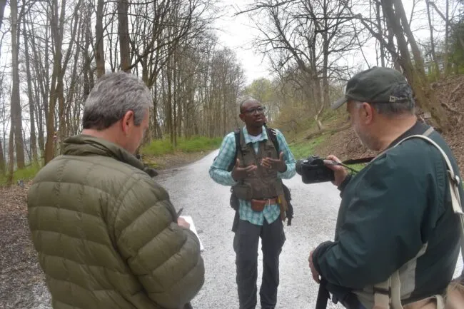
Back up on the street, the crew ran into a local man out for a stroll. He described feeling the quake, then blamed it on fracking in nearby Pennsylvania. “Nothing like it has ever happened in human history,” he proclaimed. The scientists did not try to disabuse him of the notion.
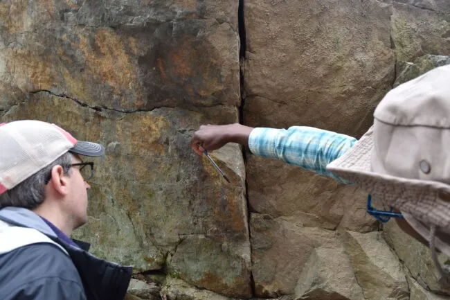
On the way to the next stop, Kolawole suddenly veered into a drive leading to a public baseball field. He had spotted a big gneiss outcrop on a wooded knoll that was not on any geologic map. Kolawole got out and clambered around on it. “Crack, crack, crack,” he called out to Foster-Baril. “This thing is all cracked up.” In one section, he found 12 apparent earthquake fractures, all oriented along the same plane. They could be from 200 million years ago, he said―hard to tell. In one spot, he shone a flashlight on the surface and questioned whether shear through the rock was much fresher, but could not reach a conclusion.
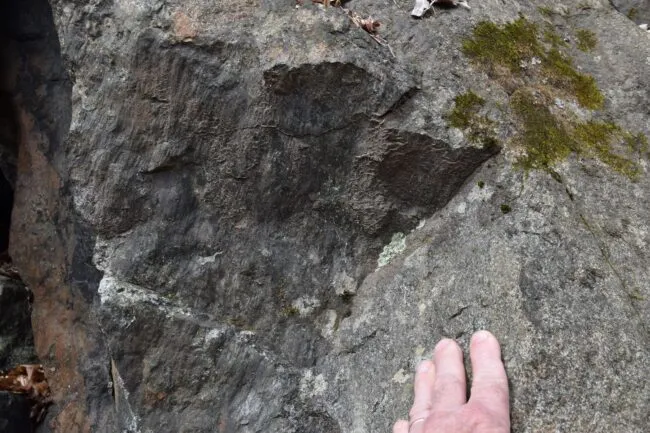
Some more stop-and-go traveling took the crew to Ken Lockwood Gorge, a conservation area where the south branch of the Raritan River runs through gantlets of bedrock. The team got to work recording data on several big rock faces. These too were rife with quake fractures. At several spots, they found rare examples of slickensides―exposed, well-preserved remains of ancient, once-buried faults where one side rubbed against the other, creating a polished surface lined with striations in the direction of movement. These ones aligned north-northeast, the direction of the Ramapo Fault. Even the river itself bears witness to earthquakes; geologists think it may have made its bed by taking advantage of faulting that long ago broke the surface and provided a direction for water to flow.
Toward the end of the day as the team hiked out of the gorge, rain broke out and drenched everyone. No one had spotted a fresh fracture, but Kolawole was not disappointed. He was planning on coming back.
Update: Shaking From April’s New Jersey Quake Went Oddly Far, Raising Questions on Regional Hazard