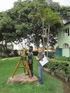
Since our work will focus on detailed mapping and sampling of glacial deposits, we are heavily reliant on high-resolution aerial photographs of the field sites. Therefore, our first port of call this morning was the Instituto Geografico Nacional, a cartographer’s dream where enormous collections of maps and imagery are stored. It’s a spartan building with a distinct military air – a real throwback to more austere times – but the personnel there were very helpful, dutifully returning from store rooms with stacks of black and white photographs for us to peruse. Incidentally, these photos were taken in the 1960s by the United States Air Force and it never ceases to amaze me just how much the has retreated over the past 50 years. Some of the glaciers have vanished.
With that chore done, we’re currently packing (and repacking) our equipment for the next leg of our journey. Tomorrow we fly to Arequipa, Peru’s second city, located at 2300 m at the foot of the famous Volcan Misti. There we’ll meet up with Matt, who’s on his way from Tacoma as I write. Though we’ve been here only a few hours, it’ll be great to leave the coastal smog for the blue skies of the Andes.
Gordon

