High in a Cloud Forest, Tapping Into the Breathing of a Volcanic Beast
On Costa Rica's active Poás volcano, scientists install geophysical instruments that can monitor the underground in real time.
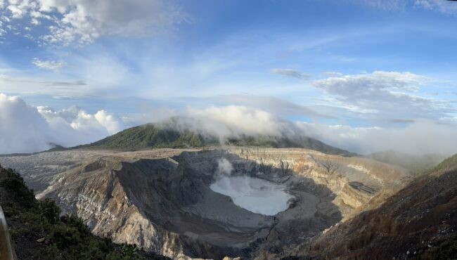
As one of the world’s few drive-in volcanoes, Costa Rica’s Poás is a huge tourist attraction. An hour or so from the capital city of San José, surrounded by picturesque mountain roads, the center of the volcano is nestled amid cloud forest. From a futuristic-looking national park service visitor center, it’s a short walk to a viewing platform overlooking a yawning, mile-wide crater. Far below, a strangely colored lake burbles sulfurous liquid and poisonous gases—perfect for taking what looks like a selfie in hell, without the inconvenience of actually going there.
Poás is also a huge menace. The crater has erupted about 40 times in the last 200 years. Its 9,000-foot-high edifice, covering some 150 square miles, has grown over hundreds of thousands of years through uncountable layers of lava flows, ash deposits, blasted-out boulders and mudslides. Woe to the surrounding region should Poás stop its current snoring and grunting and really wake up.
Worldwide, some 800 million people live within striking range of an active volcano. Poás is one of a half dozen in Costa Rica that have erupted in modern times; an equal number are classed as dormant, meaning slumbering, but still alive.
Many volcanoes signal a coming eruption with small earthquakes, increased gas emissions and tiny ground movements that may go unnoticed by locals. Scientists have developed instruments to spot these often subtle phenomena, but no foolproof ways to forecast whether an eruption will come, or when. Moreover, many volcanoes lie in remote areas and within poor countries, where scientific resources are scarce.
A team from Columbia University’s Lamont-Doherty Earth Observatory is working to advance forecasting techniques and extend access to the necessary tools to monitor active volcanoes. The central idea: a consistent set of instruments that can be assembled cheaply, deployed anywhere and monitored remotely in real time, using recent advances in satellite communications.
There are many varieties of volcanoes. “Only a handful are adequately monitored,” said Lamont volcanologist Einat Lev. If more were wired up, she said, “it may change our understanding of how to read the warning signs.” As a test case, in 2021, the scientists installed instruments on two highly active volcanoes in Alaska’s Aleutian Islands.
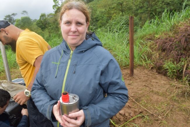
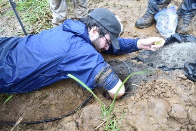
The team’s new target: Poás. The researchers recently worked with scientists and technicians from OVSICORI, Costa Rica’s volcanological and seismological observatory, to supplement the country’s existing instrument network. The expedition took them from out-of-the-way spots on the volcano’s verdant flanks to the harsh and dangerous inner rim of the crater itself.
Poás is thought to have blasted out the crater less than 5,000 years ago. Deposits visibly layered along its upper rim tell of more explosions over the last 1,000 years, before historical observations began in 1828. At least two people went missing during a 1953-56 eruptive series. In 2009, a magnitude 6.1 earthquake, apparently connected to the volcano’s plumbing, wiped out the mountainside village of Cinchona, killing dozens and wrecking bridges and roads.
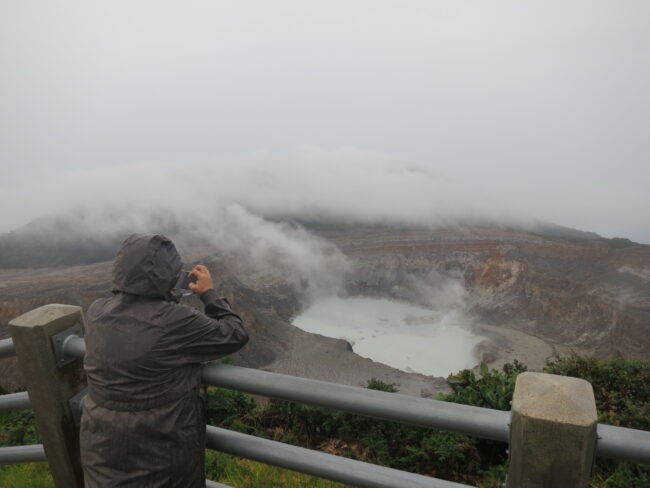
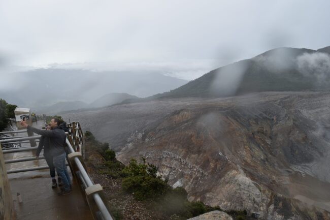
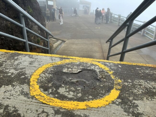
In April 2017, a series of eruptions sent columns of ash and poisonous gases two miles into the air, then down onto nearby towns. Incandescent rocks weighing up to several tons each rained around the crater rim, including onto the viewing platform, where impact marks remain today. Luckily, authorities had detected increased gas emissions and a smaller explosion a few days prior and evacuated the area. The park has since reopened, with the addition of concrete bomb shelters and a siren in case gas levels suddenly rise.
Prior to the recent expedition, OVSICORI seismologist Henriette Bakkar Hindeleh had driven around the volcano’s flanks looking for landowners willing to host a broadband seismometer. Alonso Gazo, an adventure-tour operator and owner of a former pig farm, volunteered.
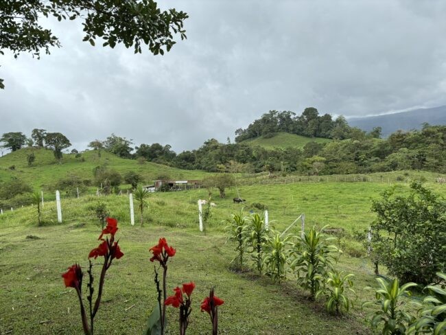
Reached by twisty, narrow roads, the farm sat in a rolling valley on the volcano’s northeast side. It being rainy season, bouts of cloud and fog alternated with downpours. OVSICORI already had a seismometer on the southern flank, nearer to San José (population 1.5 million), which could be affected by a major eruption. This new seismometer, and another to be planted a few days later, were designed to triangulate the sources of small volcano-related earthquakes over wide areas.
While there are many varieties of volcanoes, they all produce earthquakes of various kinds. Some five miles or less below the Earth’s surface is a boundary where relatively warm, pliable rock meets the hard, brittle rock of the upper crust. If rising magma breaches that line, it may produce high-frequency tremors—an early warning. If it rises further, the tremors will increase and change frequency—at a certain point, a possible cause for concern, when combined with other geophysical data.
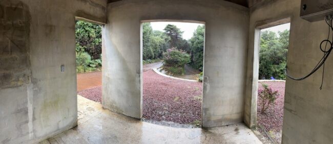
The team walked around the farm with Gazo, looking for a good place to put the seismometer and related equipment. Eventually, they settled on a plot of relatively level pasture just uphill of a horse barn.
Installing geophysical instruments generally involves digging lots of holes, and this expedition was no exception. The team set off into the loose volcanic soil with shovels and a post-hole digger. There was one hole to bury the seismometer, another for a metal post to hold a data transmitter, control box, solar panel and battery. Others were for a barbed-wire fence to keep out errant livestock. All this digging amid the off-and-on rain created a muddy mess.
As rain spattered down. Lamont postdoctoral researcher Conor Bacon worked underneath a newly erected solar panel to protect his open laptop, then wallowed in the mud to level and orient the seismometer in its hole. After it was wired to a transmission cable, the team tested it out by jumping on the ground to see if an attached digital needle would move. Success. An antenna above the solar panel would transmit any tremor signals to the local cell network. Mission accomplished, the team buried the instrument and drove back to a motel to dry off.
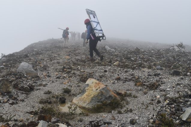
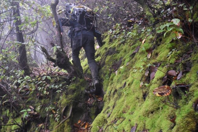
The next couple of days were spent at the business end of Poás. Starting near the viewing platform, a crew of about 15 people filed down a steep, overgrown trail into the lower part of the crater, wearing hard hats to protect against flying rocks and carrying respirators to wear in case of a burst of poisonous gases. The leaders carried a machete and a small chainsaw to hack through vines and trees; others lugged 60- to 70-pound loads of solar panels, steel rods, batteries, tools and geophysical instruments. Here, at higher elevation than the previous day’s work, the weather was much worse. Occasional whiffs of fire wafted up from below.
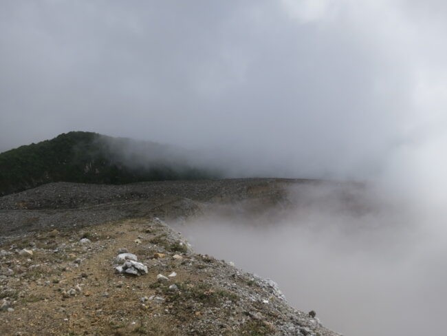
Eventually the vegetation thinned, then disappeared, as the trail bottomed out at a shelf of ash and rocks teetering over the crater lake. Swept clean by periodic eruptions and frequently washed with unfriendly gases, the shelf was barren except for a few low bushes. A hard, cold wind blew. The lake itself, below a forbidding vertical drop-off, was covered in mist.
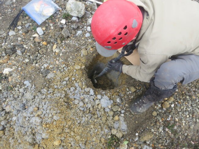
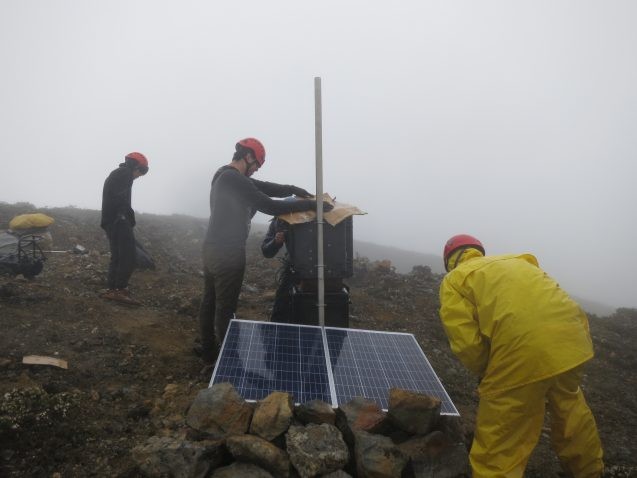
The team trudged along the crater edge, passing kitchen-table sized boulders thrown out in the 2017 eruption. After 20 minutes or so, they divided up to work at two sites. Bacon and Maarten de Moor, an OVSICORI volcanologist, led the effort at one. The process was the same as on the previous day, minus the fence; very little danger of living creatures wandering around here.
Along with a seismometer, they planted a gas sensor in the ground. Volcanoes commonly emit carbon dioxide and sulfur dioxide; increases in either, or a change in their ratio, could signal impending activity. Bacon later installed a magnetometer, designed to detect changes in magnetic field, which may shift with magma movement—a somewhat still-experimental technique pioneered by Japan, which has one of the world’s most advanced volcano programs.
Several team members drilled a hole in one particularly huge erupted boulder in order to anchor a GNSS instrument (similar to GPS), capable of detecting subtle changes in ground elevation or horizontal dimension, another sign of rising magma.
As the team worked, a hard rain set in—big, heavy, cold drops. The wind picked up, driving the rain sideways. Most team members were wearing heavy rain gear, but everyone was soon soaked and cold. This went on for quite a while, then stopped. Then it started again, and kept up. After a while, several people who had neglected to dress adequately started shaking with the beginnings of hypothermia.
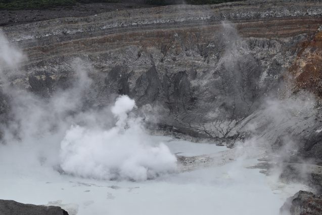
During a lull in the rain, the wind suddenly swept the mist out of the crater, revealing the lake. It was threateningly close. On its grayish surface, a geyser-like fountain was intermittently vomiting thick, yellowish material into the air. Steam puffed from the naked cliffs at the lake’s edge.
In the afternoon, the team climbed back up the trail. Then, the next day, they descended again to complete the installations. As Lev ascended back up in the afternoon, the mist cleared briefly, and she stopped with her cell phone to make a selfie video with the lake in the background. At that moment, there was a phreatic eruption—an explosion of steam, induced by the meeting of groundwater with magma somewhere below. With a huge whoosh, a whitish cloud shot out of the lake and hovered, before rising and dispersing high in the air. Lev did not miss a beat; she just kept talking to the camera.
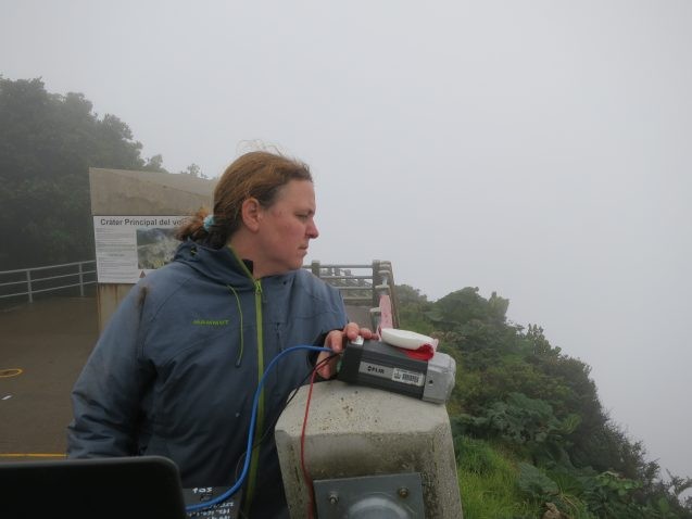
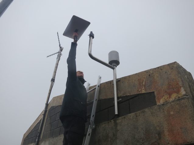
Back at the viewing platform, engineers John Bolaños of OVSICORI and Lamont’s Nicholas Frearson were balancing precariously on the roof of a concrete bomb shelter. Here, they rigged an antenna and other equipment to receive radio signals from the instruments down in the crater, and a dish to pass them by satellite to the internet.
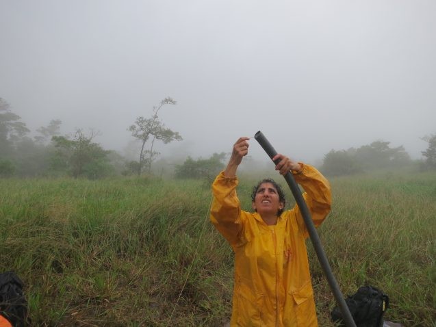
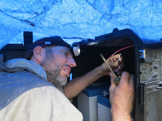
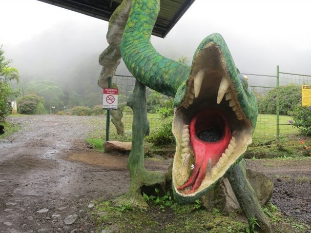
The last day of the expedition was at the base of the volcano, far from the crater. Here, OVSICORI’s Bakkar Hindeleh had somehow convinced the management of an amusement park called Dino Land to host an instrument station. As the name implies, the largely wooded Dino Land features life-sized reproductions of Brachiosaurus, Velociraptor and other actual or imaginary creatures of the past. Many are rigged with machinery to make them snap, lunge, bellow, grunt or roar. At the park’s restaurant, kids can order chicken tenders that come in a Brontosaurus-shaped basket.
The instrument site was in a pasture up above the dinosaurs, whose guttural sounds provided a soundtrack for the work. As usual, it was raining and misty. A park employee obligingly hauled the team’s equipment with an all-terrain vehicle.
The digging here was hard; loose soil was heavily interspersed with solid volcanic rocks that had to be fragmented with a heavy iron bar before being hauled out in pieces. They must have been thrown or flowed here—a reminder of the volcano’s violent power even far from its center.
Along with a seismometer, Bacon gently placed a magnetometer into a separate hole, tucking it into the soil like a baby. The park employee took off, then returned with a pile of freshly cut saplings. Soon, he was expertly setting up a fence to ward off nearby cows.
Once everything was set, one of the scientists handed him a small pile of Costa Rican colones, and everyone shook hands all around. From down below, the sounds of prehistoric monsters continued to waft up the hill.
