With Drones, Geophysics and ArtificiaI Intelligence, Researchers Prepare to Do Battle Against Land Mines
Finding land mines the old-fashioned way—on foot, with a metal detector—is agonizingly slow and dangerous. Scientists are working to make the process faster and safer.
When Jasper Baur was a freshman at New York’s Binghamton University, his interests centered on earth sciences. Then he got involved in a seemingly unrelated pursuit: harnessing drone-mounted geophysical instruments to aid in the slow, dangerous work of detecting land mines.
Baur, now a PhD. student at Columbia University’s Lamont-Doherty Earth Observatory, is now combining graduate studies in volcanology with developing new demining technologies. “Volcanoes and mines are both explosive hazards,” he said. “We use a lot of the same instruments and data analysis techniques to study them. If you want to protect people, you have to understand the earth, and how these hazards fit in.”
164 countries have signed a 1997 treaty banning the use, stockpiling, production or transfer of antipersonnel mines (though not anti-vehicle mines), but its effects have been quite limited; many war-torn countries along with major powers including the United States, Russia, China and India have declined.
The results are clear: some 100 million mines and other pieces of unexploded ordnance (UXO) such as dud artillery shells lurk in nearly 80 countries. According to the UN, they kill or maim as many as 15,000 people every year; about 80 percent are civilians, many of them children. They keep large swaths of land useless for travel, agriculture, construction or anything else. Mines and UXO from World War II and even World War I keep turning up, along with stuff from recent or ongoing wars in Afghanistan, Angola, Azerbaijan, Cambodia, Chad, Iraq, Nigeria, Libya, Myanmar and Kosovo. In Syria alone, mines and UXO have killed nearly 5,000 civilians in the last dozen years including about 1,400 children, and these are probably vast underestimates.
Then there is the newly crowned most mined country in the world: Ukraine. Baur has visited twice since the beginning of the war. Mines, booby traps and assorted UXO are believed to now litter a third of the nation, or some 70,000 square miles—the size of the U.S. state of North Dakota. More are being laid daily on the active eastern and southern battlefronts. The World Bank estimates that if the war ended tomorrow and massive aid flooded in, it could take upward of $37 billion to clear all the dangers. Some experts say that at the current rate of clearance, it would take the approximately 500 demining teams now working there about 750 years to finish the job.
Demining technology has changed little since the 1930s: People walk around with metal detectors, then dig up whatever they find—agonizingly time consuming, expensive and treacherous. A team of mine technicians, or sappers, can clear maybe 150 square meters in a good day, at a cost of $300 to $1,000 for each mine removed, depending on the terrain and density of mines. Most of the day is consumed with digging up harmless junk such as nails, shrapnel and bullet casings. When there is an actual mine, sometimes it is booby trapped to set off a second one if someone tampers with it. The UN estimates that for every 5,000 mines removed, three workers are wounded or killed.
In war, armies often use brute force to clear narrow paths for their forces to pass through minefields, including specialized bulldozers and missile-launched lines of explosives. But once a conflict is over, it is generally up to humanitarian agencies to clear the much larger remaining areas. Civilian researchers have recently been looking into using geophysical instruments already employed in fields like mineral exploration, volcanology and archaeology for finding mines. These include ground-penetrating radar, magnetometers and infrared imaging. But so far, these technologies have not been generally adopted. “The demining community is very conservative about adapting new ideas, and for good reason,” notes Baur.
The recent availability of cheap drones and miniaturization of instruments to sizes where they can be carried aloft, and, now, advances in artificial intelligence could bring bring drone-borne geophysics to the fore. This is where Baur and his colleagues are coming in.
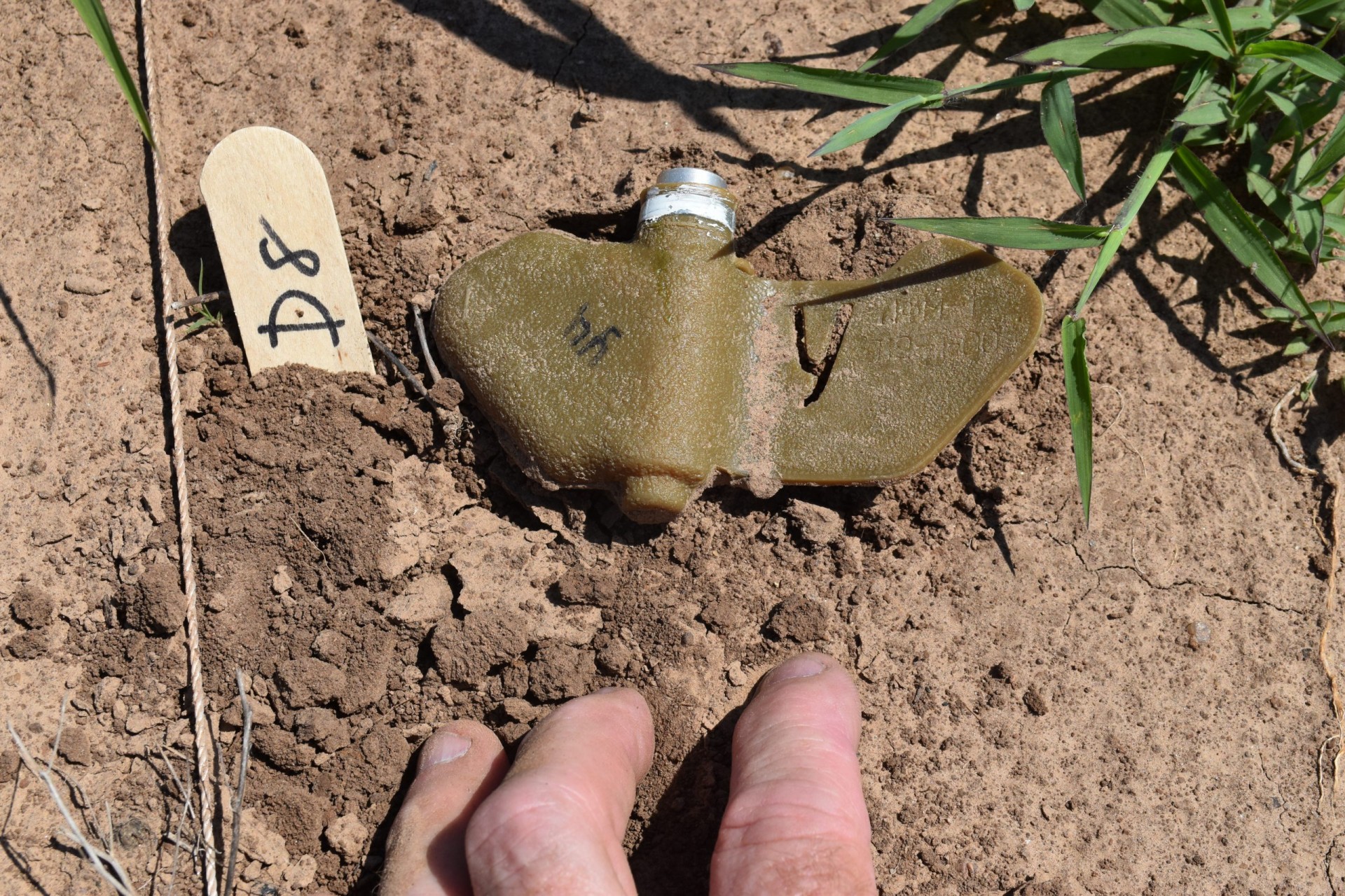
Baur started working in 2016 as a student with University of Binghamton geophysicists Alex Nikulin and Timothy de Smet, early pioneers in the field. They first focused on probably the world’s most common mine: the Russian-made PFM-1 antipersonnel device, a small, butterfly-shaped thing made largely of hard-to-detect plastic. Designed to be dropped from the air in batches of hundreds, they flutter to the ground like flocks of birds, then await the unwary. Designed mainly to maim, not kill, it takes only 11 pounds of pressure to set one off; they have been nicknamed “toy mines,” because children often pick them up. Afghanistan has countless ones left over from the Russian invasion of the 1980s. Now, the Russians are planting them in Ukraine, along with a dozen other kinds of devices aimed at both people and vehicles.
Working with disarmed PFM-1s bought from military collectible dealers, the Binghamton team found a fruitful avenue in airborne thermal imaging, because in early morning and day’s end, the mines heat and cool at different rates than surrounding soil and vegetation. In experiments, the instruments spotted three quarters of the mines this way; so did instruments using combined visible and infrared light spectra.
But analyzing the imagery with the human eye took time, so the team started teaching computers to do it; this greatly speeded things, and upped the detection rate to 90 percent. They have now shown that a drone flying at 10 meters over the surface can survey 300 square meters in three and half minutes; data analysis comes shortly afterward. But this is for only one kind of mine, and 90 percent is not good enough. At this point, the technology could be useful mainly for delineating the boundaries of minefields and locating most of their contents so that sappers can more easily go in and finish the job, says Baur.
Baur and his former fellow student Gabriel Steinberg have since founded the nonprofit Demining Research Community, and have been consulting with much larger demining organizations including the Geneva International Centre for Humanitarian Demining, the HALO Trust and the United Nations, which has multiple demining agencies.
This March, they carried out their latest research project, planting 143 assorted disarmed devices in a range run by Oklahoma State University’s Center for Fire and Explosives, Forensic Investigation, Training and Research. Laid out in a plowed field covering less than an acre, they buried some, while leaving others on the surface. Then they waited a few months for the objects to settle in, weather and become less obvious, as they would in real life. In June, they invited colleagues from Binghamton, the University of Maryland and Oklahoma State for a kind demining festival, where everyone could test out their own technologies for picking out explosive devices.
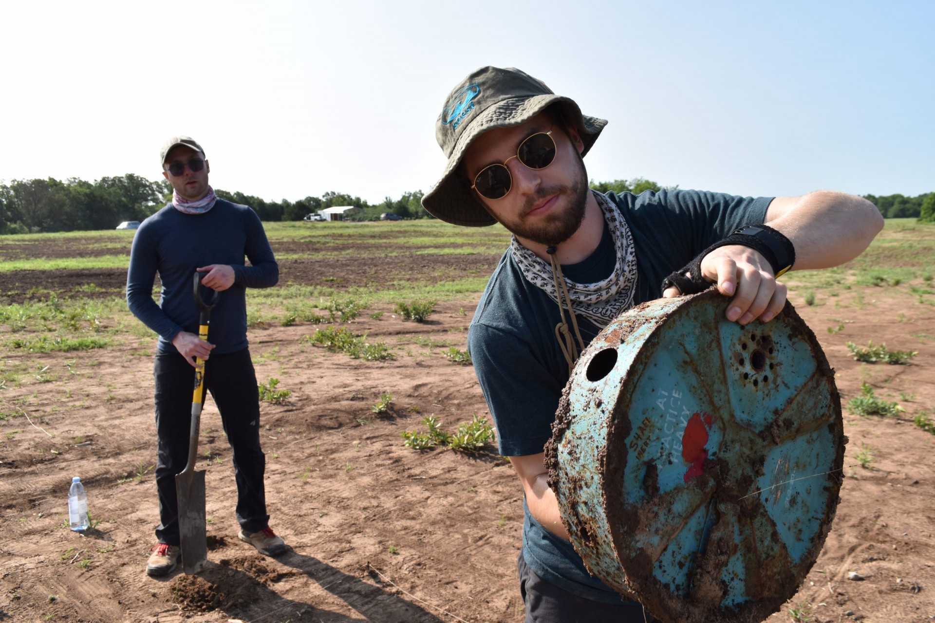
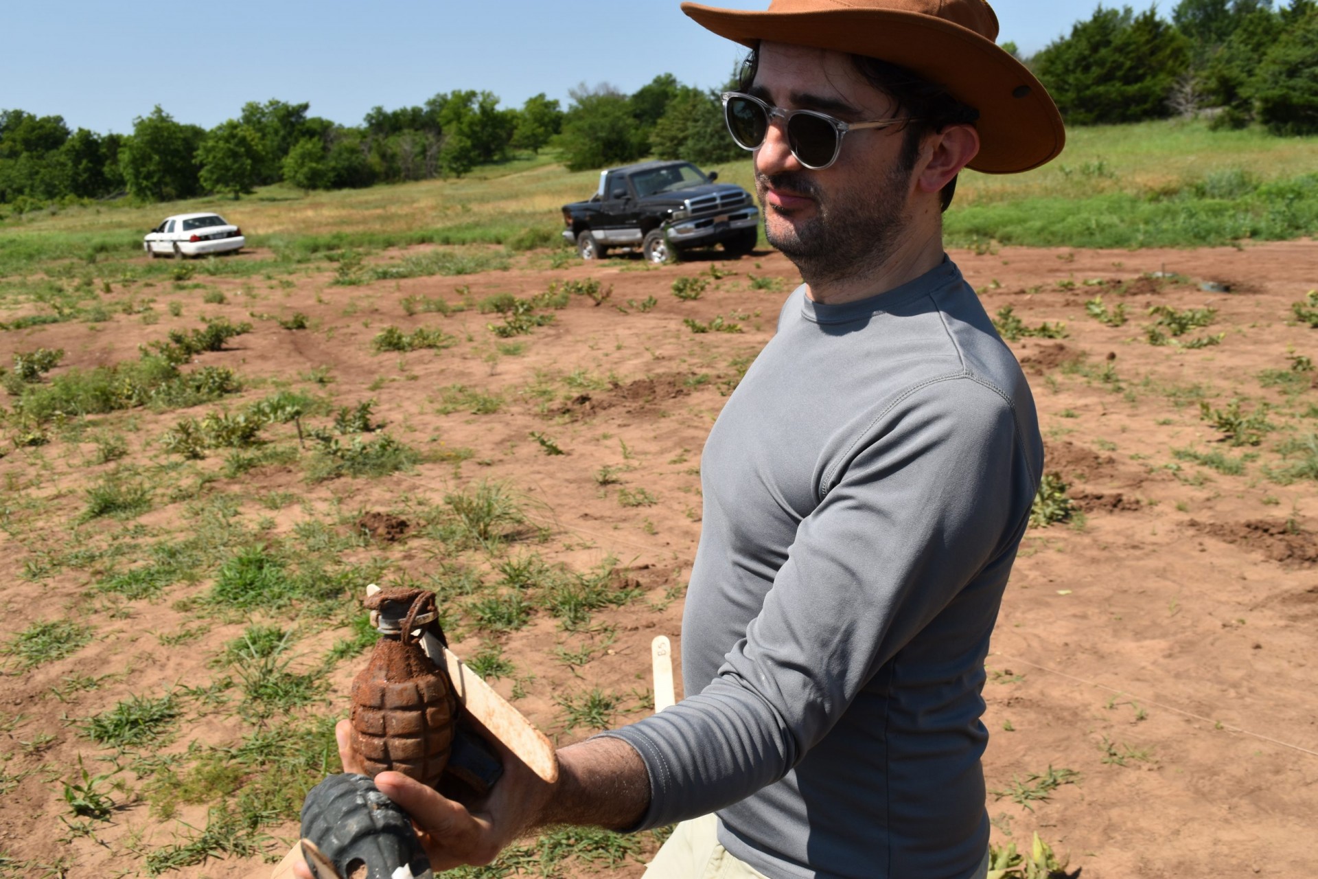
The range, outside the little town of Pawnee, is reached by a series of long dirt roads running through deserted pastures and woodlands. We were greeted at the gate by manager Billy Magalassi, a retired U.S. Bureau of Alcohol Tobacco, Firearms and Explosives agent. A short drive on we reached the now partially revegetated field and its diverse crop: hand grenades, anti-tank mines, rockets, cluster bombs, antiaircraft rounds, pipe bombs, mortar shells and anti-personnel mines, along with decoy objects that could be mistaken for munitions, like chunks of shrapnel and a cell phone.
Under a fierce morning sun, work had already begun. Ved Lekic, a geophysicist from U of Maryland and his students were taking turns wheeling a lawnmower-like contraption equipped with ground-penetrating radar over the grid. Another group led by Heidi Meyers of Maryland was pushing what looked like a giant food-service cart with antennae; it contained magnetic sensors, infrared imagers and LiDar, the latter for detecting subtle variations in surface elevation that might signal a buried mine. Such instruments could be one day mounted on drones, but they would have to be made much smaller.
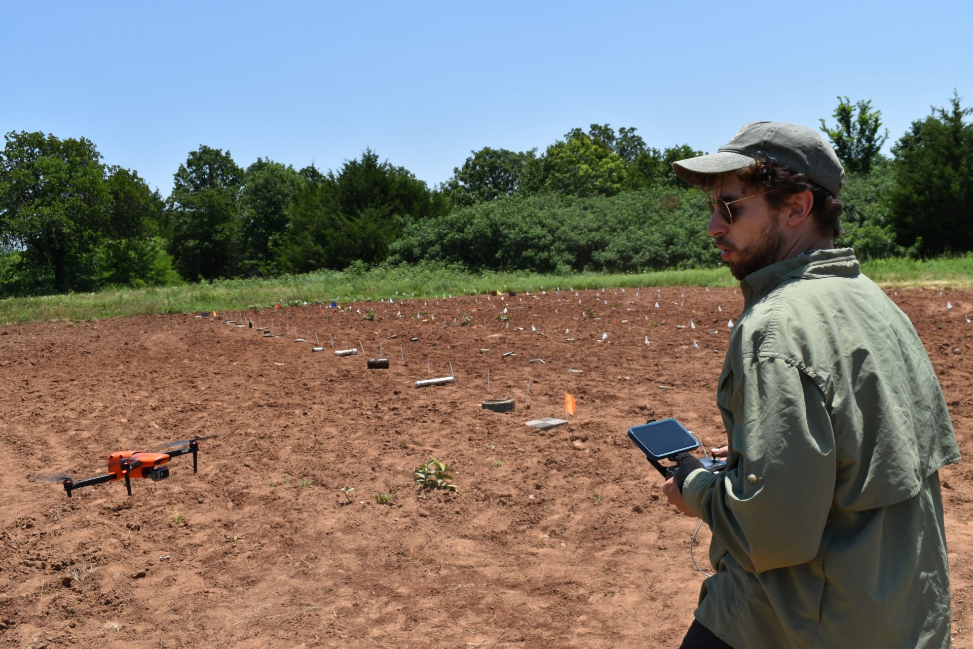
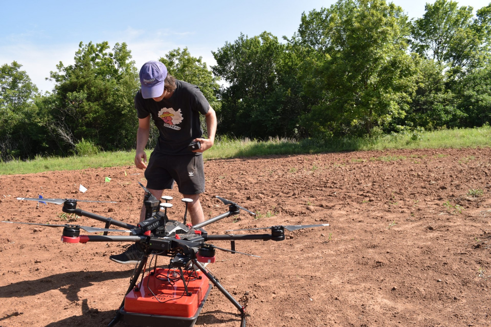
Baur had a small commercial drone equipped with a thermal sensor, whose images he could see in real time on a little screen as he flew it. There was also an instrument that produced 3D imagery from combined infrared and visible light. He flew it a few courses over the field at about 20 meters off the ground. Later, Baur helped navigate a much larger drone weighted down with ground-penetrating radar a meter off the surface—an initial attempt to get such instruments airborne.
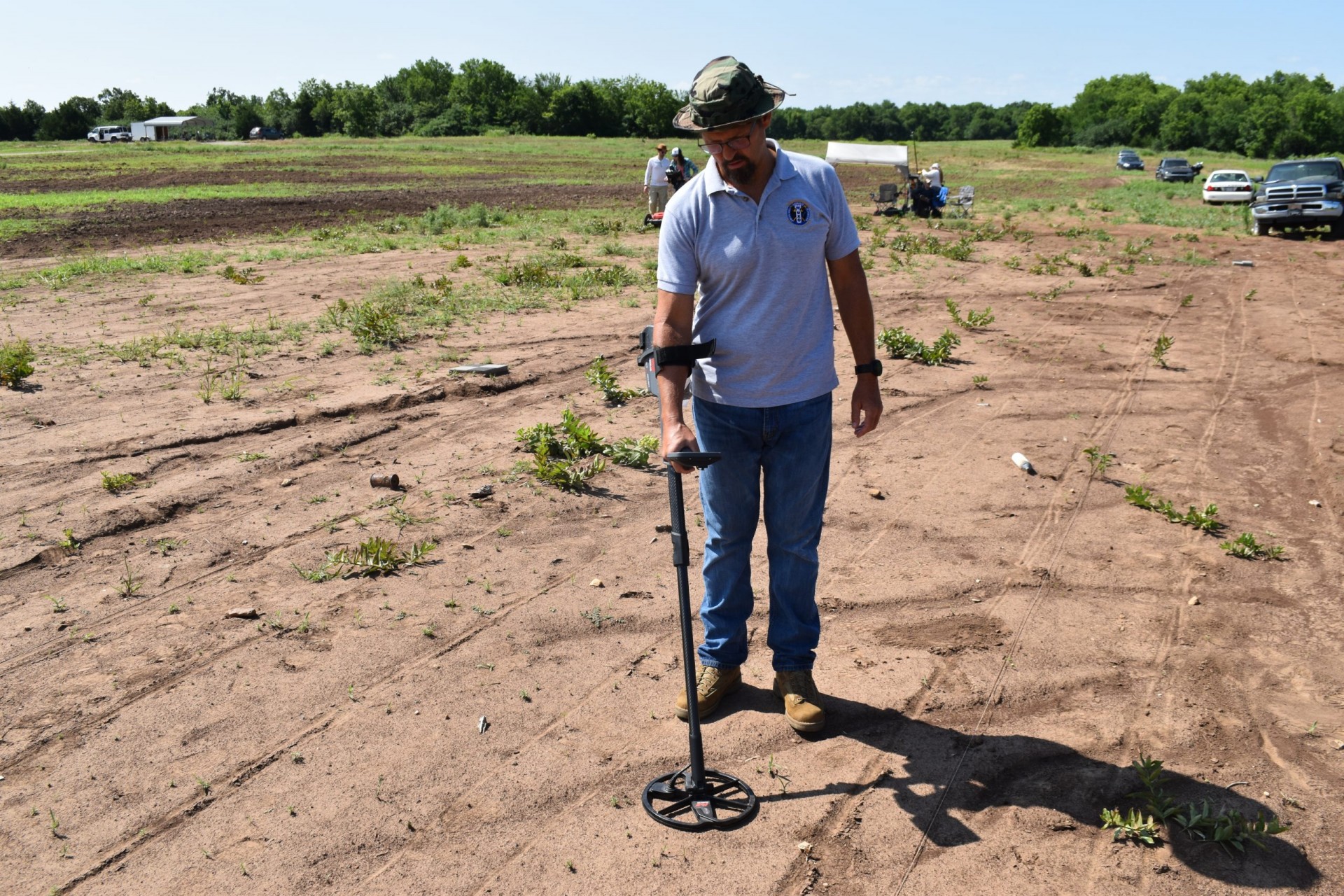
Also working the plot was Tony Brinkley, a 25-year U.S. Navy demining expert. He was now pursuing a Ph.D. in explosives forensics at Oklahoma State. Brinkley has worked “unfortunately, in all the bad spots on the globe,” he said—Iraq, the Philippines, Cambodia, Ukraine. Even on the Pacific island of Guam, where he was mainly based, his team had found leftover World War II explosives pretty much every day. “People in this field don’t have to worry about being unemployed,” he observed.
Brinkley’s main job today was using a standard metal detector to see how it stacked up against the new-fangled instruments. Every time he came to something, it emitted a high crackle, and sometimes a screaming, siren-like alarm, depending on how he moved and angled it, and the size and shape of the object.
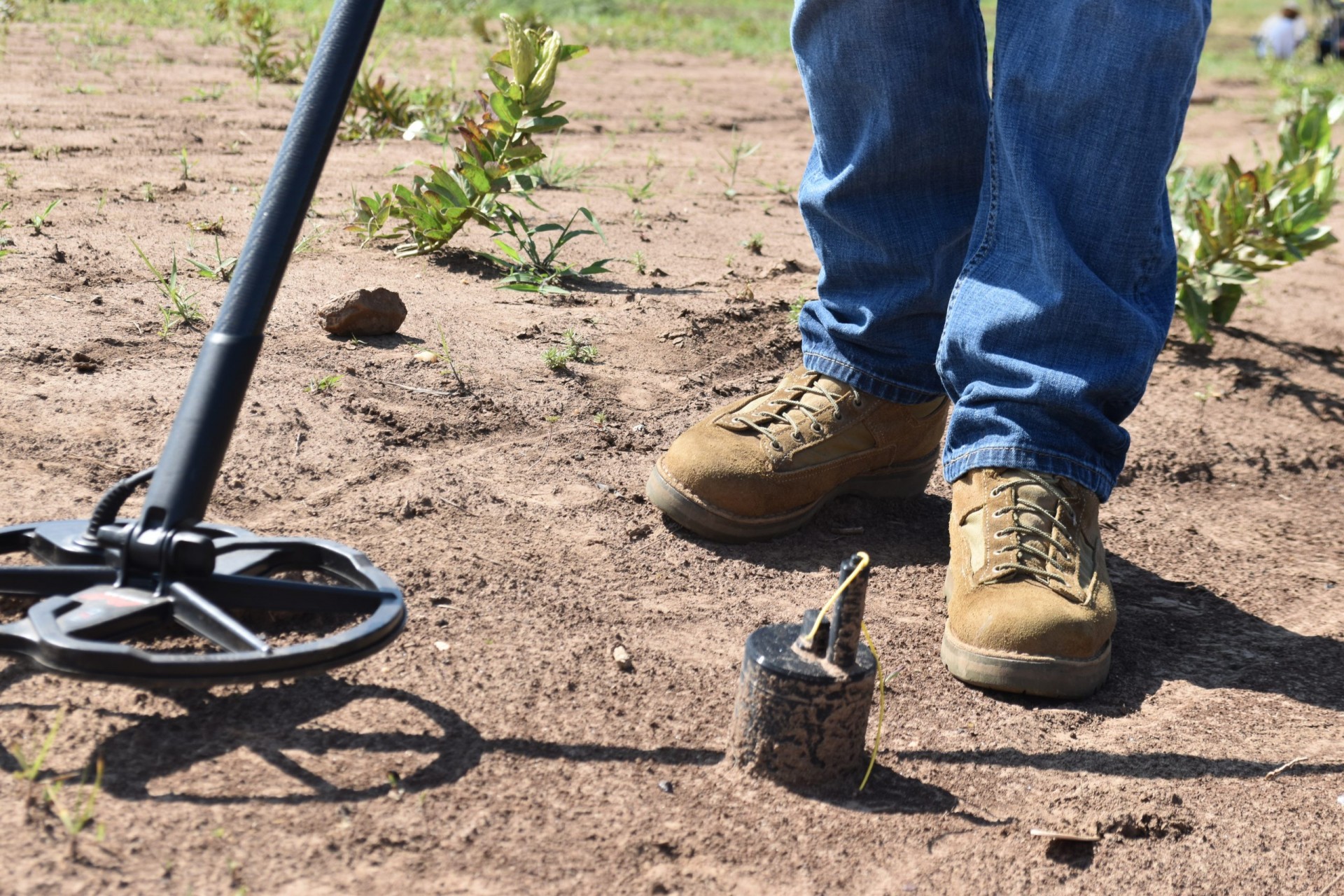
Here on the surface was a Russian OZM anti-personnel mine, black, about the size and shape of an oversize soup can. A bit of yellow plastic line was attached to the top. “Hate these,” he said. “Seen a lot of them in Ukraine.” The yellow line usually extends out to form a trip wire, so you don’t need to step directly on it.
Over in another row was a small, cylindrical M42 submunition, part of a cluster bomb. One artillery shell or rocket can deliver dozens to hundreds of these bomblets, exploding above the ground and scattering them over a wide area. But many of the submunitions don’t go off as planned and remain on the ground, ready to explode at the slightest jostle, just like land mines. For this reason, 123 countries signed a 2008 international convention to ban cluster bombs. Exceptions: the United States, Ukraine and Russia. This model is made in the United States, and has a failure rate of as much as 14 percent—and in the July the United States started shipping artillery shells equipped with them to the Ukrainian military, despite widespread international protest.
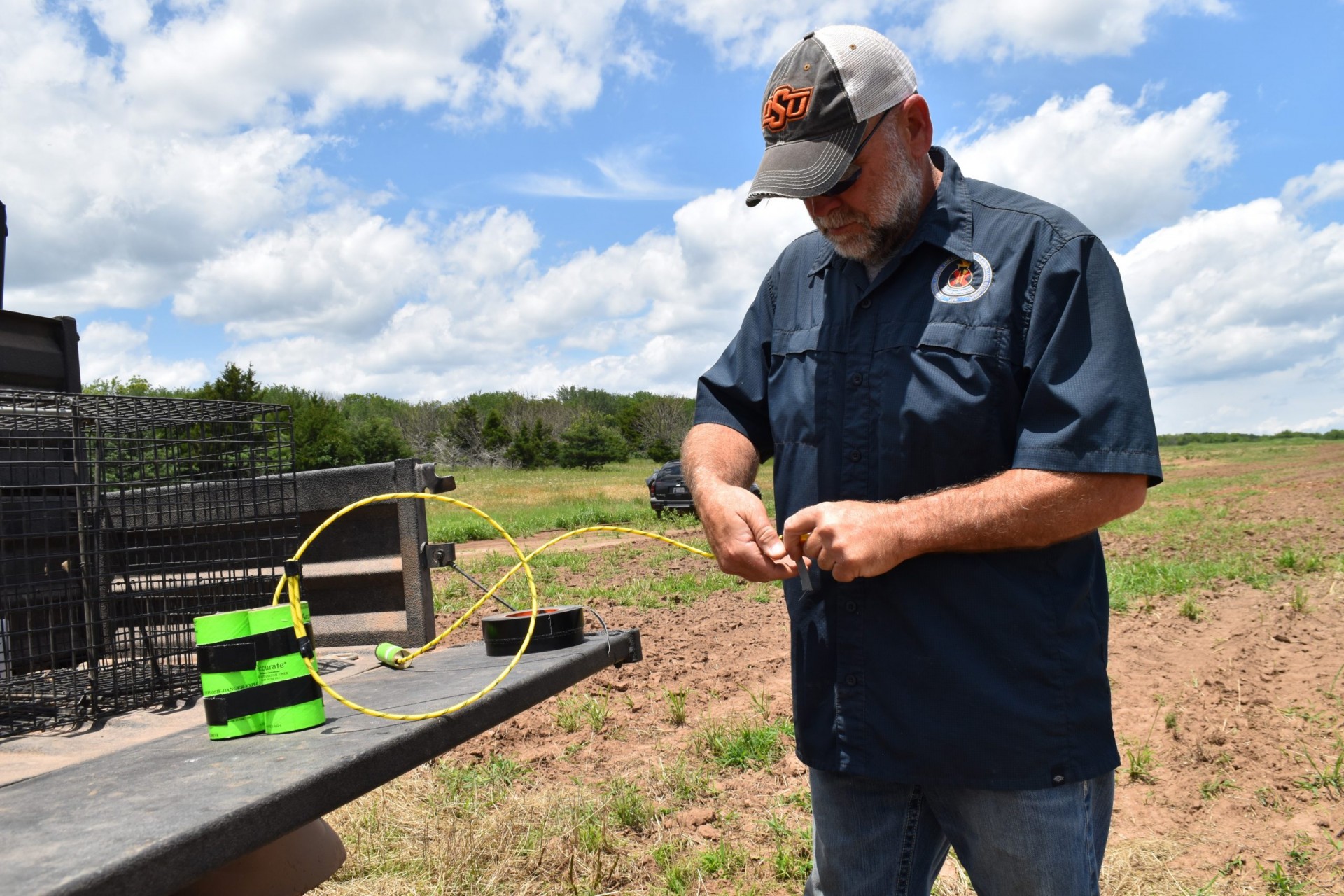
Range manager Billy Magalassi, despite his long career in dealing with explosives—he has 80 percent hearing loss, he said—was easily persuaded to demonstrate what the real versions of some of these devices could do. To simulate an anti-personnel mine, he buried a stick of TNT (the explosive of choice in most mines) rigged to a radio transmitter, near a junked care. Near another car, he taped several TNT sticks weighing a total of about three and half pounds of TNT imitate an anti-tank mine.
With everyone off a safe distance and wearing earplugs, he counted down and yelled “Fire in the hole!” The faux anti-personnel device went off with a sickening bang, throwing dirt a dozen feet in the air; it was easy to imagine what it might do to a human body. When the anti-tank demo went off, it produced a visible fireball, throwing debris over a much wider area.
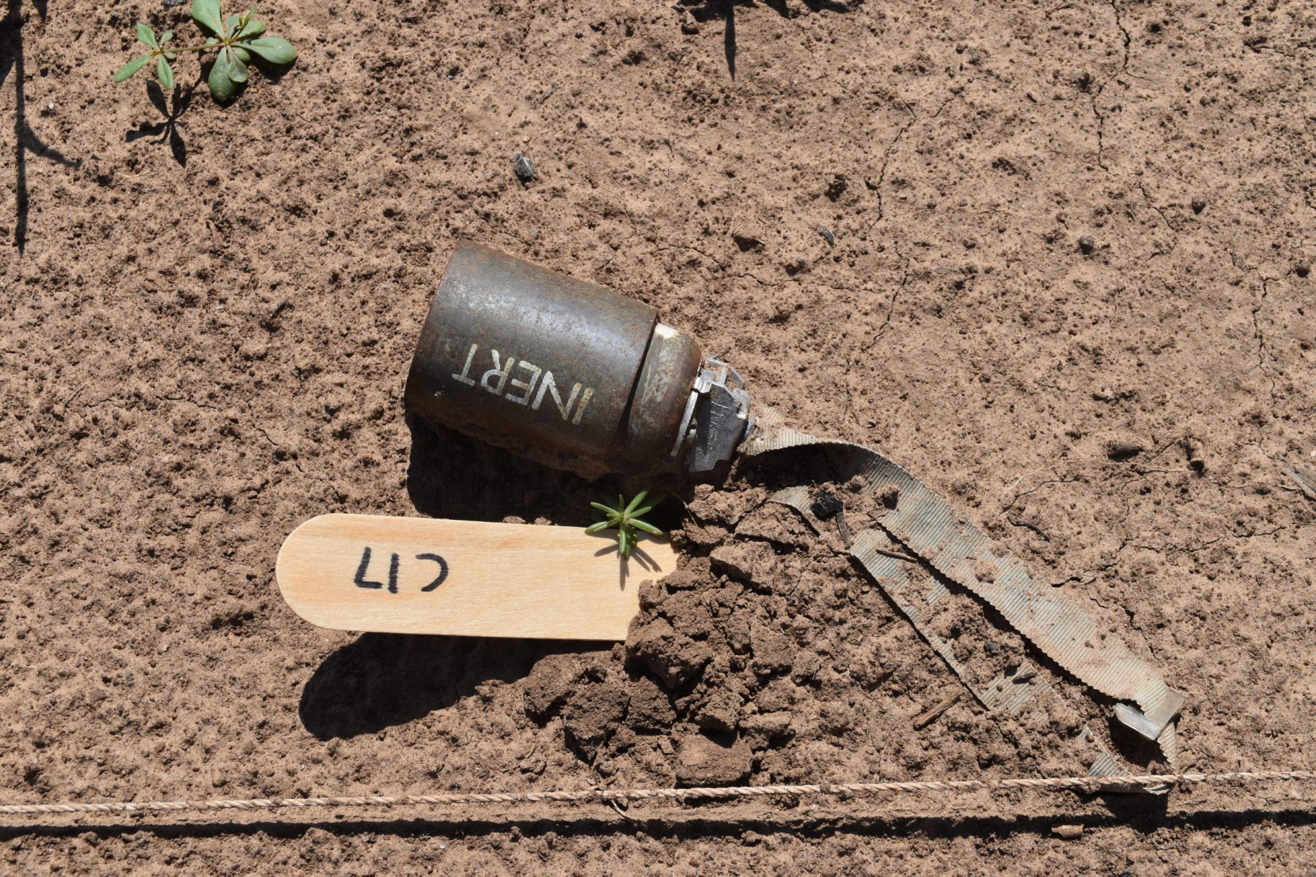
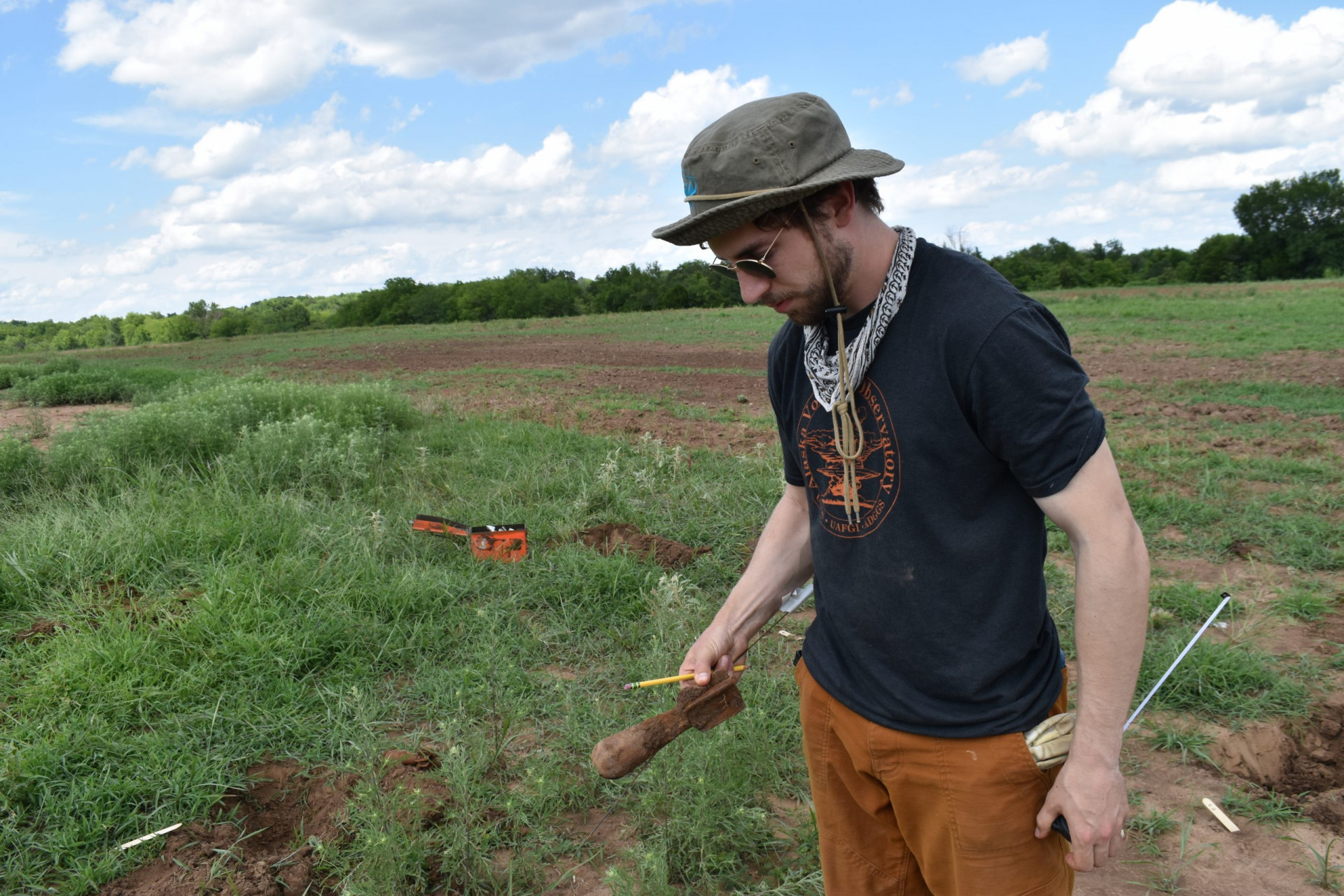
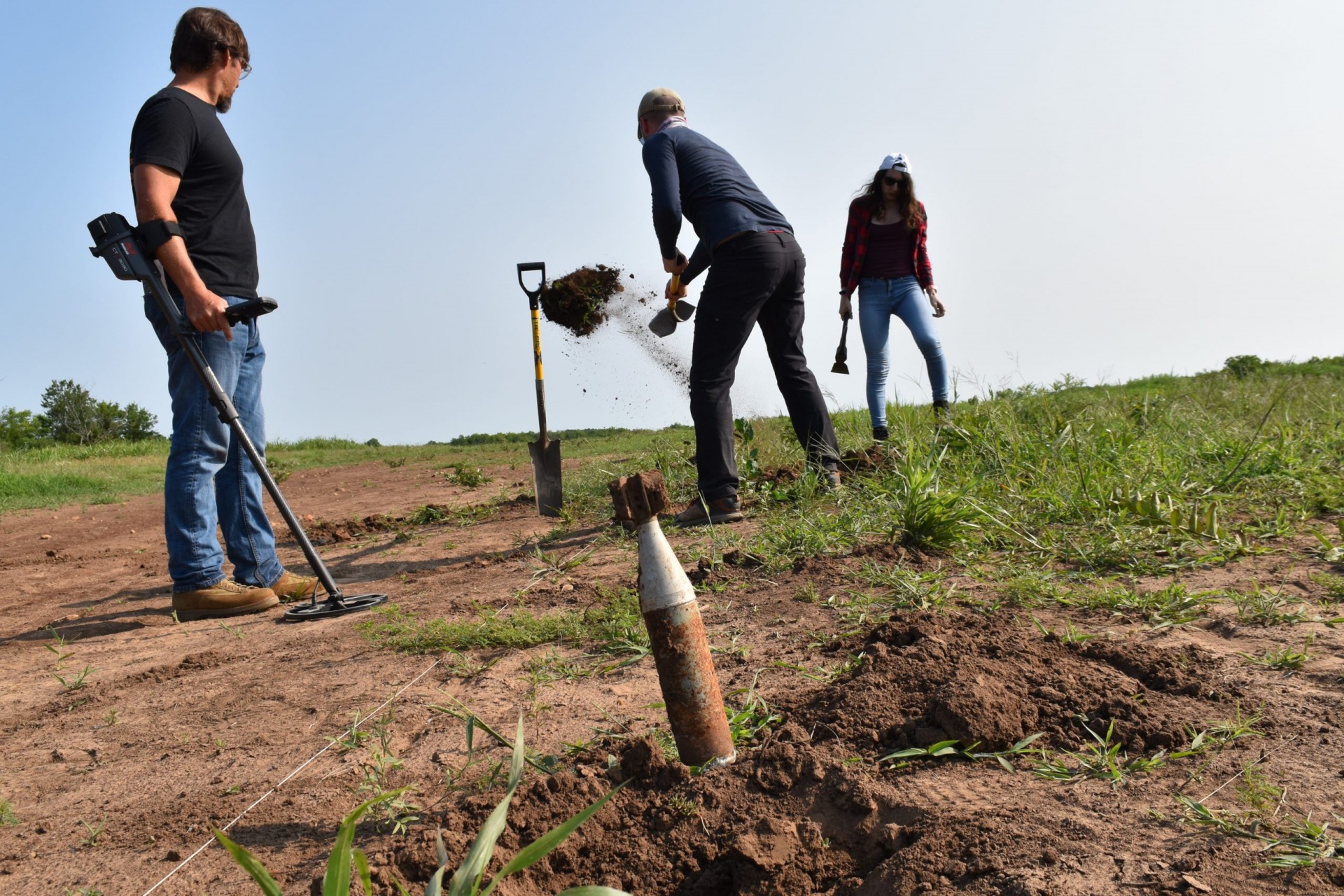
The rest of the day was spent retrieving the mines and other devices for relocation to another, more permanent research plot a few hundred yards away. The surface objects were easy to collect, but the buried ones required a pick and spade, and often were hard to pinpoint closely enough to dig up, even though each was marked with a little popsicle-type wooden stake. In many cases, the researchers had to call in Brinkley with his metal detector to find exactly where to dig.
“It makes a really good demonstration why handheld instruments are still the gold standard, and how far we have to go with the other stuff,” said Baur. But he is optimistic. He and his colleagues are continually refining the artificial intelligence algorithms to spot mines, and they are getting better. Another innovation Baur has in the works: a drone device that will drop little marker flags on any mine detected, in order to aid ground crews in real time.
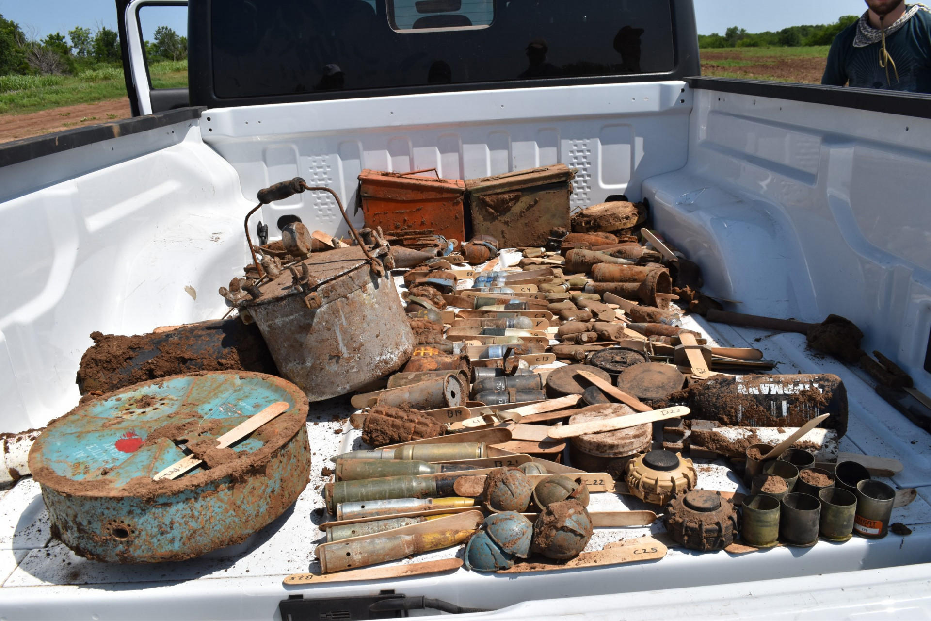
The following day, the crew finished digging up the buried devices, then sorted everything into the bed of a white pickup truck. Baur drove the truck over the bumpy field to the new site. Here the crew spread out everything in the exact same order and spacing as in the first field and reburied things. Any researchers after this could come by and test out new instruments or other technologies.
A few days after wrapping up, Baur and his partner Gabriel Steinberg flew to Warsaw, on their way to Ukraine to answer a call for demonstrations of the latest mine-detection technologies. From here, a cab driver took them across the border.
Signs of war were everywhere. In Kyiv, they heard frequent nighttime explosions; unlike the locals, Baur was not yet attuned enough to know which ones were Russian drones or missiles hitting their targets, or Ukrainian air defenses shooting them down. They proceeded on to the demonstration ground outside Chernihiv, a city northeast of the capital. A major hotel in the middle of town was collapsed into itself; other buildings were pockmarked by shrapnel. They were almost killed at a bombed-out bridge with only one remaining lane, when an 18-wheel tractor trailer came barreling at them the other way. They swerved out of the way just in time.
Here, the experimental plot was much bigger and more complicated than in Oklahoma—a brushy expanse with all kinds of disarmed anti-personnel and antitank mines, grenades and projectiles. Baur and Steinberg brought with them a commercial drone equipped with a high-resolution rapid-fire camera. To the sound of nearby artillery practice, they worked for about five hours, analyzing the images with artificial intelligence, and found everything that a much slower ground crew would have found, said Baur.
The downside of this particular method: it might not spot objects hidden by sufficiently high or thick vegetation. They are now working on a new method to measure vegetation height and combine that with visual imagery to further refine such a survey. “There will never be any one method to find everything,” he said. “In the end, humans must decide what is a mine.”
